Wednesday, August 18, 2010

Everest and K2 (books about)

Ed Viesters has a saying, *Getting up the mountain is optional, getting down is mandatory'. My Himalaya's quote is not so dramatic, “It's not just about having a great book to read on the train, its also about making sure not to cry every time someone summits or dies" (both of which happen with great regularity).

During my own peak bagging lull, while we're bike riding on weekends in preparation for a week's cycling vacation in Vermont and Northern New York, I've been climbing The Big Ones (mountains over 8000 meters) vicariously. It all started innocently enough when a friend recommended Last of His Kind, the biography of Bradford Washburn, the past director of the Boston Museum of Science, and lifelong climber of Alaskan Mountains.

Next someone lent me Edmund Hillary's account of his 1953 ascent of Mount Everett, View from the Summit: The Remarkable Memoir by the First Person to Conquer Everest. That then inspired me to reread Touching my fathers soul, a book by Tenzing's son who was part of the 1996 IMAX team. I'd read this book a few years ago as it talks a great deal about the Sherpa's, their climbing and culture. Then came Tom Hornbein's Everest: The West Ridge. Which tells not only how Tom Hornbein and Willi Unsoeld climbed Everest via the West Ridge route but also contains great quotes about mountaineering by the great mountaineers.

Then somehow I start 'climbing' K2. The second highest, and some say deadliest mountain. First there was K2: the savage mountain which is about the 1953 expedition. While one of the team members did die, it really is, as all the other mountaineers in the other books say, a book about the 'brotherhood' of climbers. The culture that makes for a great climb, instead of just a summit. K2: Life and Death on the Worlds Most Dangerous Mountain, details all the climbing attempts on the mountain.
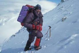
And then came Ed Viesturs. The name had come up repeatedly in the other books. Apparently he was this guy who had decided to climb all 14 peaks above 8000 meters, without oxygen. He was with Jamling Norgay during the 1996 climb of Everest (his first summit of Everest without oxygen), he climbed K2 in 1993, and finished his quest in 2008 with Annapurna. I'd read somewhere that he had, with the assistance of David Roberts, written a book/autobiography. No shortcuts to the top is great! It is an honest look at an honest and really competent guy. Sometimes you wonder if he doesn't think a little too highly of himself, but then you realize, he's just relating the facts. It's the facts that speak highly of him. And he has a sense of humor. (Here's a clip of him on The Colbert Report)

It is said that books open up new worlds. Reading these mountaineering books I've not only seen worlds I'd never see in person, I've become slightly conversant in them, the people who have lived and died in them, the culture that is there, that congregates around the mountain,

And now, not only can I pretend to be in the Tour de France when I ride my bike, I can also pretend to be summitting K2, without oxygen, in 50 mph winds while hiking in the White Mountains.

Wednesday, July 28, 2010

Tecumseh: The Western Approach

Just because it's the shortest 4000fter doesn't mean you have to take the shortest path to the top. At 4003ft, the peak of Mt. Tecumseh is accessible via two routes. One up the ski slopes of Waterville Valley is the shortest but the Western Approach (which sounds much more impressively technical) is the nicer.

Starting form Tripoli Road, a unique combination of fire road/campground, the trail crosses two brooks then begins a gentle ascent along an old road. One guide book called it a logging road, but another book, Logging railroads of the Saco River Valley, suggested it might have originally been a farm road. Now days, it is a nice wide path through a mature forest of maples, oaks, and gray and white birches. While the area was last farmed/logged in the 1910's it apparently never suffered through the devastating fires that set back forest reclamation in other areas of the White Mountains. Still the trees are so big, it's hard to believe that some of these large trees are only a hundred years old.

After about .5 miles the trail takes a right hand turn off the old road and begins ascending at a steeper pitch just as a few conifers begin to appear in the forest. Occasionally clearings offer views North to Mt. Osceola or turns in the trail bring you face to face with a fox. We saw this guy twice, once on the way up, and again on the way down. Tom, the only other person we met on the trail had seen the fox too, said it even walked in front of him for a little while. When we first 'met' Mr. Fox, he just sat in the middle of the trail and looked at us. Very calmly. The second time he had a chipmunk and only a few seconds for us. It was obvious from his demeanor and the many little paw prints in the muddy sections of the trail, that this was his hunting ground and that he was very comfortable with people. Not sure exactly, however, we fit into his plans.

The rest of the walk was very nice, the trail wide, and the view from the top was off to the North and the  Tripyramids. On the way down we hiked through a great thunderstorm. They really are so much more enjoyable when you've got a warm car and a dry change of cloths at the end of the trail! 

Wednesday, July 14, 2010

Miles from Nowhere - Bicycle Touring

Miles From Nowhere is one of the best bicycling touring books ever! Joe Kurmaskie's Metal Cowboy: Tales from the Road Less Pedaled and Riding Outside The Lines: International Incidents and Other Misadventures with the Metal Cowboy are great fun, but they don't come close to describing the day – to – day hunting and gathering- all-the-while-dealing-with-new-cultures aspect that Barbara Savage manages to brings out during her and her husband Larry's two year ride around the world.

Today's world is remarkably different than the late 1970's when the Savages took their ride and you can't help wondering how it would play out today. Certainly they wouldn't need to go months without hearing from home, or pedal furiously over dirt roads to be in town for a wire-transfer, scheduled 6 months previous and we know that the wind still blows furiously in South Dakota and Austria, the Himilayans still have very high passes, India is hot and dry, and New Zealand is still populated predominantly by sheep but the bigger questions remain. Do drivers in the Florida Keys still run bicycles off the road? Can bicyclists still camp at Stonehedge? Do Egyptians continue to stare at foreigners, or just foreigners on bikes? Will New Zealanders loan you their car to tour the island? Can you still camp on the beaches in Tahti?

Hmmm, maybe I'll have to take a ride and find out.

Wednesday, July 07, 2010

Mt. Cabot

If a 200 year-old trail goes through private lands, does a new landowner have the right to close it? Sunday we hiked to the summit of Mt. Cabot, the northern-most of the NH 4000fters via the Bunnell Notch Trail as the person who owned the first mile of the traditional Mt. Cabot trail has closed it to hikers. Don't get me wrong, the Bunnell Notch trail is a fine trail, and since the closure of the other some wonderful folks have added a number of stone steps, bog bridges and reroutes to drier land, but when you join up with the remainder of the old Cabot trail on the West side of the mountain, you realize that not only was it the most direct route to the summit, it was also an historic trail. From the careful placement of the stones, and the carefully chosen switchbacks, it becomes obvious that this, like yesterday's Starr King trail, was also one of the historic bridal paths constructed in the 1850's when the Grand Trunk Railroad came through Gorham, NH making it the center of the Victorian hiking experience.

According to the AMC White Mountain Guide and the various forums on the internet, the property owner closed the trail sometime in the early 2000's. Although there was optimism that it would reopen (following negotiation with various clubs?/lawsuits?) it is still closed and that section has been removed from all official maps. Some hikers feel justified in trespassing, either through disregard, or as a political statement, maintaining that the trail is protected by a deeded, legal right of way. Others believe the owner closed the trail to avoid possible liability lawsuits.

Trails crossing private lands is not a new, or even unusual thing. Many times while hiking in the Whites, and other places, a sign on the trail will notify hikers that they are entering/leaving private land. The signs also usually ask that the hiker stay on the rail. Most hikers honor the request, most landowners allow the trails to continue. But as with all things, there are the exceptions.

I can understand some of the landowners concerns. Not all hikers adhere to Leave No Trace, not all assume personal responsibility for their well being on the trail. Some have even been known to sue the folks who rescue them. But there are laws to protect the homeowner and I do believe that if you purchased a piece of land with an existing trail, and in this case, an historic trail, you have an obligation to keep that trail open. If you can not fulfill that obligation then don't buy the property, or deed the land over to a land trust that can open the trail.

As it stands now there are three trails to the summit of Mt. Cabot. One that 'starts' in the middle of the woods on the border of the White Mountain National Forest land, one, the Kilkenney Ridge trail – which is an overnight backpacking trek a long a scenic ridge, and the Bunnell Notch Trail. I chose the path of least resistance, and am a bit disturbed by the situation.

Tuesday, July 06, 2010

Mt. Waumbek

Saturday we walked up Mt. Waumbek taking the more popular route from the parking lot off RT 2 and crossing over the summit of Starr King Mountain. The honor of naming (and renaming) of the White Mountains seems to follow the rules of war – whoever possesses them gets to name them. For instance, the Presidentials were named by a bunch of hikers from nearby Lancaster, NH who happened to be the first group to climb Washington with necessary supplies for toasting the newly named peaks.*

Whoever (re)named Starr King Mountain must have done so sometime after 1850. Considering Starr King's cache at the time, I'm surprised at at the selection. Don't get me wrong, it is a nice mountain, with a good view South to the Presidentials but Waumbek, less than .5 miles to the East is higher, and has better views, and Starr King was, at the time, the guy who wrote the book on The White Hills: Their Legends, Landscape, and Poetry (Classic Reprint) as he titled it. Part guidebook, part romantic rhapsody the book combines a call for all to visit the Hills as well as preserve it and is credited with being a major cause for the White Mountain tourist pre-Civil War tourist boom.

At one point Starr King Mountain had a summit cabin and a bridal path leading to it, as many of the White Mountains did at the time. The stone hearth now stands in a small meadow. Hikers gather there in the sun to enjoy the views and a snack, often before moving on to Mt. Waumbec. Most do not know about Starr King (full name Thomas Starr King, who was also a famous Unitarian Universalist Minister in Boston, and later San Fransisco where he has another mt named after him.) but everyone who makes the climb has a chance to enjoy what he most enjoyed.

If hiking Mt. Waumbek from the West be sure and walk about 40 yards passed the3 summit. The peak is forested but there is a clearing to the East with views to the South of Adams, Monroe, and Jefferson.

*Forest and Crag, A History of Hiking, Trail Blazing, and

Saturday, June 26, 2010

Whiteface (I will not wear cotton while hiking)

I will not wear cotton while hiking, I will not wear cotton while hiking, I will not wear cotton while hiking. And seriously, after all those years at EMS, I should have known but today I hiked Whiteface with a cotton t-shirt. It was hot, it was cold, it was windy, it rained. It was a great hike. Scrambling up the cliffs on the Blueberry Ledge Trail, lunching on the bald peak while looking South over the Sandwich Range, hiking the ridge to the Dicey Brook Trail and down. But I should not have worn cotton. If it had gotten any hotter, any windier, any wetter, it would not have been be good. But the luck of the dumb but eager hiker was with me!

Oh, and a shout out to the Wonalancet Hiking Club. They do an amazing job of signing and maintaining their trails, and their map is fantastic. Printed on tyvek (as all good trail maps should be) it covers the entire Sandwich range on a 1:40,000 scale. The reverse of the map side contains great trail descriptions too.

Monday, June 07, 2010

No Wildcats, but a Beaver, a Bear, and an Osprey

In Walking with Spring Earl Schaffer, the first person to continuously thru hike the AT, notes that the climb out of Pinkham Notch via the Wildcat Ridge Trail is one of the more challenging sections. So it was with some trepidation that we headed to that very trail on the most beautiful morning of the entire week. I wasn't all that confident that two middle-aged city workers could scale the rocky 3000 elevation, especially now that we had our packs loaded for a three day trip.

We left the Joe Dodge Center at Pinkham Notch following The Lost Pond Trail, a level .09 mile spur going to the Ridge Trail and bypassing, what was referred to as the 'dangerous Ellis River Crossing'. Have I mentioned that it was a beautiful morning? It was. So clear you could make out every detail of Mount Washington, and so still that you could see the ridges of Tuckerman's Ravine reflected in Lost Pond, broken only by the determined swimming of a Beaver. There are times, especially in the age of digital cameras, when you realize your photos probably look just like thousands of others, and then there are times, very unique occasions when you realize you are being presented with a rare photo opportunity – and you wish you had the skill to take that phenomenal photo. This morning was one of those moments. I'll let the pictures I did get do the 'talking' but just imagine...


It was while admiring the beaver dam that SD felt his pack give. The left stay ripped right out of its pocket and barring a sailors palm and needle (which we did not have) was irreparable. Duct tape might have done the trick temporarily but it was not responsible to head out into the wilderness for 4 days, up the roughest ridge in the Presidentials, with a broken pack. And so we headed back to the trailhead, back to the car, and back to North Conway.

And that's when we first saw the bear. And I was just where I wanted to be when I say my first bear – in the car. He was cute, and he did look like Pookie, especially as he stood up and looked over at us. He also looked like he could swot your head of with flick of his adorable paw.

Osprey Atmos 65 Pack, Green Apple, MediumWe took a few (bad) photos and headed on our way to Eastern Mountain Sports where SD picked out an Osprey Atmos 65 Pack . By the time we repacked the bag and returned to Pinkham Notch it was noon. Too soon to call it a day, too late to reattempt the Ridge, we choose instead to take the 19 Mile Brook Trail with the idea that while we'd miss the Wildcats, we could stick with our original plan.

Sunday, June 06, 2010

Mount Hale and North Twin Mountain

For two mountains standing right next to each other Mount Hale and North Twin Mountain make for very different hiking experiences. For while the 4054 ft summit of Mt. Hale is  reachable after only 2 miles, and North Twin is 4761 ft and a 4 mile hike, North Twin is by far the better trip.

We hiked Mount Hale first. Leaving from the trailhead on Zealand Road the Hale Brook Trail immediately begins its ascent,crossing a nice stream after roughly .5 miles the grade increases until the second stream crossing where a series of switchbacks begin as you enter the higher elevations of the conifer zone. Many of the firs here are dead or dying, probably as a result of ice storm damage a few years ago, but the good news is that this opens up occasional views North to Mount Washington. The firs on the summit, however are doing well and surround the clearing where the fire tower once stood, blocking all views except from the top of the man made cairn, and creating a nice wind-free haven for black flies. For those continuing on to Zealand hunt the Lend-a-Hand trail leaves the summit to the east but we headed back down the Hale Brook Trail. It was a nice hike, but probably the best part was checking Mt. Hale off the list once we returned to camp.

North Twin is another story. This was my third attempt although the first from this direction. Previously I'd planned to summit North Twin as a 'quick side trip' from South Twin. Not a great idea unless you're in good enough shape to make a quick 4 mile side trip after hiking at least 8 miles just to get to South Twin.

Barring that, the North Twin trail is a great day hike that starts as a walk on an old railroad bed along a perfect NH stream and ends with an invigorating climb to two great outlooks. Along the way we did waded in the stream, passed through the zones, post-holed through snow, ran into a tree, and battled hungry black flies. The first, the false summit, offers views to the North from the Bonds to Mt. Washington. From the true summit, while bracing oneself against the 30 knot winds, the view looks out over the Southern Pemigawansett, particularly from Garfield to Flume. On the day we arrived the view was a bit hazy as a result of the Canadian forest fires, which cast a literal pall over the day. Enjoying one forest so thoroughly, its sad to know another is burning out of control. Still in all, it was a great day and another 4000fter was under our belts.

Friday, June 04, 2010

Climbing the 4000fters Zone by Zone

Last week we ascended from 2000ft above sea level to 4000+ feet, 4 times in our successful attempt to bag 7 more 4000fters. Each time passing through distinct climate zones, zones so distinct that by the last descent I could tell how much further we had left to go just by the plants. (As opposed to how much my legs hurt going up or my toes going down.) 

2000ft - The Trillium Zone
As wildflowers go, the Trillium is pretty special.  Classified as one of the spring ephemeral perennials, they bloom only briefly, and only in the woods. This week at 2000ft they were blooming everywhere and on the trail up signaled the start of another adventure. On the trail down, especially on the last day, coming down from North Carter, in the pouring rain and thunder, they were absolutely beautiful.

3000ft - The Lady Slipper Zone
The hunt for the rare Lady Slippers, or wild pink orchids,  has become an annual ritual with my girls and me and so I was very sad that this year, what with being in Boston and all, I had missed my chance to see one of my favorite spring blooming wildflowers. However, I soon found that what blooms in early May on the seacoast is in full bloom in late May at 3000 ft. And they were everywhere! Considering that this plant is on the "At Risk" list and was almost extinct 100 years ago it was great to walk through large patches of them - even just as the terrain was starting to get a bit steep, my calves were starting to ache, and I questioned whether or not we really needed that extra pound of trail mix.

4000ft - The Conifer Zone
Somewhere between 3000 and 4000 ft the hardwood canopy of maples, birches and beech is replaced by pines and firs. Almost every trail we hiked had recently been effected by blow downs.  There were trees down all over, especially in areas that had been hit by the ice storm a few winters ago had suffered significant tree damage. So aside from scrambling up and down rock faces, we also enjoyed the challenge of navigating over, under and around some significant tree piles, and on occasion, making full body contact with a limb or two, as I did with the branch of one tree only 1/2 inch short of my eye. (An impact that soon resulted in a lovely purple eye). On the plus side, all those downed trees opened up some amazing views, and as always, the feeling of being "Up There" just makes the day.

4000 fters

The following list is of the 4000+ ft mountains in New Hampshire, listed in order of height, from greatest to smallest. Following the name, and the elevation will be the date I climbed said mountain. (This originally was in columns but the formatting has somehow been erased.)

1. Washington 6288 1976
2. Adams 5774 9/08
3. Jefferson 5712
4. Monroe 5384 9/08
5. Madison 5367 9/08
6. Lafayette 5260 7/07
7. Lincoln 5089 9/08
8. South Twin 4902 7/07
9. Carter Dome 4832
10. Moosilauke 4802
11. Eisenhower 4780 9/08
12. North Twin 4761  5/10
13. Carrigain 4700
14. Bond 4698  5/09
15. Middle Carter 4610  6/10
16. West Bond 4540  5/09
17. Garfield 4500 7/07
18. Liberty 4459
19. South Carter 4430 6/10
20. Wildcat 4422
21. Hancock 4420 7/08
22. South Kinsman 4358
23. Field 4340 5/10
24. Osceola 4340
25. Flume 4328
26. South Hancock 4319 7/08
27. Pierce 4310 9/08
28. North Kinsman 4293
29. Willey 4285  5/10
30. Bondcliff 4265  5/09
31. Zealand 4260 7/07
32. North Tripyramid 4180
33. Cabot 4170 7/10
34. East Osceola 4156
35. Middle Tripyramid 4140
36. Cannon 4100
37. Wildcat D 4070
38. Hale 4054  5/10
39. Jackson 4052 9/08
40. Tom 4051  5/10
41. Moriah 4049
42. Passaconaway 4043
43. Owl's Head 4025
44. Galehead 4024 7/07
45. Whiteface 4020 6/10
46. Waumbek 4006 7/10
47. Isolation 4004
48. Tecumseh 4003

Friday, May 21, 2010

I have been to Mecca and I have seen God

...or would you believe the Stockyards and a rat on a cat on a dog? It was a sight so unbelievable as to pull the tourists who came for the cattle drive, the civil war buffs talking to Wild Bill Hiscock, and country western fans gathered around the yodeling elderly couple. Seriously, how often do you get to see a rat on a cat on a dog?

The Forth Worth Stockyards are pretty cool, a combination of old west town, rodeo honky tonk, kitcky shops and a great bar full of stuffed armadillos, bears, buffaloes, skunks and wildcats. Every day at 11:00 and 4:00 there is also a long horn cattle drive down the main street. Which is probably the height of slow motion fun. But all this action aside, it is probably the rat, cat, dog combination that will stay with me the most.

I tried to upload the video to YouTube but for some reason it won't go. So I figured, hey, something like that, chances are someone else has uplaoded it. And that's when I discovered this guy and his act are National heroes! They've been all over the country and have pulled from more than cattle drives and the video has had 5,981,583 views.

Thursday, May 13, 2010

Fort Worth Water Garden - The next thing to being there

Being in the Desert Canyons of Arizona and Utah with the wide open sky above, the warm, skin-melting air all around, and a miraculous waterfall before you is one of the most wonderful experiences. But, if you can't be there, and you happen to be in Forth Worth the Water Garden is a great place to be; almost like being there.

Constructed of brown pebbly concrete, water everywhere, and selective plantings the Water Garden is a man-designed desert oasis. The conference I'm attending has sessions split between two hotels, each located on opposite sides of the Water Garden. Some times, I suspect, I selected a session just to have the excuse to walk through the Garden. Yesterday I took a little longer and shot a video by the "Active Pool" which, hopefully goes some little way to sharing the experience.

This morning I woke up early and spent some time by the quiet pool, which honestly is my favorite of the three pools. Composed of a large, shallow pool surrounded by Cyprus trees and contained within the peddled concrete walls, it reminds me of Calf Creek Falls in Utah. It's rare when a man-made place invokes in me, a feeling of restfulness and connection like this one. The photos just don't do it justice.

The designer of the park, Phillip Johnson, also designed the Glass House in New Caanan, CT as well as many other master works of architecture.

Wednesday, May 12, 2010

You Know You're in Texas - the full, illustrated edition

  1. The SUV is the economy car
  2.  A fellow librarian is referred to as "the sweetest piece of sunshine"
  3. Storefront signs inform you that the unlicensed possession of a gun is against the law. (But guns in general are just fine.)
  4. There is Tequila in the Sangria
  5. No one knows that the bus actually does run from your hotel to the stockyard and they insist you must take a cab
  6. There is a stockyard
  7. The local bar (excuse me - honky tonk) has an indoor rodeo
  8. The TV doesn't have PBS (and you can't watch the show on Whaling)
  9. You just watched an Armadillo race - and the winner won a can of Armadillo milk
  10. You're encouraged to "ride a horse, save a cowboy"
  11. Fried okra is served at least once a day 
  12. The enchiladas taste like heaven!

Sunday, May 09, 2010

The Neon Lights of Fort Worth

Fort Worth isn't what I expected. In a number of ways - but for now I just want to talk about neon signs. In 1923, the French company Claude Neon,introduced neon gas signs to the United States, by selling two to a Packard car dealership in Los Angeles. From that time the use of neon signs grew until reaching its peak in the 1960s, at which time popular taste turned against it and most were destroyed. . What was once "liquid fire" was soon considered harsh and trashy and were trashed.

But for some reason, there are quiet a few in Fort Worth, and while I too was in the trashy camp, the ones here in Fort Worth are actually pretty cool.

Inn Hiking in Vermont and New Hampshire

A friend asked me to recommend some Inns that would be great places from which to hike. Knowing that the minute I sent the list, I'd remember another one, I thought it best to make a webpage (i.e. blog post), and if you know of some that should be added, please do!

Coming in at #1 is The Inn at Long Trail, Killington, Vermont. Aside from the fact that the inn is a great place to stay, the inn-keepers are really helpful, and the location is easy to get to, it is right in the cross-roads of some great trails. Just North of the Inn the Long Trail and the AT meet up (or diverge - depending on your direction). Hiking to the South on the AT takes you up to Killington Mountain for some really spectacular views.

The Inn at Long Trail also offers services for Thru-Hikers. During the season there are lots around - just in case you want a little inspiration for making that trip yourself, or if you just want to hear some good stories.

Cardigan Lodge - located in New Hampshire at the base of Cardigan Mountain, is another good hiking base. Run by the Appalachian Mountain Club has two private rooms, in addition to two bunk house. It may be a little rustic, but the food is good (they'll even pack your lunch for the trail) and the hiking is great!

Along the same lines, but on a bigger scale is the AMC's Highland Center. There are some really great trails nearby. To the North is a great hike up Mount Pierce and Mount Jackson.

Back to Vermont - A friend recommended the Blueberry Hill Inn. I've never been but the location is good. There are lots of trails in the area and...Robert Frost lived for a time in nearby Ripton, VT.

Saturday, April 24, 2010

Sea change: Time for Acquaculture

 NOAA is currently seeking public input to help shape the scope and objectives of a draft policy for marine aquaculture.You can comment online at: http://www.nmfs.noaa.gov/aquaculture/policy1/#comment


My comment? - Culturally, Americans have always favored the hunter/gathers in our society.  The cowboy is much more exciting than the farmer, pirate tales win over that of the merchant seaman, and the fisherman's life is preferable to that of the fish hatchery worker. Historically, economically and environmentally however, it is always the farmers who endure, the farmers who end up providing the most food while (hopefully) depleting the natural resources the least.

In this evolutionary progression of man from hunter/gatherer to farmer it is now time for the fisheries to realize that they have reached the end of an era. The buffalo no longer roam the plains in herds large enough to blacken the plains to the horizons, and fish no longer swim in vast schools. They have been fished out. And - as was done for the oyster over 200 years ago, it is now time to turn to responsible farming - if we are going to continue to harvest them.

Economically speaking the adoption of widespread aquaculture is a no-brainer - it's already making lots of money in other countries.  Environmentally speaking the pieces all fit also. Why drive wild species to the point of extinction when we can, with sound regulation, raise the species without harming the environment? Presently over 70 percent of all fish sold in the US comes from foreign fish farms - farms that are not regulated and that do harm the environment. Bring the farms to the US where they can be regulated and it will not only improve the environment but also the safety of the product. And while it is always difficult for the hunter to become a farmer, in the cases where the transition has already been made in the US, it is the fishermen who are now making the best aquaculture farmers.

Wednesday, April 21, 2010

Temple Mountain (aka Bunny Mountain Temple)

A few weekends ago, on one of those summer days in spring, we hiked the Wapack trail from the base of Pack Monadnock South to Burton Peak over Temple Mountain. It is a nice ridge hike and with the leaves just beginning to bud we had great views North to Pack Monadnock, West to Mount Monadnock and East to Boston. While a little cloudy it was clear and we could clearly see Monadnock's summit and maybe even some of the hikers braving the wind up there!

Located as the Wapack trail is, within an hours drive of Boston, there were lots of other hikers even on the lesser-known mountain. There was also lots of evidence (in a good way) of other hikers. While almost always I swear by the leave no trace credo there are times when I appreciate a little human input into the landscape. The giant rock cairn on top of Mt Eisenhower is one example. We summited in the dense fog and without the cairn there really would have been nothing to see, maybe even no real way to know we'd reached the summit. On the AT in Vermont, at a place called White Rocks, there is forest of white quartz cairns of all shapes and sizes. Coming upon them after slogging through a muddy swamp was truly delightful and one felt a kinship with the thousands of creators. Each one may be only placing one rock but together building an art installation in the wilderness, for only the lovers of the wilderness to share.

Temple Mountain also has it's collection(s) of cairns. Why folks choose a spot for cairn building often seems a bit random, there certainly are appropriately sized rocks all over New England, but once one is built, it seems everyone wants to get in the act. The Temple Mountain cairns are spread over a mile of the trail, smaller communities of rocks every other rock outcropping or so. One group was extremely abstractly sculptural, another modestly handcrafted. But my favorite held The Bunny. On one of the larger balds, someone had built a 5 foot high cairn with a hollow shelf in the middle. There, in the middle of the hollow shelf, peering out of the shadows was a stuffed brown bunny. Happy spring hiking everyone!

Saturday, April 17, 2010

I'm going to Texas!

The second week of May I'll be in Forth Worth, Texas at a conference. While my first inclination was to try and use this opportunity to add three states to my list (Texas, Oklahoma and Arkansas), the voice of nagging reason (aka S.D.) has convinced me that a better option would be to explore the area where I'll be.

So what, you may rightly ask, does Fort Worth, Texas have to explore?  (Any and all suggestions are greatly appreciated!)

Apparently - in the days of the Chisolm trail, it used to have one of the most notorious red light districts. Known as Hell's Half Acre, this area hosted a number of saloons, and brothels, along with their famous and infamous visitors. The Earps, Bat Masterson, and my childhood favorites, Butch Cassidy's Wild Bunch. I'll actually be staying in this area. Of course the actually buildings were all plowed under years ago and it is now the site of Fort Worth's convention center and tourist district but hey...Northfield, MN is now a midwestern yuppie haven.

But wait, no need to be discouraged, Forth Worth does has an historic stockyard! Yup. You can't visit the brothels of yesteryear but you can see where all the cows were rounded up. Right next to the Armour and Swift meat processing plants. The historic stockyard features a twice daily cattle drive and gunfight.

I've also just begun exploring the beer situation, and it does look promising. Aside from Forth Worth being "the first brewery to produce Miller Lite, Fort Worth can make a Texas-sized claim as the birthplace of the low-calorie beer revolution" apparently there is a bar, The Flying Saucer that serves over 100 types of beer. The week I'm there, Wednesday night is "Drink the Beer, get the Glass" night. Starts at 7pm, for a limited time only...so we're looking at 2 glasses at the most. But it's really about the thrill of the hunt, isn't it?

Just like going to a new place is about the thrill of the new adventure.

Friday, March 26, 2010

Orient Express

This morning the train was dark, as in no lights, no electricity. Had it been a sunny morning the only inconvenience would have been the loss of wifi. But on this gray, rainy morning it was downright eerie. We all spoke in hushed voices and wrote sentences that contained phrases like “hushed voices.” Had someone screamed 'murder' no one would have been surprised, especially when we went through the tunnel at Salem (you know the one with all the witches).

The diversity of things that can wrong on the train seems endless, and if you're not in a hurry to get to work, rather entertaining. Last week the 5:25 train was an hour late getting to Manchester. The train, two trains previous had, according to the conductor, “caught on fire.” After getting that one off the tracks the next train had to make extra, and longer stops to pick up all the discharged passengers. Two days previous we had been delayed leaving North Station because “someone forgot to change the switch.” We then were treated to a play by play account of how that someone was 'coming out of the house”, “approaching'” and then “throwing the switch'” I certainly appreciate the communication' I'm not so sure that the other passengers were as amused.

Two weeks before all this the hour delay was remarkable not because it was a whole hour but because we arrived at North Station at all. This was the day of the big storm. A number of commuters didn't make it to the train that morning because their power was out (and alarms didn't go off) a number couldn't make it because there were giant trees in their driveways, or getting by that, their cars were not able to ford the rivers that now crossed the lower parts of road. When those of us who did get to the station saw a train approaching we were amazed. The amazement only increased when we boarded and were informed that this train was actually the 6:05. The train that was supposed to be here 40 minutes ago. Not only did the MBTA have a large number of really large trees to clear off the tracks but several of the road crossing gates had been broken and the conductors had to get out and manually stop cars at each and every crossing. We (and by we I mean 3 train loads all packed into 1) arrived at North Station at 9:03. It had taken the train 3 hours to do its normal 1 hour run. But the really surprising thing was that it had done the run at all. I number of folks in the greater Boston area couldn't get anywhere near Boston that day.

The MBTA and for that matter, all mass transit is a great thing. Who knows what traffic nightmares I've avoided by the taking the train. I do know I've saved some money and used less of the limited precious resources on this planet. I've also joined a select community, one I would not have known had I been in a car cocoon. It's also interesting to note that the conductors do no collect tickets on these days, and if you've prepaid for the ride you get a credit for another. And just think of all the new stories I can tell.

Wednesday, March 10, 2010

Born to Run

Back in the day at Eastern Mountain Sports we had a life size cut out of ultra-marathoner Dean Karnazes. We had received it as part of a promotion for his autobiography, Ultramarathon Man: Confessions of an All-Night Runner. For a few weeks it stood at the front of the store and then Brian moved it to the back. To the bathroom actually, where every time you turned on the light the thing would scare the crap out of you. Because that thing was scary! Karnas was in full tilt, half naked, full wild-man running mode – and aimed right at you. But it not only scared the crap out of me, it also pissed the crap out of me. I've always really admired the long distance athletes. Marathoners, ultrmarathons, rides across the country, all that is just really cool . And here was this weird parody of a man representing all that in a way that was even scarier than most people already viewed it. Well actually, most people think distance events aren't so much scary as they are crazy.

And thats what brings us to today's topic - the Book Born to Run: A Hidden Tribe, Superathletes, and the Greatest Race the World Has Never Seen – the bestest book ever on running, long distance running, and the human body's true function and potential. Revolving around the story of one man's running injury and a tribe of life-long runners in Mexico, the author relates the history of running, ultra-marathons and marathoners, (in which he also mentions the exception that is Karnasses), human evolution, the evil that is the sneaker industry, the beauty that is the human foot, the misguided advise of the medical profession, and the potential in all of us.

The upshot - “baby we were born to run!”