Thursday, March 28, 2013

Day 2: Uber Crater, Uber Weather and a Couple of Canyons

Day two in Death Valley and we headed north for the Ubehebe Crater. The weather forecast was for cloudy skies with a thirty percent chance of rain. Back home, New England was enjoying its sixth consecutive weekend snow storm. In comparison our weather was a welcome improvement.

Ubehebe Crater, black bands near the top. One for each explosion.
The Ubehebe Crater, actually craters, as there are about five of them, are a relatively recent geological happening in the Valley. Only three thousand years ago some rising magma bubbled up into and underground reservoir. The resulting explosion blew ash all over a six mile radius, and left a series of giant holes in the ground. It was fun to figure out which craters blew first. Each crater had a different number of black bands around its rim. The one that blew first, having the most.

At about eight am we were standing on the rim of the largest looking one mile down into geological history. Hmmm did I say standing on the rim? Well that may be a bit of an exaggeration. SD was standing on the rim, I was about five feet back sneaking glances into the crater and then quickly steadying myself by looking at the gently slopping land on the other side. My fear of heights was kicking in pretty strong.

The guidebook estimated the walk around the rim to be between one and two miles depending on how many of the smaller craters you included. The weather was still cloudy but calm and relatively pleasant sixty degrees so we set off.

Titus Canyon
The thing about walking around the rim of a magma crater when you have serious vertigo is that sooner or later the rim narrows below your comfort level to places where there is only a foot or two of walkable ground between you and the sudden death of a mile long fall. That moment happened exactly half way around the crater. Being goal-obsessive in addition the height-averse I struggled with the decision of whether to turn around or continue on. S.D. came to the rescue however and offered to scout the trail ahead of me. I've found that walking behind him, focusing on his shoes rather than the drop beside them can get me through some of the trickier places including the six inch wide trail ahead. After about 100 yards the trail widened, returning to leveler ground.

Continuing on, views of the crater and the surrounding valley were spectacular as was the scene above and to the south where it was abviously raining pretty hard. The cloud cover was dark and thick and while it had seemed stationary for most of our hike it suddenly seemed to be racing north. Right to where we were. Just as we were passing the far northern rim the front hit us with thirty to fourth knot winds. Almost knocked me off my feet before I had the chance to lean into it. We scuttled back to the car and got in just when the rain smacked into the windshield.

The Mosaic Rock
The remainder of the day was spent hiking in the calm of deep canyon washes of Titus and Mosiac Canyons. Both canyons were interesting but each in its own way. Titus Canyon was notable for its scale. The walls tower above you, sometime blocking out the sky, and the Canyon extends all the way through the Grapevine Mountains. The hike up Mosiac Canyon was short but colorful. The Canyon was named for a rock formation known as the "Mosaic Breccia." Breccia is the Italian word meaning "fragments". The resulting rock is a beautiful.

It was now late, and it had been a full day. We headed back to our hotel in Beatty after our second day in the Valley.

Thursday, March 21, 2013

Day 1: Fish, History and Hiking

Fish in Death Valley? Pupfish no less. The very idea of pupfish is so adorable you wonder why they don't have their own YouTube channel. These little fish live only in the salty creeks and ponds of Death Valley, and they were something we really weren't expecting.

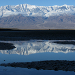
Salt Creek: Home of the Pupfish
Like a lot of National Parks, Death Valley has a number of roadside easy -to-access-point -of-interest stops with interpretive displays and very little walking. Our plan was to check all of those out, the pupfish at Salt Creek being the first stop, get the lay of the land, its history, geography and geology. We also wanted to get in our first good hike, hopefully about mid-day at the Golden Hills.

After the Pupfish, which we never saw but it was a nice hike around a running creek that was quite salty, (SD tasted the water and declared it more salty than seawater) we headed south to the Harmony Borax Mine Historical Site. You can't visit the area without talking about mining. Old mine shafts, abandoned mining towns, assorted historical sites, and even a few working mines cover the area. Even before entering the Park we'd stopped at Rhyolite, an abandoned mining town outside Beatty, Nevada. Walls stood alone in fields, rusted cans piled up along the side of old roads, cave openings high in the hills were all the remained of old mine shafts. The graveyard, still accepting occupants, was particularly cool. Of all the abandoned mining towns we'd see in the next few days it was the only graveyard.

Borax mining, on the other hand, didn’t require mine shafts. Miners scrapped the borax off the flats, refined it and shipped it out in huge wagons pulled by twenty mules. The Harmony Borax Mine Historical Site had two of the wagons and a water tank and they really were impressively large.

A mile south of the Borax mine site was the Furnace Creek Interpretive Center. It was our first encounter with the bus tourist. A bus-full of people who are driven from stop to stop, descend on a site, and then as if by magic disappear back into the bus and leave. But the Center was also loaded with great displays and we spent about an hour learning history and geology.

After a full morning of touring and studying we were ready for some hiking but when we arrived at the parking lot for the Golden Hills it was packed and there wasn’t a space available. According to the guide book it was a spectacular but narrow trail.

Craving a bit of desert solitude we drove on, turning left onto a side road about two miles south. That road went east for about a mile then abruptly stopped. Other than a no camping sign there were no signs but a faint path left the road, curved to the east south east and into a canyon wash. I’d read that like Utah, most of the Death Valley trails were walks up canyons and that really you could just pick any canyon and walk up it. With a dedicated parking lot I figured this was as good a canyon as any.... after the hike I suspect it was better than most.

It's hard to see, but the rocks further down are green and red.
The wash, or the sand and gravel that wash out of the canyon opening was about half a mile long. After that the canyon walls narrowed quickly. We twisted up and south and south east under smooth walls of white, red and sometimes green rock. Looking at the topographic map it looked like our canyon was running into the Artist Hills, an area renowned for its colorful layered rocks. The further in we hiked the more colorful the rocks became and the closer we through we were to topping out at a pass. Two times we explored side canyons hoping to reach an overlook. But it’s funny in these canyons, you are hiking up but at the same time you are hiking in. They rarely top out. Like the little side canyons most end at a high canyon wall or a "fall", a large rock fall inside the canyon that blocks any further progress. We hiked in for an hour and a half, and although the temptation to go around one more corner was strong, we eventually turned around.

It had been a great first day, from pupfish to historical sites to a great hike, the desert was starting to work its magic.

Thursday, March 14, 2013

Mid-winter hiker's dream

Three days ago, the last day of our escape from the gray days of New England, we stood on Dante's Peak. Below, and to the west, our past adventures spread out on the landscape. In the previous days we'd been from Badwater Basin, the lowest point in the US, to the flanks of the highest, Mt Whitney. From 80 degrees on the Mesquite Dunes to hiking in six inches of snow and 30 degrees on the Wildrose Peak. One day we were being blown over by thirty knot winds on the edge of the Ubehebe crater, the next listening to absolute silence in the depths of an unnamed Canyon. On Friday we left a backwater Nevada town for an L.A. backcountry outpost. Two days later we hiked up to a rare desert waterfall.

Needless to say it was an awesome time and a lot happened. It's going to take a few posts and I hope I can cover it all.

But first a little geology lesson.   You can't really understand Death Valley until you know the geography and how it was formed by geological forces over the eons.  Death Valley is not just one valley it's a couple of valleys and about five mountain ranges built over millions of years. The National Park Service has a great diagram that illustrates the process. The faults pulled apart lifting the mountain ranges, some as high as 11,000 ft.

Mt Whitney, just 50 miles outside the park towers over the Sierra on the West at 14,505 ft and is the tallest mountain the the contiguous US. And while this is all desert, what little rain there is all stays in the valleys and evaporates. What very little plant life there is, is not enough to create top soil and all those millions of years to rock building, lifting and eroding is all just out there. Visible to the naked eye. I imagine it's a geologists dream. I'd had my doubts about the place being a hikers dream but S.D. was right after all.

Friday, March 01, 2013

Death Valley Preparation

During The Month, S.D. promised to take me on a trip anywhere I wanted to go. It being December and the start of winter I dreamed of somewhere sunny, with warm days and cool nights.

And Viola! Next week we're going to Death Valley.  Now I haven't missed all my friends vacation stories and facebook posts from Disney Land, Caribbean Cruises, and all the usual winter-time-get-away hot spots. And don't get me wrong, they all seem very nice.  I just wanted to go somewhere a bit different, and some where with lots of hiking and exploring options. Death Valley fits that bill.

After three straight weekends of snow storms, followed by 6 straight days of rain, I'm more than convinced this was the right decision, and the right time. The 2013 outdoor adventure season will officially begin for me next week

---

That said, in February I began compiling and working through the reading list:

Salt to Summit: A Vagabond Journey from Death Valley to Mount Whitney
This hiker's journey through the desert is the perfect intro to the area. The author talks a bit about the geography, the plants, animals, weather and history.

Land of Little Rain
Published in the early 20th century this little volume is more of a stream-of-consciousness telling of Mary Austin's interests and feelings about the area, its peoples and her times.

Hiking Death Valley: A Guide to Its Natural Wonders and Mining Past
This one I've only peeked through as I'm saving it for the plane and for while we there. It provides technical descriptions of the various regions and hikes in the area along with notes on what to look for. These range from rock formations to old mining tools, and it we're lucky, wildflowers.

However, as long as it's sunny with temps between 50 - 70, and as long as I've got S.D. with me, I'll consider myself very lucky. Actually - all I'll really need is S.D.