Day 3, June 2, 2016 : Skihist Provincial Park to Lac La Hache 104 miles
 |
| Hat Creek Ranch |
The landscape was beautiful and the history inspiring. We even managed to do some touristing. The first stop was the Hat Creek Ranch, an historic roadhouse, ranch, and first nation interpretive site. The coffee shop also sold an awesome sausage roll pastry thing. The exhibits explained how the gold rushes of the 1860s brought miners to the area, which were quickly followed by ranchers and the stage coaches and supply waggons. (PS that is the correct, local spelling of waggon.) Clydesdales were big on these stage routes and the Ranch was home to many who pulled the stages.
 |
| Trapper Cabin with Sod Roof |
70 or so miles up the road we stopped at 108 Mile House. This historic roadhouse and building collection included a barn that once housed 200 Clydesdales. It was a big barn! There was also a cowboy bunkhouse, complete with a bathing plywood cowboy and also a sod roofed trappers cabin.
A quick aside on the name 108 Mile House. Roadhouses along the early stage route to the gold fields were named for their mileage location on the route. Eventually some of those stops became small towns and today, in the land of the Metric System, there are now towns with names such as 70 Mile House and 100 Mile House.
Soon after leaving 108 Mile House we pulled into Lac La Hache Provincial Park and picked out a nice site overlooking the lake. At the same time, the rain started and the mosquitoes picked us out for an afternoon snack. Hmmmm, I don't remember there being mosquitoes in Arizona either.
Day 4 , June 3 2016, : from Lac La Hache to Quesnel 125 miles
 |
| Biggest, Blackest, Slug Ever |
After driving an other day through lake-filled ranch land, through small towns with worn false-front stores, many with "Mile House" in the name we set up camp just north of Quesnel. Aside from having an awesome name (pronounced Qwee-neel) the towns other remarkable features are that it sits at the confluence of the Quesnel and Fraser Rivers and has a giant gold pan. According to the map we drove right by the gold pan, but some how missed it.
 |
| Slugs and Bears!! |
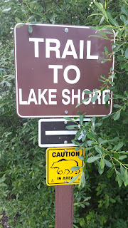
Today's campsite was along-side 10 Mile Lake. After setting up, taking a long walk (our first with a bear warning), eating dinner and taking another long walk we hung up towels over the bedroom windows, stuffed a spare cloth in the bedroom skylight and went to bed. It was 10:00 pm and just getting dusk. Waking up at 6:00 the following morning, the sun was blazing through the rear window. We're only about a third of the way North that we need to go, and it's not even the equinox yet, but...wow, there's a lot of daylight.
No comments:
Post a Comment