Thursday, June 23, 2016

Through the Yukon: Kluane Lake and Kluane National Park

Lunch with a View - Kluane Mountains
June 15-16, Whitehorse to Kluane Lake

Everywhere you go in the Yukon people will tell you that you need to go somewhere else. At Teslin, the host insisted we should drive the Top of the World Highway. In Whitehorse, a fellow camper told us Dawson City was a must see. Back on Boya Lake, a fellow traveler insisted that Atlin Lake was "The Place." At the Kluane National Park Visitor Center we talked to a couple just returning from Haines, a place they just loved. All those places do sound great. We hope to see them all someday, but in the meanwhile...You just have to go to Kluane Lake and Kluane National Park!

Driving the road north out of Whitehorse is much like driving on a rollercoaster through Tiaga. Built
Outhouse with a view - Kluane Visitor Center
over permafrost that causes the road bed to freeze and thaw, and dip and rise the road winds along for over 100 miles through Tiaga, sparse forests that live above permafrost. Named by early Russian explorers, it means "little sticks" because that is what the forest looks like. Thin 20 or 30 ft high spruce trees doted above marshy ground. The further west you go, the more glimpses you get to see of far off mountains until at last, you reach Haines Junction and you're in the Kluane Mountains.

Roll another 60 miles down the road and the eastern end of Klaune Lake comes into view. Klaune Lake is the largest lake in the Yukon covering 154 square miles. It's a long, narrow, bright blue lake, one of the biggest and the most beautiful in the Yukon. It's at the edge of the Kluane National Park, and there is a territorial campground midway along the south side. In that campground is a campsite right on the lake. We camped there, Mesmerized by the lake we finally looked up and noticed the huge, towering snow covered mountains of the Kluane Range to the south.

Campsite with a View - Kluane Lake
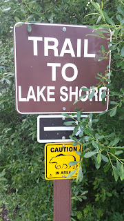
It was sunny, beautiful and warm. Needless to say we spent two days at the Lake. Hiking along the shore on the first day. On the second day we hiked up into the mountains, Sheep Mountain to be specific. The Rangers at the Station thought the Dall sheep that live there had already moved onto higher ground, but there had been bear sightings. We did not see any bears, even a bear paw track. We did see a sign commemorating the memory of a woman killed in a "bear encounter", lots of sheep tracks, amazing mountain scenery, and far off the blue tongue of the Kaskawulsh Glacier.

If you every go to the Yukon, you've just got to go to Kluane!

Wednesday, June 22, 2016

Through the Yukon: Part One

Through the Yukon
June 13 - 14, Watson Lake to Whitehorse: 438 miles

Stopping for fuel at The gas bar 100 miles west of Watson Lake we hear that two days ago the generators in the town of Teslin failed. Without generators the gas bar (Canadian gas stations are gas bars) can't pump gas. The Teslin gas bar is the only other place to get fuel on a 150 mile stretch of the Alaskan Highway between Watson Lake and Johnson Crossing.

Teslin Totems
Folks will tell you that the Yukon is remote. They'll say that the population of the capital city is only 28,000 and at that size it holds 60% of the population for the entire territory, a land mass bigger than a whole bunch of big states combined (not having access to the internet, I can't look that up right now) But trying to calculate if you can make it to the next fuel pump, or should stay in town until Jack fixes the generation puts the remoteness of the Yukon in a new perspective.

Teslin,  the town sans generator mentioned earlier, is no exception. The visitor information center in Watson Lake hands out a flyer listing all the gas stations, restaurants, hotels and campgrounds between it and the capital of Whitehorse, 282 miles away. The flyer is double-spaced, 14 point font and one page. We've only had cell phones reception in one town, and there has been no data service in any of Canada. The only wifi to be had is via the painfully slow dial-up or satellite hotspots offered at various camps and information centers. There are a lot of trees, and lakes and mountains. The remoteness, at first, is discomforting, but after a little while it starts to feel good.

Teslin is in the middle of all these woods, and mountains, set on the shore of Teslin Lake, an 88 mile long, 2 mile wide lake that runs approximately east - west. It's the home of the interior Tlingit, a First Nation tribe that runs a very nice Cultural Center. You get the idea these folks were doing just fine being 'remote.' It is, in fact, not remote to them. It is the center of an amazing universe.

S.S.Klondike
And that's where we spent the night.

June 14, Whitehorse

The next morning we hit the road early, heading to Whitehorse. The plan was to set up camp early. Get into town, stock up and spend two days looking around.

Whitehorse is the capitol of the Yukon. For a territorial capitol, it's very small. Laid out on a 8 street by 24 street grid on the floodplain of the Yukon River, at the head of the navigable waters. Apparently S.D. and I are becoming acclimated to being out of town. Even as small as Whitehorse is, it didn't feel right. There were too many people and cars. The rain and clouds didn't help as we couldn't see any of the surrounding mountains.

After touring the S.S.Klondike, a 1937 stern wheeled steamboat, (which was really interesting) we walked around town, had lunch, bought groceries, filled up with diesel, and decided we'd move on tomorrow. We needed to get back into the country.

Monday, June 13, 2016

Cassier Highway : Part Two

June 10, Mezadin Lake to Iskut 150 miles

The mosquitoes situation has progressed from wicked bad to holy shit.

Lynx - checking us out
Last night we camped right on the shores of Mezadin Lake, a beautiful site not less than five feet from a crystal clear lake. Apparently it is also the mosquito capital of British Columbia. We did not enjoy our evening beverage outside.  Additionally, we did not enjoy our evening beverages inside.  While at first we were sadistically amused by their massing outside our windows, they were the ones that got the last laugh. Somehow the little buggers were able to get in. While I perfected my mid-air mosquito grab, S.D. plugged every possible hole he could find.  We killed so many their cold spindly bodies littered the bathtub, but still they came....and they wanted blood.

It was a beautiful site but we were glad to leave the next morning, shooing the last remaining bugs out of the truck cab as we hit the highway.

From what we've heard, that will not be the last of them, they will probably get bigger, and we really need a way to keep them out of the trailer!

June 11-12, Iskut to Watson Lake

We were just starting to get a bit jaded.  How  many times can you gasp at snow capped mountain vista's and clear, blue mountain lakes? And that's when we pulled into Jade City. Seriously, there is a store only the Cassier Highway called "Jade City."   The Cassier mountains, through which we were passing produces 80% of the worlds jade.  The "City" is a direct seller of jade things. Statues, pendants, earings, and beatiful big blocks of jade. 
Beside the beautiful blue water of Boya Lake
Even more beautiful however, was the lake we camped beside later that day.  The bottom of Boya Lake is compsed of white granite sand which reflects the sun, giving the water a definetly tropical blue and green cast.  The weather was warm, and sunny and it was impossible, despite the cold water,  not to go swimming.  I did, and it was lovely!

The next day we drove the few miles to Watson Lake, leaving B.C. and the Cassier Highway.  We're officially on the Alaska Higway now!

Cassier Highway : Part 1

Close up of Kitwanga Totem
June 8-12, 2016 : Kitwanga, B.C. to Watson Lake, Y.T. 450 miles

Does a bear poop in the woods? Apparently not if the Cassier Highway is close by.

The Cassier Highway runs 450 miles, almost due north through northeastern British Columbia. We had read that bear, both black and brown would be all alongside the highway.  Other travelers reported seeing big brown bears and black bear cubs running alongside them.  We saw three black bears, and a whole lot of bear poop.

There are few roads to Alaska.  Eventually, in fact everyone has to drive the 800 or so miles of the Alaska Highway from Watson Lake , YT and over the U.S. boarder to Tok. Before and after those two towns, however there are a couple of routes.  From Prince George there are two options. Go due North and hit the Alaska Highway at Dawson Creek, aka Mile 0, or take the less traveled, route west out of Prince George on the Yellowhead Highway, then turn North on the Cassier Highway.

The Yellowhead Higway is a well traveled, developed route from Prince George to the major port of Prince Rupert.  The Cassier, was only just completed in 1972.  And it's still kinda rough. Naturally, that is the route we choose. As previously mentioned a hot spot for bears but there are also miles of trees, lakes that are miles long, rivers that run wild, stands of totem poles, masses of mosquitoes, few towns, fewer but lovely camping spots and an awesome side trip to the Pacific Coast with a few glaciers thrown in for dramatic effect.

June 9 : Side trip to Stewart / Hyder

S.D. on the Seafood Bus
One of the highlights was the side trip to the town of Stewart, and it's neighboring town of Hyder, U.S.

It was an awesome trip.  The day, which was forecasted to be rainy, was actually only partly cloudy and in a good way.  There were clouds and there were large patches of blue skies.  We were able to see the deep, glowing blue of the glaciers and sometimes the far off snow covered mountains that probably rose all around.  Driving West along the Bear River, wildflowers bloomed alongside the road, hanging waterfalls tumbled off every mountainside, and the river roared through the little canyon.

It tooks a little over an hour to arrive in Stewart, B. C.  A small town, right at the foot of the Portland Canal/harbor. We stopped at the Visitor Center, had a nice chat with the staff, walked out their boardwalk into the center of the harbor, marveled at the meadow wildflowers and then headed a mile west up the road to the United States and Hyder, Alaska.  (No customs or boarder patrol)

Ice Field of the Salmon Glacier
...Which was smaller than Stewart, but which also had a Seafood Bus.  Finally, our luck was turning.  So far on this trip we've been too early for a lot of places. Museums have been closed, campgrounds locked, etc. Today however, we arrived on opening day.  The fish and chips with really, really fresh, the halibut was awesome!!!

Continuing down the road, and this is the only road, we turned up alongside the Salmon River, re-entered Canada, bounced over potholes, squeezed over to the side to let giant mining trucks pass, passed an operating gold mine, climbed up a steep rock-strewn, avalanche-prone grade and arrived at the overlook for the Salmon Glacier.

Whoa! Glaciers are awesome!! Having witnessed their after effects for years in New England, and all across the country it was amazing to see one in action. And yes, action is the right word for although they move at a pace of inches per year, still you can see the massive amounts of soil and rocks built up in the side and terminal morans,  You can see the marvelous blue jumble that is the ice field and the cracks and striations in the body.  Just awesome.

Reversing our drive we headed back. Minus the fish and chips lunch and this time, passing through Canadian customs on the way into Stewart (What he thought we possible could have purchased in store-less Hyder I have no idea), we wound back up the Bear River valley. Just as lovely as it was that morning.

Thursday, June 09, 2016

Smithers, B.C : Back in the Mountains- with Sausages

Just a little glacier hanging out over town
Day 7 : June  Lake Telkwa to Smithers, 9 miles

Early this  morning we swapped lakefront for riverfront, moving only 9 miles up the road to the municipal campground at Smithers, the best town on the road so far.  So good it has two bike shops, two bookstores, three coffee shops and two sausage shops. 

Yes, not one but two sausage shops. Both featuring good cheeses and local, homemade sausages made from elk, deer, buffalo, beef, lamb and / or pork. It took about 25 minutes of pacing and deliberating but we ended up with a sampler of dry sausages from The Sausage Factory. 
Downtown Smithers
Even more impressive however, are the views and the hikes. Just south of town, visable over every street is Hudson Bay Mountain.  The Babine Mountain range rises to the North.  All the mountains are still snow covered, waterfalls are dropping off every cliff and the Buckley River is roaring. According to the helpful folks at the visitor center there were also lots of great hikes in those hills.

After walking Main Street, oogling all the sausages, checking out a few of the oudoor stores and enjoying a fine cup of dark roast at a street-side table we set out on our first one.

So far on our trip through British Columbia we'd stayed mostly along the river bottoms. Admittedly, most of those rivers have been huge, and the bottoms wide and wild. But they'd also been flat.  Immediately after turning left off the Yellowhead Highway, 4 km from town, the road began to rise steeply.  The trail, immediately off the trailhead was no different.  Two short kms later, all alongside a rushing whitewater creek we came to viewing platform at the base of two thunderous waterfalls.

Day 8 : Smithers, 0 miles

It's too nice here to move on just yet. Hiking along the Buckley River and then up alongside a side creek was a wonderful way to spend the day.

That and pondering why Smithers does not have a brewery. It's the perfect town for one, and it did have one. Plan B Brewery was voted best Northwest B.C. brewery in January 2013, and then closed. It's presence is sorely missed.


Tuesday, June 07, 2016

Rest and Refuel Day : Prince George - and S.D. Goes Native

Day 5 : June 4, Quesnel to Prince George 60 miles

Mr Prince George
the giant lumber guy?
It was the moment that he turned to me and said, "The mosquitoes are wicked bad, eh?" that I knew S.D. had gone native. Still retaining the important Boston idioms, S.D. had picked up the ubiquitous Canadian 'eh'.

We were in Prince George, BC for a day of stocking up, doing laundry, accessing the interwebs, and chatting with the locals. The eh's were everywhere and they were contagious.  I dare anyone to spend more than 3 days in Canada, or with a Canadian and not start sprinkling them randomly into sentences. Sometimes they turn a statement into a question, as in "20 degrees Celsius is 70 Fahrenheit, eh?".  Sometime it is attached at the end of a statement to provide emphasis. 'It's a gravel road, eh." meaning, you know it's a really bad, gravel road that you really might not want to haul your trailer down. And then it also shows up in the middle of long sentences or paragraphs, seemingly just to make the listener nod and acknowledge that they are still listening. For example:

60 ft. Fly Rod
(for Mr P.G.?)
Private, Provincial and Canadian stores all sell liquor. Private stores usually have a larger selection, eh, but the prices are higher. The Provincial stores only charge Canadian tax, eh but don't carry much beer. The Canadian stores are the best deal, but there aren't all that many, eh....

Regardless, we stocked up as tomorrow we're headed West along the Yellowhead Highway, into the Lake District. There aren't many towns, fewer liquor stores of any kind, lots of lakes and apparently, the mosquitoes will be wicked bad, eh?

Day 6 : June 5, Prince George to Telkwa 220 miles

An hour west of Prince George as we approached the first town of the day I asked S.D. if he wanted coffee?

Canada, eh.
"Timmies, eh." he replied. Sipping our Tim Horton's regular brew was another truely Canadian experience. It wasn't as bad as I'd remembered. Extremely mild, but smooth enough.

Later that night, our Canadian experience reached an even deeper level. Camped beside Lake Telkwa we listened to Loons, the very inspiration for the Canadian dollar, call and wail. Long into the night... long past sunset (at 10:15), they continued to call.

It had been a longer than usual driving day. The road was relatively straight, rolling and easy driving, the countryside rural, mostly farming. Where there were woods, they were primarily aspen and pine. The towns, the few that there were, were small rural towns. A grocery store, gas station, post office, lumber mill and Tim Hortons. It looked a lot like New Brunswick. Nice, but no reason for tourists to stop and hang around.


Red Winged Black Bird at Lake Telkwa

We finally stopped just outside Smithers and camped beside the large Lake Telkwa, and underneath Hudson Bay Mountain, the first big mountain we'd seen in a few days. The site was nice and close enough to the lake where we could see the water shimmering in the sunlight and the mosquitoes wouldn't have to travel far for their dinner.

Sunday, June 05, 2016

Canada's Arizona


Day 3, June 2, 2016 : Skihist Provincial Park to Lac La Hache 104 miles

Hat Creek Ranch
The road north through the Southern Cariboo area of British Columbia rises up out of the Fraser River Canyon and onto the Fraser Plateau. A vast expanse of rolling grassland know for its large cattle ranches. Some of the promotional materials also called it "Canada's Arizona", or "Canada's Wild West" It is not. Yes it does have ranches, cows, cowboys, colored rock formations and small towns with false front stores. But it does not have thousands of over grazed acres of grassland, massive irrigation dams and projects draining it's mighty rivers for the benefit of far off unsustainable cities. Additionally it also has a boggy plateau, hundreds of lakes and wolverine crossing signs. I suppose there are also wolverines but so far no sightings.

The landscape was beautiful and the history inspiring. We even managed to do some touristing. The first stop was the Hat Creek Ranch, an historic roadhouse, ranch, and first nation interpretive site. The coffee shop also sold an awesome sausage roll pastry thing. The exhibits explained how the gold rushes of the 1860s brought miners to the area, which were quickly followed by ranchers and the stage coaches and supply waggons. (PS that is the correct, local spelling of waggon.) Clydesdales were big on these stage routes and the Ranch was home to many who pulled the stages.
Trapper Cabin with Sod Roof

70 or so miles up the road we stopped at 108 Mile House. This historic roadhouse and building collection included a barn that once housed 200 Clydesdales. It was a big barn! There was also a cowboy bunkhouse, complete with a bathing plywood cowboy and also a sod roofed trappers cabin.

A quick aside on the name 108 Mile House. Roadhouses along the early stage route to the gold fields were named for their mileage location on the route. Eventually some of those stops became small towns and today, in the land of the Metric System, there are now towns with names such as 70 Mile House and 100 Mile House.

Soon after leaving 108 Mile House we pulled into Lac La Hache Provincial Park and picked out a nice site overlooking the lake. At the same time, the rain started and the mosquitoes picked us out for an afternoon snack. Hmmmm, I don't remember there being mosquitoes in Arizona either.

Day 4 , June 3 2016, : from Lac La Hache to Quesnel 125 miles

Biggest, Blackest, Slug Ever
Sunset: 9:35 Sunrise: 4:15

After driving an other day through lake-filled ranch land, through small towns with worn false-front stores, many with "Mile House" in the name we set up camp just north of Quesnel. Aside from having an awesome name (pronounced Qwee-neel) the towns other remarkable features are that it sits at the confluence of the Quesnel and Fraser Rivers and has a giant gold pan. According to the map we drove right by the gold pan, but some how missed it.

Slugs and Bears!!
We had, however, stopped at Williams Lake, headquarters for the two biggest log home builders in the world. Big is big out here. The visitor center was a huge log structure, a joint project of both companies and it was beautiful done. Carved beams, soaring atrium, lofty spiral staircase, all with a solid feel and faint pine smell.

Today's campsite was along-side 10 Mile Lake. After setting up, taking a long walk (our first with a bear warning), eating dinner and taking another long walk we hung up towels over the bedroom windows, stuffed a spare cloth in the bedroom skylight and went to bed. It was 10:00 pm and just getting dusk. Waking up at 6:00 the following morning, the sun was blazing through the rear window. We're only about a third of the way North that we need to go, and it's not even the equinox yet, but...wow, there's a lot of daylight.

Saturday, June 04, 2016

Driving Through Canada: Along the Fraser River

Day 1 , May 31, 2016, 50 miles from Sumas, Washington to Emory Bar, Canada

There was a time in this fair land When the railroad did not run 
When the wild majestic mountains stood alone against the sun 
Long before the white man and long before the wheel 
When the green dark forest stood too silent to be real.
   - - The Canadian Railroad Trilogy, Gordon Lightfoot

We spent the first hour after crossing the boarder into Canada refreshing our math skills. Navigating east on Canada 1, converting miles to kilometers and gallons to liters. Grocery shopping in Chilliwack, converting ounces to kilograms and dollars to loonies and two-nies at the Visitor Information Centre. When it's time to fill up with diesel, I'm just going to fill the thing. Liters and gallons, and the exchange rate calculations are just too much.

61 kilometers east on Canada 1, and our math-challenged selves fell away as our adventurous selves took over and turned North into the Fraser Canyon. 35 km later we backed into our first British Columbia campground at Emory Bar. Right on the banks of the Fraser River, and surrounded by huge pines, big leaf maples and cotton woods.
Loonies and Toonies

The Fraser River runs from high in the interior of British Columbia to Vancouver, where it joins the Pacific Ocean. Pushing over 200 millions gallons of water per second at 25 mph, this huge green roiling river is serious. Apparently it had also been loaded with gold. In the 1850s gold miners began flooding up river, followed by roads, the lumber industry and railroads. 150 years ago the campground had been a mining town of over 20,000. Today there were less than 20 campers. .. and the railroad. Two, in fact. North bound freight used the western track, south bound used the eastern, right alongside the river, 500 ft from the campsite.

Even with rumbling, or maybe because of it, the site remained scenic, beautiful and historic. With every train I thought of the first peoples, the miners, the railroad workers the road builders and eventually the setters. After the train, I marveled at the "green dark forest" and the flowing green power of the river.

Day 2, June 1, 2016 : Emory Bar to Lyntton, 62 miles

Retraction Ferry
Just for the record - we're in no rush and have all of June set aside to drive to Tok. It's a trip that many do in a week but our Plan is to average 100 miles a day and see the sights. And there are a lot! But it will be interesting to see just how much touristing S.D. and I can actually manage. One year on the road and we're still working on our relaxation skills.

Today we continued North of Canada 1, rolling and winding along side the Fraser River. Hell's Gate is a spot on the river where all those rushing 200 million gallons squeeze through a narrow rock chasm. B.C. has built a gondola that carries tourists from a platform alongside Canada 1, down hundreds of feet, over the Gate and to a little museum/salmon exhibit/fudge shop. We arrived 25 minutes prior to the first gondola ride. Walked alongside the canyon, watched a gondola - load of workers descend to the fudge shop and left. Not sure how well this slow trip to Alaska is going to work.

After setting up camp at Skihist Provincial Park, we visited the nearby town of Lytton. Lytton sits at the confluence of the Fraser and Thompson Rivers, and at least 5 different railroad lines. It also boasts one of few remaining retraction ferries in operation. Retraction ferries use only the power of the water for propulsion. Like a sailboat on a reach, but using the ferry's hull and a series of seriously strong cables and wires the ferry almost sprints across the Fraser River without using an engine of any kind. (The was a small push boat tied alongside but it was not used.)

Tomorrow we leave the Fraser for about 200 miles and head into the heart of the Cariboo, "Canada 's Arizona. "