Wednesday, December 02, 2015

2016 : From Pupfish to Grizzly Bears

2016 is promising to be an extreme year, in an extremely good way!

In January and February S.D. and I will be volunteering at the Ash Meadows National Wildlife Refuge in Southern Nevada. July and August we'll be at the Tetlin National Wildlife Refuge in Tok, Alaska.

Ash Meadows is the home of the small, endangered and endemic pupfish, the cutest-named fish on the planet. Pupfish live in only a very specific environment and the crystal pools at the Refuge are one of them. When S.D. and I visited the Refuge back in September we took a walk down to the pools. We didn't catch a glimpse of the famous fish but we were amazed by the beauty, and diversity of the crystal clear water and shoreline. What's even more amazing is that the Meadow is less than an hour from Death Valley. That's only 60 miles from a barren salt flat to an oasis.

Tetlin has plants and fish too but it's more well known creatures are a bit furrier a bit larger, and cute only from a distance. We weren't able to stop by so all we know about the place is what we've read online and learned from talking with the supervisor, but we do know that there are bears, black, brown and grizzly. Our campsite will be at Deadman Lake, mile 1249.3 of the AlCan (Alaska Canada Highway), and it's remote. The nearest town/store is Tok, Alaska - 70 miles to the Northwest, and we won't have cell phone coverage or reliable internet. At the same time, there is plenty there to keep us busy.

All 560 National Wildlife Refuges throughout the United States are dedicated to... After traveling around for over half a year, S.D. and I are really looking forward to hanging out in two of these special places and getting to know these places, their animals,fish, fowl and plants in detail.

Except for the fact that we have to get from Nevada to Alaska, and then from Alaska back to the lower 48, all other stops and travel routes are still up in the air, that too promises to be a great adventure!

Thursday, November 26, 2015

Arizona - Above the Mogollon Rim

Our travel plans are often influenced by three factors, the calendar, meteorology, and geology. For the week and a half after our 'release' from St. George those three factors were the Thanksgiving holiday, the coming of winter with an exceptionally southern cold front, and the Mogollon Rim.

The Colorado River at Lee's Ferry, AZ.
Our campsite was just above this.
The Mogollon Rim is an escarpment approximately 3000 to 4000 ft high that runs east to west (approximately a few miles south of I-40) across the upper third of Arizona, about a three hours drive north of Phoenix. Generally speaking, the land to the south, and closer to Phoenix, is at around 3000 to 4000 ft above sea level. The land above the rim is significantly higher, and significantly colder. This works out well for the city folk in the summer as they can leave Phoenix on a 100 degree day, drive three hours north and up the rim, and enjoy some awesome 70 and 80 degree weather. In the winter, and say for Thanksgiving holiday, they stay below the rim.

Our truck was finally released, for the last time, from the auto-body shop on Thursday, November 19. The thought was to leave St. George the next day and head south into Arizona. Not wanting to run into all the holiday travelers, and actually not sure if we could find room to camp, we did not want to go below the Mogollon Rim until the Sunday after Thanksgiving.

That left 9 days for us to get from St. George to roughly, just south of Flagstaff AZ. 301 miles. Plenty of time to enjoy the high desert county in between. Except...there was this cold front coming, and the weather guesses were guessing snow around Thanksgiving.

The Paria river valley just north of the where it
empties into the Colorado River
The first leg turned out to be pretty easy and sweet. We left early Friday morning, headed east on 89, up to North Rim of the Grand Canyon, and then along the bottom of the Vermilion Cliffs. Within three and a half hours we were camped at Lee's Ferry Campground. Our site overlooked the Colorado River to the South. The Vermicelli Cliffs rose to the North and the Paria River ran to the east. It was one of the most spectacular camps. With the new RV, and it's full window dinette, we could even enjoy the scenery from inside. Which we did, when the temperatures dropped into the thirties.

To hike up the Paria River you have to
wade across the river a number of times.
I think we did it 5-6 times in two hours.

We also had some great hikes there up along the Colorado and Paria Rivers. It was such a great place that we even decided to stay longer. That was until the check engine light on the truck came on, and that only after we had to try about 12 times to get it to even turn over. With sadness in our hearts we packed up Sunday morning and headed South to Flagstaff, the nearest Dodge dealer.

To make that story short, the truck turned out fine. But now we were already on the Rim, with 7 days to spare and the cold front, now with below 30 degree temps and possible snow was still coming. The good news is that the new RV is insulated, and has thermal windows so we weren't worried about the system freezing. We were more concerned about how to have fun in the colder temps.

With all that in mind we drove west along I-40 to Williams, AZ. From there it was an easy day trip to the South Rim of the Grand Canyon, but it was a little warmer and we could stay in an RV park that had power (and use our electric heater).

Our route from Hurricane Utah to Flagstaff, AZ
The Grand Canyon was awesome. Cold and windy but just as awesome as ever. Williams, the town, is neat too. Billing itself as the last town to be by-passed by I-40, and hence the last town on RT 66, it has lots of great RT 66 stuff. The cold front came through yesterday with 40 knot gusts, a low of 27, but no snow.

Today, we're heading east, along I-40, back through Flagstaff and on to Homolovi State Park. It should be a little warmer, but it's still above the Rim, so shouldn't be crowded...and there are some great hikes there along the Little Colorado River.

Sunday, as all the city folk head back to work, we're driving down to the Verde Valley.

Tuesday, November 17, 2015

Our New Home : the Creekside 20FQ!

Cabin Replica (wikipedia)
While writing this post it has occurred to me that I'm fulfilling (an other) childhood dream. Ever since reading "Walden" I've wanted to go into the woods, live simply and write. That dream was far from my conscious mind last May when we sold the house and hit the road. Way back then, almost six months ago, S.D. and I had more ambitious, more Spartan, plans of backpacking. With time those plans softened. We decided to keep car camping, then bought an R-POD, a very small trailer. When that was totaled in a car crash we decided to go slightly bigger.

Friday the 13th of November was our lucky day. Around noontime we picked up our new home, a
Our Little (Portable) Cabin!
Creekside 20FQ (20 foot, front queen bed). It should really be called the Creekside 20 Awesome. We're what's known as "full time RVers" so while we want an RV to have everything we need to live, we also wanted it to have a small footprint, provide an outdoor living experience, and be comfortable year round. The Creekside does all that!

The 20 FQ measures 8'x20'. 160 sq ft, plenty of space for two people. Coincidentally, Henry David Thoreau's cabin at Walden Pond measured 10' x 15', or 150 sq feet, and he was the sole occupant.

The 20FQ is compact, and really comfortable. Luxurious even. The bedroom is just big enough for a fluffy queen bed and adequate space to walk around it. Over, beside and under the bed are various storage spots. Enough for clothes, hiking and biking equipment. There are even bedside tables on each side, each with a 110 electrical outlet. Although these outlets won't work unless we're in an RV park.  Day-to-day life off the grid is strictly 12 volt.

The bathroom is also compact, but more than adequate. Unlike Thoreau's outhouse which was more spacious but unheated and without plumbing, the Creekside facilities are similar to a yacht "head" (bathroom), with a foot-pedal-flush toilet angled in next to the sink, and just 20" from the mini tub/shower. The medicine cabinet, vanity and small shelves nestled in next to the toilet provide just enough space for toiletries and cleaning supplies.

The kitchen is bigger than a lot of kitchens we saw in similar sized RVs, and it's layout is even more efficient. Along with a gas oven and three burner stove there is an almost full-sized refrigerator, a microwave, pantry, two bowl sink, spice rack, three drawers, two large cabinets, counter space and an-over-the-sink window. We haven't found enough stuff yet to fill all the spaces and we suspect that even if we stock up enough food to be on the road for two weeks, we'll still have plenty of storage room left over. Needless to say, Thoreau didn't have a kitchen, often slipping over to Emerson's house when he wanted a solid meal.

But I saved the best for last. The rear dinette! Taking up the entire back of the RV, measuring 8'x 6', is the perfect living, dining, wildlife viewing area. The three surrounding windows are so big that sitting on the big bench seat is not only comfortable it's the next best thing to actually being outside.

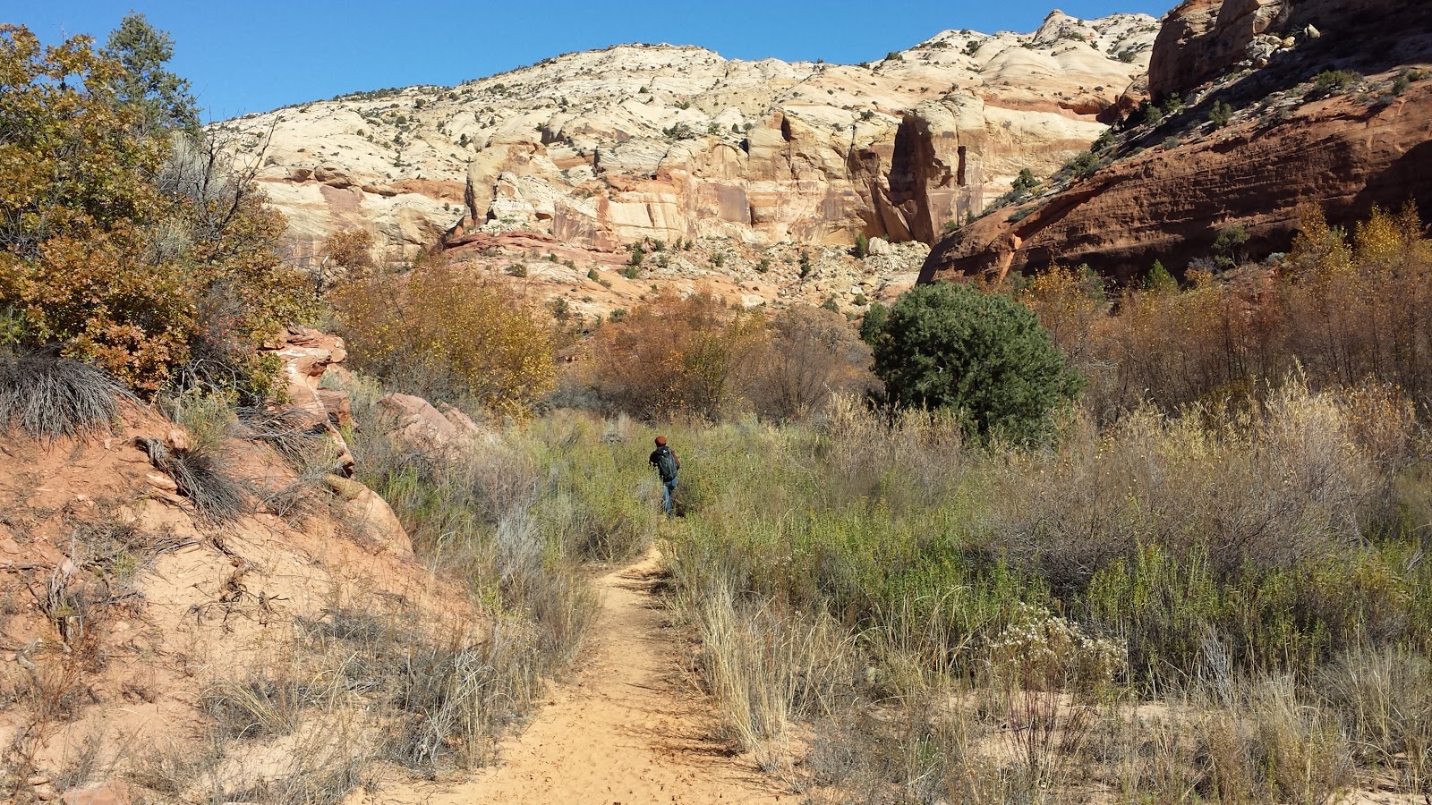
But wait, there's more. Because the 20FQ is so compact we can be outside more, and with a very small environmental impact. Being only twenty feet long allows the RV to be towed with a relatively small truck. It also allows us to camp in most of the National State Parks, close to all kinds of great
Just one, of the places we'll go
hikes. The RV is also well insulated and has thermal pane windows, saving energy usage. Right now it's 25 degrees outside and with very little heat, it is very toastie inside. The lights are all LEDs which are more than bright enough and also use very little energy. But there's also a solar panel that helps keep the batteries charged.

The low resource usage along with 2 propane tanks, 2 six volt batteries, a sixty gallon water tank and ample food storage space makes living entirely off the grid and out in the wilds possible for weeks at a time.

Thoreau:

"went to the woods because I wished to live deliberately, to front only the essential facts of life, and see if I could not learn what it had to teach, and not, when I came to die, discover that I had not lived. I did not wish to live what was not life, living is so dear; nor did I wish to practise resignation, unless it was quite necessary. I wanted to live deep and suck out all the marrow of life, to live so sturdily and Spartan-like as to put to rout all that was not life, to cut a broad swath and shave close, to drive life into a corner, and reduce it to its lowest terms.”

With slightly more luxury, less-Spartan, and even less space per person, the Creekside 20FQ allows us to do just that, and to do it all over the country. Next stop - Arizona!

Thursday, November 12, 2015

Does a Person Poop in the Woods?

While the question of whether or not a bear poops in the woods may be rhetorical, it's not so easy when it comes to people. Yes people are in the woods, and sometimes, like other creatures, they need to eliminate, but when, if and how are matters of debate and in some cases, regulation.

It was on our recent hike to Calf Creek Falls that I began pondering the question most seriously. (Hiking leaves lots of time for serious contemplation!) The Falls, the large catch basin beneath is and the small surrounding field are an oasis in a desert. Reached by a short, level three mile hike they are also a destination for lots and lots of people. People who apparently feel it's not only a good place to swim, and picnic, but also poop.  So much so that the Forest Service has had to put up a no poop sign - directly opposite the falls.

(note the small black pile)
There are places in the wilds where no person should poop. For folks well-acquainted with backwoods pooping protocol and the reasons therefore,  the need for a sign was pretty surprising.  We know that human (and all animal) waste leaching into water is one of the leading causing of giardia, and that all eliminations should be done at least 300ft  away from any water source.  But apparently not everyone know this and hence the surprising but rather witty sign. 

While in the Sierra's  we also learned that people are also not allowed to poop (or rather leave their poop) on Mt. Whitney. The reason is not so much the water quality but the quality of the overall environment. While poo is organic, the harsh, cold climate does not allow the material to decompose and whatever is left there, stays there.  Historically the summit was the place to go. Until 2007 there was actually an enclosed stone pit toilet on the summit. Every year the Forest Service had to fly in a helicopter and fly out the 'stuff'. Now "All Mt. Whitney visitors must pack-out their solid human waste. Pack-out kits are distributed with wilderness permits. You must carry the waste bag back down the mountain to the poop disposal box at the trailhead."  

WAG
(toilet not necessary)
The referred to pack out kits are technically known as WAGs (Waste Alleviation and Gelling) Bags, Brian's Backpacking Blog has a great description on wags you can check out if you want to know more.  WAGs are now sold at most outdoor stores including REI and we've been seeing them in a lot of places. They can be purchased or homemade.

Mt. Everest is a good example of what happens when lots of people eliminate in  an environment where things don't decompose and WAGs aren't used.  The Huffington Post article "Mt Everest is Covered in Human Poop." explains the dirty details. It all goes to show that you can and often, should take it with you.

So when and how can a person poop in the woods?  Ideally you find a composting toilet. If one isn't  available, you're more than 300 ft from water and there is plenty of other organic matter in the area, dig a six inch deep hole, do your business, cover it over first with dirt and then with leaves, etc. Within three to six months the whole thing should be gone.

So yes, while bears just go randomly where every they happen to be,  a person can poop in the woods, but only in way that no one would ever know.  Now if we could just figure out the whole tree falling in the forest thing.

Tuesday, November 10, 2015

Mini Break to Grand Staircase Escalante

Snow at Bryce
Since the collision three weeks ago, we've spent most of that time in St. George. Weekdays are generally quiet and the local trails relatively empty. Every weekend however, there are numerous events and the place fills up. Considering that there are over 35 large hotels in town, that's saying something. One Saturday morning we woke up to discover that the entire hotel was booked by the Montview Marching Band. They and 30 other high school bands were in town for the Regional Marching Band finals. The air was tense at breakfast on Saturday. Sad and quiet on Sunday. Aside from Marching Band competitions there have also been bicycle tours, senior athlete games, and a huge art and craft show. On top of all that there are thousands of Utahians that just to go St. George for the weekend. Since we like life on the quiet side we decided that for our fourth weekend we'd leave...and happened to discover another reason everyone goes to St. George.
Grosvenor Arch

Our destination was Grand Staircase Escalante National Monument. Our hotel was in Cannonville, UT. The Grand Staircase Inn and Country Store is the only business in the small town. Located 12 miles east of Bryce Canyon, 6 miles north of Kodachrome Basin State Park, and 36 miles west of Escalante it promised to be quiet as well as the perfect location for exploring one the most awesome National Monuments in the country. The weather called for cold nights with temperatures in the low 30s, and daytime temps in the 50s. Every day sunny and clear.

The drive from St. George to Cannonville is only two and half hours. We left on Friday and took the
scenic route through Zion. Saw some bighorn sheep and buffalo. Stopped at Bryce Canyon for a little walk along the rim. Only two hours out from St. George and some differences were already clear. The rim of Bryce Canyon is around 8000 ft above sea level. St. George is 2880. We were wearing shorts when we left St. George, there was snow and ice at Bryce. Also, strangely enough a lot of the hotels, stores, restaurants and gas stations on the way in were closed. There were people around but you could tell from the number of empty spaces in various parking lots that there were a lot less than would be there at peak season. We didn't mind, it was great having the place mostly to ourselves.


Slot Canyons!
After a walk around we headed east and down to Cannonville passing through the town of Tropic. It's a larger town than Cannonville and since it was the only one of the two with restaurants, it was where we'd planned to eat. That flaw in that plan became evident as we noticed all of the restaurants (4 in total) were closed for the season.

Arriving a few minutes later at the Inn, and checking in at the grocery store located beneath the rooms, the cashier confirmed our observations. He also informed us that the grocery store was closed on Sunday. With no restaurants, and only the kind of food stocked in a small town store it became depressing clear that this was not going to be a weekend of good eating. I thought back wistfully to the Hawaiian Poke that folks in St. George would be enjoying.

With peanut butter and jelly sandwiches as our main staple we did however enjoy some excellent hiking over the weekend. Friday afternoon we hiked through the Willis Creek slot canyons. A series of four slot canyons along a mile stretch of the creek, the hike was the perfect start to the weekend.

Calf Creek Falls together!
Saturday we drove east, stopping at the Escalante office of the Grand Staircase Monument. They have some great exhibits there on the local wildlife, and the soil. Yup. The soil. Cryptobiotic soil  is everywhere in the southwest. Composed of lichens, mosses, algae, microfungi, and bacteria that hold things together making the soil crust are like a woven mat. The woven mat then helps control erosion and support other life. Continuing east and dropping down to the Escalante River we stopped at the trail head for the Lower Calf Creek Falls trail.

The Lower Calf Creek Falls trail deserves a blog entry of its own. Coincidentally I have already written that and you can, and should read it! Both S.D. and I have already hiked it, but if you are in the area, it is too beautiful a hike to miss and doing it this time with the most wonderful man in the world made it that much better. We enjoyed our peanut butter and jelly luncheon in a sunny spot by the creek watching the trout swim and dive under the rocks. We saw a few other hikers on the trail, but not so many as you'd expect at such a wonderful place.

Driving home we stopped for gas at the one station that was open but where the 'pump was cold' and so took about 15 minutes to fill the tank.

Under Powell Point

Sunday, the day everything was closed, we packed up another round of PB &Js and drove east again. This time S.D. had suggested that instead of hiking along the bottom of a canyon that we climb up and go for the long views. We chose the "Below the Point" trail. It was an excellent choice, and surprisingly while we had the best views of any hike, we didn't see another soul the entire time.

Monday morning we drove back to St. George. Back to open stores, restaurants, fast gas pumps, sixty-degree temperatures and lots of people. We now know that folks flock to St. George on weekends because not much outside of town is open, but we also know that makes the rest of southern Utah a great place for solitude and hiking...provided you have your own food and housing. The perfect place to be if you had an RV!


Wednesday, November 04, 2015

Living the dream, how we got here


Another guest blog entry by SD: Silent Dave.

The most common comment we get is still "wow, you're living the dream."   As I explained in a previous post (http://kellytimetoo.blogspot.com/2015/08/living-dream-will-take-some-getting.html) it needed some getting used to.  After five months of living on the road I can say we are definitely getting used to it and at the moment we would have serious issues with going back to our previous life style.  Another question we often get is how we did it.  In a couple of entries I'm going to address that one starting with how we got ready for this adventure.
A casual wedding

One of the best things I did was to find (after more than 50 years of looking) a great partner.  It might not be completely necessary to have a great partner, but it sure makes everything better.  KD tells me that on our first date she thought I was trying to scare her away by relating how I would like to get a van and hit the road and how that did just the opposite as she liked the idea.  It took a while to hit the road, eight years or so, but its worked out great.  We had lots of adventures in those eight years, now culminating in the KDT.   We keep looking forward and planning where it will take us next.

Yoga with snowshoes on, I'm not the most
 graceful even with out the winter coat and
snow shoes on! 
Another important aspect to getting ready for this adventure was staying in shape.  I always joked that going to the gym during the week and heading out for bike rides or hikes in New Hampshire was just enough to keep us from dying before we really started our adventure.  Sure we struggled with this and working in sedentary jobs made it tougher.  But it kept us close enough to being in shape that when we did hit the road, after a few weeks of all day activity killing us, now we can hike and bike and not feel like its killing us.  Being in shape, as an old work colleague told me and I completely buy into, means having strength,endurance and flexibility.  Cardio and lifting takes care of the first two, yoga takes care of the last.  In addition to hitting the gym after work I was also lucky to have a yoga class a couple of times a week during lunch hour at work.  It not only kept me flexible, well I'll never be flexible but I'm a lot better than I would have been with out it.  I was fortunate to have a great yoga instructor who keep pushing just enough to keep me getting better the more I practiced.

Additionally staying in shape meant keeping to a good diet, trying to stay away from junk food and all that and eating lots of fish, veggies and fruit.  A good chunk of dead flesh cooked over the grill never hurts either!        

This is what my hips look like now.
And lets hear it for modern medical science too.  Actually without the benefits of great surgeons I wouldn't be here as I was a hurting unit for a while there.  In the two years before hitting the road I had both hips replaced and arthroscopic knee surgery.  I was lucky to have a couple of great surgeons in Beverly who made it possible for me to hit the KDT.

Lastly I'll mention that having some cash also helps.  I've been putting money into retirement accounts, IRA's and the like, since I was in my 20's.  The only retirement I have is from 6 years as a Fed and that almost pays for our health insurance.  Almost.  Fortunately I've made some good investments in mutual funds and bought and sold a few houses over the years that were profitable.  One of the problems that KD foresaw was my thriftiness might be a problem.  But after saving for 40 years I've made the transition, with a little bit of hesitation, to spending.   In a few years I'll be able to collect Social Security, that'll help too.

After all, aren't you supposed to spend your last dollar the day you leave this mortal coil?  I'm working on that.

This is a quick primer on how we keep ready to take the plunge.  Next I'll go into the first phase of taking the plunge.


Tuesday, November 03, 2015

St. George Sojourn

Lee's Pass Trail
This Wednesday marks the third week since the Collision. During that time we've been living mostly at the St. George Inn and Suites, sorting out details with GEICO, travel trailer shopping and getting outdoors whenever we have a spare moment.


Somewhere in Snow Canyon

St. George is a pretty nice town. Considering that it's the winter destination for Utah, the climate for October and November is pretty mild. There are even palm trees outside the door of our hotel room. Further down the street, and two blocks west we discovered the Hawaiian Poke Bowl, a Poke restaurant run by a native Hawaiian. Poke is marinated fish served over rice and it is good! It's funny but we've eaten more fish the two weeks we've been in St. George, UT than we did the entire month we were on the Pacific Coast.

Taylor Creek Trail
 GEICO, our insurance company has also been pretty great. Although it seemed like forever to patient folks like S.D. and I, it only took one week for them to approve repairs to the truck and get it in the shop and two weeks for them to settle on the R-POD. During that two weeks we'd been busy researching our next travel trailer so that when they issued the check S.D. and I drove down to Las Vegas to pick it up and the next day drove up to Salt Lake City to put down the deposit on our new home, a Creekside 20FQ. It's a small travel trailer, but it has everything we'd ever want in a home...and it's easily trailerable. Now we're just waiting for the truck to get out of the shop so we can turn in the rental car, check out of the hotel, get our stuff out of storage, drive up to Salt Lake City, pick up the Trailer and head back outside.
Looking down into a slot canyon on the tail to
Observation Point

After six months of living mostly outdoors in wilderness it's been strange to be living inside, and in a town. Luckily it's a town that is surrounded by awesome hikes. Twelve miles west of town in Snow Canyon State Park,a canyon carved from the red and white Navajo sandstone. Trails run along lava flows, up petrified red dunes, and into slot canyons. Thirty miles west is Zion National Park, the park is a busy place but once we were a mile up and into the eight mile hike to Observation Point no less amazing. I last visted Zion in 2006, BD (before Dave) and have apparently been annoying him with its effusive praise ever since. A little bit into the hike S.D. understood, and agreed.

More Snow Canyon awesomeness
But more Zion surprises awaited us both. The North entrance of the Zion National Park leads to Kolob Canyon. Here we hike two other awesome trails. Taylor Creek and Lee's Pass. Taylor Creek is a lovely four mile hike along the creek between canyon walls so red that the light itself has a redish tinge. If that isn't amazing enough, the canyon ends at a huge cave/arch. Lee's Pass is a very long trail of which we only hiked about six miles. This trail also follows a creek but is very different from the Taylor Creek Trail. The creek bed is much wider, the canyon walls neither close nor as steep. But still amazingly beautiful. I never tire of the variations and intricacies of the various microclimates around here.

Word has it that the truck will be out of the shop 'this week'. Hopefully next week we'll be off and exploring new places in Eastern Utah.

Sunday, October 18, 2015

A Bump in the Kelly Dave Trail: Collision 2015

The Perfect Conversation Starter
There's no better conversation starter these days than the tailgate of our brand new 2015 Dodge Ram Truck. Since Thursday, October 15th people will stop us in parking lots, and even in the middle of the road to ask what happened. "Did someone run into you, or did you run into something?"

The answer is a bit more complicated. We were towing our POD, taking a left hand turn into an RV Park in Panguitch, UT (i.e nowhere) when someone going 65 mph hit the back passenger side of the POD.  The force of impact shredded the back corner of the POD, pushed the entire POD

Bumper POD
up into the truck tailgate, shredding the front right corner of the POD, bending not only the trailer tongue but also the half inch solid steel hitch,  thereby demolishing the truck tailgate. Or as I like to say, the POD and the tailgate  acted as giant bumpers between a 65 mph car and a stationary truck. The car and the POD both are totaled, the truck made out much better and only needs a new tailgate, some painting, and a new tool box.

The good news is all the people involved are okay, and GEIGO, our insurance company is being extremely responsive and helpful. The truck is in the queue at the auto body shop to be repaired sometime next week.

The bad news is that we now have to shop!  Overnight our day-to-day lives have become much different. I used to joke that we were homeless, now we really are!  Currently we are living in a hotel in St. George, UT (a much bigger town than Panguitch), and eating out and it's getting old real fast. While the last post was on finding the perfect camping spot, since Thursday, our days are filled with phone calls to insurance, storage, tow and repair companies. And shopping. Neither of us enjoys shopping but...we need a new home. 

Prior to the collision we had already been talking about getting a slightly bigger trailer but we hadn't started the research. Now we're deep into it.  There are an awful lot of RV makes, models and options and it's taken awhile to sort through it all. After spending two days visiting seven to eight RV dealers and browsing the internet lists we've narrowed down our choices.  Turns out the one we probably
We'll be back soon!
want isn't in stock around here. Tomorrow we're 'moving' up to Salt Lake City to visit a few other dealers including one that is an authorized carrier of our model. They don't have that particular model in stock but we can at least see the quality of the other models in the line...etc.  We'll also stop in at other RV places, just to make sure we haven't missed anything. Just too much fun.

But I really miss being under the stars at night and the quiet of the woods. It's the thought of getting back to it that keeps me shopping.


KD and SD and the Three Campsites

(This post was written October  14th. One day before The Collision described in the upcoming post)

Once upon a time there were two nomads named KD and SD who lived and traveled in an R-POD. Camping and hiking their way around the county was fun but sometimes it was hard to find a good campsite. One that had great views, great hikes, a nearby town, quiet, and good weather.

Above Yosemite Valley
 Sometimes they found a great campsite, like the Oh Ridge Campground on Lake June in the eastern Sierras. Nearby were two great towns, Lee Vining and Mammouth Lakes, Great coffee shops, bookstores, outdoor stores and a Vons (grocery store). The site was quiet and the views of the mountains and June Lake were stunning. The hikes into lake filled canyons were beautiful and they could and did make a day trip over to the West entrance of Yosemite.

But ... one night the weather changed. It got
Hiking up Bishop's Pass into the Sierras
colder and snowed. The pass to Yosemite was closed and the POD was cold! And so they moved South down 395 to the town of Bishop and then up to the Four Jefferies Campground (7000ft, Jefferies in this case refers to Jeffery Pines. Those awesome butterscotch smelling pine trees that you just want to bury your nose in and never leave.) And it was just right. The next day they hiked up to the Chocolate Lakes and had a great day. But...that night the weather changed. It got very cold. Snow started falling above them at 8000ft, . Even so, they wanted to stay but the battery in the POD was almost empty and solar showers just weren't going to be very practical at 40 degrees. Then it also started to snow at the campground and KD and SD reluctantly headed into town. (They spent a night in Bishop, CA at a RV park with full hookups where they charged the battery, ran the heat, took showers, did two loads of laundry and ate Texas BBQ for dinner and German pastries for breakfast.)


Wildrose Peak Looking Down at Badwater -
the lowest point in the US
Next they drove south and east 130 miles to Death Valley. And again they found the perfect camping spot at the Furnace Creek Campground (elevation -100 ft). That night they sat out in 70 degree weather and watched the stars and the Milky Way . The next day they hiked a perfect hike to Wildrose Peak. A hike they'd actually started 2.5 years ago but didn't have time to finish. This time they made the summit and enjoyed the views down and east to their current campground near the lowest point in the continental U.S. and west to the highest point in the continental U.S., Mt. Whitney, which was still covered in snow. Returning to their campsite they found the valley temperature soaring into the high 90's with an even higher forecast for the next day. It was too hot!

North Rim of the Grand Canyon!
They then headed east toward Zion. Traveling through Nevada and stopping one night at a RV park/Casino where they swam in an awesome pool but declined any gambling opportunities. Having ventured into Zion, they left after less than two minutes as there was a line to get in and all campgrounds were sold out. KD and SD apparently had forgotten it was Columbus Day, better know these days as Indigenous People's Day, weekend.

They then headed even further East to the North Rim of the Grand Canyon were they camped at the
Jacob's Lake Campground just 30 miles from the Park entrance. Camped among the quiet of a lodge pole pine forest at 6000ft, a small store/restaurant/inn across the street, only a few miles from many awesome trails in the Grand Canyon, and it was just perfect.

Monday, October 05, 2015

Oh To Live on Chocolate Mountain!

View from the trailhead
Image four millions of years ago an immense, mostly granite, mountain range lifting from North to South for 400 miles. Then imagine hundreds of glaciers carving out hundreds of those peaks into sharp summits and broad u-shaped valleys full of small clear lakes and fast running streams. Then imagine those fast running streams continuing this sculpting for another millennium. Then imagine that those peaks which rise from the desert in the east contain five different life zones, from the Upper Sonoran Zone to the the Arctic-Alpine zone above 10,500 ft. Then imagine hiking up through all those zones on a beautifully clear mid-fall day.

That's what S.D. and I did on Saturday. But not the imagining, the actually hiking. The 7.5 mile loop
First of the four lakes. Chocolate Peak
is to the right


up into the Chocolate Lakes begins at the 9000ft trailhead alongside South Lake. The aspen were just all yellows and reds, and South Lake a perfect blue. Following the Bishops Pass trail we climbed up through the Jeffrey's pines and into the White-bark pine forests. The Clark's Nutcrackers were busy, and unusually protective of their pine nuts. At 2.3 miles we turned left off the main trail and on to the Chocolate Lakes trail.

In the Arctic-Alpine zone. There are actual
glaciers over in those mountains!
The Chocolate Lakes are named for Chocolate Peak, a lovely 11,000ft brown mountain that does indeed look like chocolate (the chocolate topping is newer dark red volcanic rock that was deposited over an older white granite mountain), and rises over the four lakes. Hiking past them and scrambling up over the pass to Ruway Lake we entered the Arctic-Alpine zone. No trees, just small plants and even more stunning views. A little further on we connected up again with the Bishop's Pass Trail and hiked along Long Lake for more stunning views including a number of small glaciers that are still sculpting these mountains.
Looking West over Long Lake to Bishop Pass

The problem with the hike, the problem with all of the Sierras so far is that they are just too darn beautiful. It's incredibly hard to hike when every other minute you have to stop to take a photo. Even when you try and pace the photos, waiting until you are in the best possible location, you turn a corner in the trail and there is another absolutely fantastic view.

But we preserved. Finished the lovely hike and have more than 100 photos to prove it! (Those you see here are only a small, carefully selected few. )

Thursday, October 01, 2015

From the Sea to the Sierras


The new rig!

It's 6:30 am on Tuesday September 29th. The sun is rising lighting up the eastern slopes of the Sierras in the high mountain desert. Only eight miles south of Mono Lake, a 65 square mile shallow saline soda lake, and forty-five miles east of Yosemite Valley, the Pod and the new truck are nestled under the Ponderosa Pines overlooking June Lake. Only last Tuesday we were riding along the Pacific Ocean with the Pod and Bruce the van. It's been a week of changes.
Logistically the biggest change was swapping the van for a truck. Any misgivings we had on that score were quickly erased last Thursday when we packed up and drove east along steep, narrow, curving roads up 5000 ft into the Trinity Alps. Bruce just wouldn't have made the trip and survived. Hopefully Bruce will find a happy, less demanding home on the California coast. Long may you run!

The truck (and that is spoken in a very deep voice since it's a manly truck) is more than up to pulling the pod, is easy enough to drive and being diesel is getting great mileage.  An added advantage is in the west and mid west diesel is less expensive than gas.  The truck easily ascends the passes and the brakes don't smell on the descents. Only two and a half hours and 2000ft after leaving the coast we were in Redding, California, the high desert. We made a quick stop at the bank, post office, grocery store and in another hour, another foot of thousand feet in altitude (the park campground was at 6,000 feet), we were setting up camp, back in Lassen Volcanic National Park, back in the land of Ponderosa Pine forests and volcanoes.

Saturday we hiked up to Prospect Peak, the capstone hike of any visit to Lassen. From the summit at the North of the park, Mt. Lassen, Choas Craigs, the mud flow, Warner Valley, the Fantastic Lava Beds, the Painted Hills and the Cinder Cone are all visible...and amazing. The view of the Cinder Cone was especially so since Prospect Peak is right next door and looks down into the cone.

Sunday was moving day again. We drove East to Susanville, CA and then south on 395, skirting the Northern Sierras and driving through Reno and Carson City, NV. Back into eastern California and into a totally different world. Our current campsite's elevation of 7000ft, but that's low compared to the 11,000 plus peaks towering above it to the west. The air is dry, the climate technically desert. Where trees do grow, they're Ponderosa and Jeffrey's Pines and in the canyons, Aspen. Sand, sagebrush and rabbit brush cover the ground. The two most prominent features of the area are the Sierra Nevada range, which we'll be hiking and exploring soon, and Mono Lake which we explored yesterday.

Mono Lake is not your usual lake. First of all it's an inland lake. Water drains in, doesn't flow out. Secondly it's salty, and alkaline. Fish don't live here, only brine shrimp (remember sea monkey's - those are really brine shrimp) and a special kind of fly. Lots of them. To eat all the brine shrimp and flies, there are birds. Lots of those too. In addition to all that there are tufta's. Tall pillars of calcium carbonate that form where fresh water springs bubble up in the alkaline lake waters. Where the lake has receded, the tuftas rise out of the plain looking very other-wordly.

The sun is up now. The dry wind is howling through the campsite and up the canyon. Later today it'll reverse and start howling down until sunset. As the sky turns pink and red, the wind will cease, the pines will be quiet again. But for now the Stellar Jay is still scolding me for not feeding him, and there are canyons to hike!

Mono Lake


Tuesday, September 22, 2015

RVs, BATS, Trucks, and Travel Plans

It's a sunny day today in Arcata, California. In fact, most of our five days here in Arcata, on the California coast just North of Eurkea, have been sunny. We're staying at an RV Park just between the coastal plain and the mountains. In the mornings the fog sits on both the coast to the west and the mountains to the east, but usually we're in the sun. By mid-day the fog has blown or burned off either the mountains or the coast (usually not both) and we can go exploring.

The RV Park, Mad River Rapids RV, our first, has been a pleasant surprise. Everyone has been friendly, and very accommodating to our changing plans. We originally pulled in for just two nights while waiting for R-POD plates to arrive. The RV park is almost always sold out but worked with us to extend our stay when the plates were delayed and again when other changes (see below) meant an
BIG two man chainsaws!
even longer stay. The guys here have also been helpful with various RV tips and tricks that we need to set up the R-POD. They also had recommendations for places to check out.

Yesterday we  went out to the Somoa Cookhouse, had a lumberjack-style  lunch (family style) and visited their lumberjack museum. I haven't mentioned the logging out here much, but it is a significant part of the West's past and present. It's hard to ignore it's effect on the present (the clear cuts, the disappearing redwoods, overt references to snowy owls, lumbermills, mill towns current and dead, etc.). It was interesting to see the old photos, artifacts, and images from the past.

Rolling coastal farmland
Friday, the fog burned off the coast and we went for an excellent bike ride through seaside dairy and sheep farms, over converted railroad bridges (below which we saw a family of otters in the river), and along the Pacific coast.

Saturday, the clouds lifted off the mountains and we drove south through the Avenue of the Giants, a 26 mile road through what we've come to call BATS (Big Ass Trees). While we decided against paying the fee to drive Bruce through a privately owned BAT, we did stop at the excellent Humbolt Redwoods State Visitors Center and admired the Nash Quad Travel Log, a 1917 truck with a hollow redwood for its body. Built by Charles Kellog who imitated bird songs, and a campaigner for the protection of the redwood forests. (http://www.npr.org/templates/story/story.php?storyId=1521510) The truck layout is nice, maybe a little cozier than the R-Pod, but definitely cool. Also a bit heavier.
Travel Log (photo from mnn.com)

And speaking of the weight of the R-POD. We purchased the R-POD for a number of reasons, one of them being it suitability for towing by Bruce, the Dodge Caravan. After towing the R-POD from Coos Bay, Oregon to Jedidiah Smith, CA we had a nagging suspicion that Bruce might not be up for the job. Our next run, 60 miles from Jedidiah Smith to Arcata, CA confirmed that suspicion. It's not the Bruce couldn't do it, it just that he might well die trying. The hills weren't that big, and Bruce made it, but thinking ahead to the Sierra's...we just kept envisioning a groaning Bruce chugging up one side of the pass, and the smell of burning rubber as we smoldered down the other side. It is with great sadness, but total belief that it is the right thing to do, we used our time in Arcata to go truck shopping. The dealer was able to order the one we want and on Wednesday, September 23, we trade Bruce in on a 2015 Dodge Ram 1500 Eco-Diesel. (Please refer all follow-up questions on the truck to S.D. I know nothing other than it is silver, it has the 'tow package', will get significantly better fuel mileage, and according to the guys at the RV park, "We won't even know we're towing anything." ).

After that change, we hope once again to be on our way. Thursday we'll drive east and with a few stops along the way, with plans to be on the east side of Yosemite by Saturday. It's starting to get chilly there but we hope to have a week or however long we want to explore there before heading further south to Death Valley.

Tenative travel plans are as follows:
Yosemite
Death Valley
Zion
Staircase Escalante
Monument Valley
Moab
(with lots of stops in between!)

Thursday, September 17, 2015

Wrapping Up Our Pacific Coast Visit

Fern Canyon
It's been roughly a month that now that we've been traveling along the Washington, Oregon and Northern California coasts and rain forests. The coast is beautiful, the forests grand, the wildlife impressive. In all that time however, we've probably had three to four solid days of sun. The rest have been cloudy and or foggy, and with or without rain. And it's starting to wear a little on our attitudes. For instance today was supposed to be one of the sunny days. It's cloudy, and as I'm sitting out here typing, it's just started to rain. Not that it was 'dry' to start with so I guess actual rain doesn't really matter all that much...except that I feel grumpy either way. 

The book"Mountain Weather", which in addition to a discussion of mountain weather around the country, also details the four major North West Pacific Coast weather systems. Each one brings rain to the Pacific coast from Northern California, all the way to British Columbia. The only differences seem to be how much rain and wind will accompany the front, and if there will be a thin layer or a down comforter like blanket of fog accompanying it.

The people here like it that way. They love the rain, and are comforted by the fog. Yes they appreciate sunny days too, but only as a rare and sparkling phenomena. It's the rain that makes the Redwoods, the rain forest and the coastal dwellers happy, not so much the sun. Tuesday we hiked to Fern Canyon. Not because we have not seen plenty of the seven different kinds of ferns that grow on the famous fifty foot high "Fern Wall", but because we're afraid the information services person at Jedidiah Smith Redwoods Park will be extremely disappointed if we do not. We can "either hike the 12 mile canyon hike or drive down to the mouth of canyon but you can not leave without going!" she implored us. As promised, the canyon was pretty cool. Lots of ferns, moss, a stream, banana slugs, redwoods, and rain.

S.D. contemplates the Rain Forest
They also love their fog. Route 101 follows the coast, sometimes right above the ocean, and often in the fog. Last Thursday we had driven south along 101 from Coos Bay, OR to Crescent City, CA. Yesterday we drove continued South from Crescent City to the Prairie Creek Redwoods State Park near Orick, CA.  On both days the coast was blanketed in fog. But even though you can't see much there were always cars pulled off into the overlooks. Folks are out, peering off into the distance or hiking down the cliffs to the beach. (Atlantic Ocean folks please note - no one here swims at the beach. I've been told by more than a few locals that the idea swimming is "just silly". However, the water seems a little warmer than the Atlantic water off Maine.)

Personally I'm more interested in running into the rutting  Roosevelt Elk that are supposed to be everywhere in the Prairie Creek Redwoods State Park. Late August through early October is prime mating season and coastal locals (from Port Townsend to Crescent City) have insisted we have to hear the bull elk mating calls. We've seen the elks, but so far they've been silent and calm.

Currently we are hanging out in Arcata, CA for the next few days. Waiting for the R-Pod license plate and registration to arrive from South Dakota. Once we get that in our rain soaked, fog covered little hands we are turning due East and hopefully the sun.


Wednesday, September 16, 2015

Back on the Road...With an R-Pod 171

Written September Saturday, 12th

R-Pod In the Redwoods
After a brief hiatus visiting with family and shopping for the perfect RV we are back on the road. S.D., myself and our R-Pod 171. Tucked into a nice spot between the towering coastal redwoods of Jedidiah Smith State Park, CA, things are looking good.

It's the third full day in the 'Pod'. After picking it up in Coos Bay, Oregon and two nights in the fog at Sunset Beach State Park, we headed south. We're starting to feel like the 'pod' will do what we need. Provide a good home base for our adventures, eliminate the need for hotel days, allow us to stay 'out' longer, and let us get in some bicycling too! At the same time, unlike other RVs we looked at, it won't insulate us from the outdoors or enlarge our 'footprint', nor our opportunity for adventure too much.

S.D. in the Redwoods
If you've ever lived in a small boat, that's what living in the r-pod is like. It seems a good compromise between being outside, and still having some of the comforts of home.  Maybe it has more headroom than a boat and with a rectangular berth instead of a v-berth, but they're still very similar. There's just enough storage space for everything to have it's place, provided there isn't too much. One person can stand and cook in the two burner, one sink galley or get dressed, so long as the other is sitting down at the settee/table, or outside. There is a functional head (bathroom) but it's easier to use the shore facilities.

This morning after brewing coffee inside, and enjoying it outside, S.D. and I hiked through the redwoods, along the banks of the Smith River. The Redwoods are as amazing as ever, the Smith River clear and inviting. We returned home mid-afternoon. It's been three months any place felt like home but the r-pod is definitely in contention.

Wednesday, September 09, 2015

Time For a Change?

S.D. Making the Coffee
Really, it was the coffee that was the tipping point. Up until the morning at Gathering Grounds when the owner emphatically urged us to get the Hario coffee grinder  we'd been happy using pre-ground coffee. Every morning (each one suddenly becoming successfully colder than that last) one of us would bundle up in every possible piece of clothing, crawl out of the tent, open the car hatch, carry the kitchen gear box over to the picnic table, get the gas stove out of the car, open it up, pump up the fuel tank, light the stove, dig the kettle out of the kitchen box, go back to the car, fill the kettle up with water from the jug, set the kettle to boil, warm up the coffee mugs, set up the pour-over with coffee, bring the water to a boil, then do the pour over - just as the other one of us crawled out of the tent. The idea of adding freshly ground coffee to the routine was appealing, but just too much work to add to an already lengthy process.

We needed a way to simplify the coffee routine, and for that matter it would be nice to do something about the cold. Tents are great at keeping out the rain, bugs and dirt but not so good at keeping you warm. And have we mentioned that using the solar shower in the cold was starting to get tricky? Sure it would heat up in the sun. Somedays even up to 104 degrees but by then it would be 4:00 or so, and the air temperature would be dropping into the 60s.

So when the coffee guy suggested a coffee grinder a small RV began to really make sense. We'd (S.D. especially) had been already thinking about RVs and been researching the options. He'd learned that Bruce's towing capacity was very limited. Any RV we got would have to be small. That seemed fine as we really didn't want anything that would limit our ability to stay at the backwoods campgrounds that we most enjoyed. We also didn't want to complicate our adventures any more than necessary. At the same time, a coffee grinder, maybe a small grill, maybe even our bikes, not to mention a warm bed and shower could be great additions to our adventures. A little more 'luxury' could make also make our adventures a bit more sustainable. Something we'd be happy doing longer. 

And so, still hiking and exploring our way around Washington and Oregon, our search began.

Tuesday, September 08, 2015

Library in a Milk Crate: Reading on the Road

The Library is in there - somewhere
No matter how exciting a life on the road is, life without books is unimaginable. Back in the day, when we lived in a house, in a town, with a library, we visited the library every other week, picking up six to seven books each time. We also had a bookshelf full of cookbooks, trail guides, local history and general info. There were also a number of books on my kindle, and when desperation struck, and there was an internet connection, there were plenty more to download. When we left Massachusetts, we left with one milk full of reading material, our Milk Crate Library. As a librarian I'd mentally subdivided the library into three sections; cartography; containing maps of Michigan, Oregon and Washington; the reference section, containing Oregon bike routes, Canyonlands hikes,etc and general reading; both fiction and non-fiction. As our adventure has continued, we've had to discover sustainable ways to keep the material fresh, relevant and still keep it in a milk crate.

General Reading
Since there are no library cards on the road, and no internet connections in campgrounds it was only a week out and we were hungry for some new books. Desperation is a good motivator and it only took a few more days for us to secure a reliable means of obtaining books. Library book sales. Almost every public library takes book donations and has at least a book trucks worth of books for sale. Now, whenever we're in need of new reading material we locate the next largish library on our route and pull all our read materials out of the milk crate. We donate the 'old' books, and then buy 'new' ones from the book sale carts and shelves.

Cartography
This section has grown rapidly since leaving New England. While we generally picked up and disposed of state maps as we drove across the country resulting in no net gain there, we have also been buying Forest Service maps. These are detailed, often water resistant maps showing roads, campgrounds and hiking trails. Invaluable for truly exploring any backwoods area we find that we are unable to weed (a library term for removing non-usefully items) them from the collection. The map section of the milk crate now contains over 13 maps.

Reference
This section is also growing and while the local and state hiking books can be considered part of the rotating library we've found some books that are always useful, as any good reference book should be! For instance after spending hours hypothesizing about the identity of various birds and wildflowers, S.D. surprised me with two excellent guides as birthday presents. We also re-purchased "Mountain Weather" the one thing so far that we regretted selling back in Massachusetts. If we keep growing this and the cartography section at the current rate, we're going to need a second milk crate...and where will we get the space to keep it?

Friday, September 04, 2015

John Day, Dayville, John Day River, the John Day Wilderness, and the John Day Fossil Beds National Monument,

There are many ways to get a place named after you. In this country one of the most successful strategies seems to be having been the first president. There are Washington states, districts, counties, towns, roads etc, everywhere.  That option having already been taken the next best method seems to be 'finding' and naming it yourself.   Apparently however there is one other option that works particularly well in central Oregon.  Get yourself robbed and stripped naked by Indians. That's what Virginia trapper John Day did in 1812 and subsequently he now has a whole slew of towns, rivers (there are 4 forks of the John Day River), a National Monument and a Wilderness area named after him. We drove into John Day (town) early in the morning after a long night of discussing what exactly all this traveling was about.
John Day Fossil Beds - Outhouse

We didn't have any real expectations aside from maybe finding a grocery store and a shower. What we found was the John Day (river) running through the high desert, and a way of life and land that was totally new for an Easterner like myself. Here was a place where water, even more than high temperature and dry air, and millenniums old volcanoes, are the major players. Many thousands of years and hundreds of volcanoes (see the John Day Fossil Beds National Monument) ago the area around John Day (town, river, monument, wilderness) was a flat volcanic plain. Then the John Day Rivers started running, starting cutting down through the volcanic layers, creating deep river valleys and wide flood plains. Revealing the fossils of the National Monument and creating the rich flood plain soil of the valley. Today, even while the erosion continues, the river and the underlying watershed are tapped to irrigate the crops of area ranches and make human high desert life possible.

Slide Lake - source of the John Day River
After locating both the grocery store and the all important Shower at the Clyde Holiday State Park (no idea why Clyde was the namesake), we drove west through the valley and along the John Day river to the Fossil Beds. Hiking up green, blue and red canyons, and visiting the Canto Ranch in 90 degree heat. Sure the weather was hot, but this was all too amazing to miss. Beside, we stopped in Dayville (named after our favorite trapper and also containing the Murderers Creek State Wildlife Refuge) on the way back for a Huckleberry ice cream cone.

The next day we drove east through the valley and along the John Day River to the Strawberry Mountain Wilderness, the source for the John Day River and hiked up through huckleberry bushes (keeping an eye out for bears) to Strawberry Lake and then along a steep canyon wall to Slide Lake. Another great day of hiking, followed by happy hour brews at the 1188 Brewing Company in John Day (town)

On the third day we drove north and then east, checking out the areas around the North and South
Granite!! trail in the Elkhorn Range
Forks of the river and eventually setting up camp at Anthony Lake in the Elkhorn Mountains. The following day we hiked up into the North Fork John Day Wilderness. Walking up, into and around those rare western granite peaks was spectacular, and it felt a little like being home. Being granite, the plant life and trail resembled the White Mountains of New Hampshire. Unlike our hikes into volcanic based mountains, here we walked along rock solid outcroppings, and along numerous bogs. The plants too felt more like home, the trees a bit smaller and with a larger percent of rhododendrons and laurels in the understory. The views however, were still western. Large sweeping panoramas of valleys, volcanic mountain ranges, buttes and plains. The perfect capstone to a week with John Day.
A man, a really un-historic event, many amazing places and a legacy that only goes to show that sometimes really bad days can get you associated with some awesome places.