Showing posts with label Oregon. Show all posts

Sunday, September 13, 2020

Livestock Evacuation


As last week's Two Four Two Wildfire billowed just a few miles to the North of home. Dave and I loaded the car and truck with financial papers, a few family heirlooms and camping gear (housing options for evacuees getting slimmer by the hour), and consigned most everything else to the flames.  Chances were good that we'd loose everything, the house, the cars, and lots of stuff. I however, had only one huge regret. I couldn't evacuate the sheep.

The Five Sheep of The Apocalypse


When planning for them - I thought I'd covered everything. They had a shady, clean and dry spot to sleep, plenty of pasture to graze, a secure boarder fence to keep them in, and the coyotes out. One thing I hadn't figured on however, was how to evacuate them in the case of a wildfire. Dave and I do not have any type of livestock trailer, or even pen that we could jury rig in the back of the truck.

Oblivious to all, Big, Little, Brownie, Roman and Brownie Boy, just went about their daily routine. A little grazing, a sip of water, an hour to two of ruminating in the shade, repeat. All we could do was hope that if the fire came the firefighters would cut the fence and let them out. It was a realistic plan. Given that the fire would come from the North, and that the sheep pasture, boarding the road on two sides, would be the fire line, there was an excellent chance that this would be where they stopped the fire.

At least that's what I rationalized. Once we were all packed and had a spare moment, I began researching other options. Livestock evacuation, especially where there is more livestock than people is a big operation.


Here in Klamath County, as soon as the fire started, the Fairground sent notice that the barns, stalls and turn outs were receiving animals. Volunteers mobilized to tend them for owners who themselves had been evacuated. Farmers and agricultural supply businesses donated bedding and feed. People posted used social media to send out requests for help, other people responded. Folks donated their own pastures, barns and food. From our house we watched empty trailers going North, full trailers coming back - even as huge black smoke clouds rose above us.

Fire? What fire?
Klamath County is in no way unique. This was, and is happening everywhere there are livestock in evacuation zones up and down the West Coast. In California, livestock evacuations happen so often that there is now a Group called Cowgirl 911. They're a huge volunteer operation that helps co-ordinate the evacuation and support efforts. Connecting evacuees with resources all throughout the west. Individual ranchers are also working overtime. I've been following one such ranch, Dot Ranch in Scio, Oregon.  The owner there has been out every day (almost every hour) pulling animals out of danger zones and getting them to safety. She's also been raising money for feed, and delivering hay and other essential supplies. The Klamath Basin Farmers  ran a convoy of seven semi-truckloads of hay up to ranchers in northern Oregon. And the list goes on.


Dave and I, and the sheep are all safe for now. But the fires are still burning, and there is a new fire watch for this evening and into tomorrow. I've got a better idea of what to do if we need to evacuate soon. Next year - there will be more fires - and I'll have a sure means, and place to take the sheep.




Friday, September 11, 2020

And We're Back


Smoke from the 242 Fire behind the house.
The small dot to the left is one of the 2 Scooper planes
that flew between the lake and the fire for 3 days.


I've been meaning to start writing again and what with being in the middle of major national event, now seems a good time.


This post is going to be about Fire. Coincidentally, my last post in December of 2018, was also about fire. Seems to be theme. An other theme, I've been meaning to write about is the differences between the East Coast and the West Coast. And here too, Fire is the perfect place to re-start.

On the East coast, and mid-country for that matter, fires are serious, often tragic, but bounded event.  They are contained both in a relatively small time and space. A home, business or empty lot will catch fire and burn. Within a day or two the fire will be put out and the painful process of recovery will begin.

Out West, or any dry region for that matter, Fires are a season. Once a fire starts, it really doesn't end until it rains...and it doesn't rain for months at a time. The goal of firefighting is to contain a fire, not to put it out, but rather to establish a barrier around the fire. Establishing the barrier, often around hundreds of thousands of acres is a huge task. Especially while also trying to protect homes and property within the fire zone and evacuate people and livestock out.

Right now, in the State of Oregon, over 900,000 acres are burning. Guess what state is just a little smaller than that? If you guessed Rhode Island, you are correct! So think about that, Rhode Island is burning, has been burning for about 3 weeks and will continue to burn for about 3 more (if we're lucky).

But wait, there's more! In California 3,577,926 acres are burning and in Washington there are  500,000 acres burning. So roughly 4 million acres or a little over the total acres in Connecticut.

Don't go yet! Idaho, Montana, and Colorado are also experiencing record fire seasons. (This is really getting depressing so I'm not going to run the numbers here). So lets just say, Connecticut, Massachusetts and Rhode Island are burning, have been burning for at least two weeks and will continue to burn for the next month.

That's a lot of burning!  A lot of displaced people and animals. A lot of ruined lives. Recovery can't even start to begin until it rains, and will then continue for a long time..until next fire season.

So, not a happy post to start back up on, so I will just briefly mention one other big difference between the West and East Coasts. The roads, or rather the condition of the roads. Every time I'm driving out West and see a "Caution - Bumpy Road" sign I gotta laugh.-Driving over the very slight "bump, I imagine the distress of the road crew trying to sign a typical Massachusetts or Rhode Island road.  They wouldn't know where to start - let alone where to place the signs amidst all the hub caps.


Friday, May 27, 2016

Wildflower Tour of Northeastern Oregon

(This post applies to adventures during the last week of April, 2016)


One of the many hillsides of beautiful sun flowers
Back in March, S.D arranged a late April tour of the Outdoors RV factory in La Grande, (Northeastern) Oregon. That's where our little home was built and April seemed about the right time since we also wanted to be in Ashland, OR the second week of May. Having sprinted through Northern Utah, Northern Nevada and Southern Idaho we found ourselves at the factory, mid-April, a week ahead of schedule.

The La Grande valley itself is largely agricultural, with a lumber mill and two RV manufactures thrown in. There are several smallish rivers and lots of mountains surrounding the plain.  In mid-April the weather was sunny, and warm in the daytime. The valley was green with the new spring grass and budding trees. The mountains however, were covered with large amounts of snow. It was beautiful but also possible, we were a little early for camping in Northeastern Oregon.
Unidentified purple flowers

We recalled from our previous time in Oregon that the natives seemed an adventurous bunch, undeterred by a rain or snow and walked into the Wallow-Whitman Forest Service Office to inquire about camping and hiking options. The Ranger inquired if we had noticed the snow? None of the Forest Service Campgrounds opened until at least May 1, and then only if the snow was gone. "You might" she ventured, "find that the state campgrounds are open."
Minam State Park - Camping under the flowers

We checked online, and it appeared that indeed they might...or they might not. It's amazing how unclear campground websites can be. But with hope in our hearts, and the promise from the Ranger that it was a beautiful spot we headed East up alongside the Minam River to the Minam State Campground. Thirty miles of winding paved and two miles of bumpy dirt road later, we arrived to find the campground. It was open, it was green and it was beautiful.

Calypso Orchid
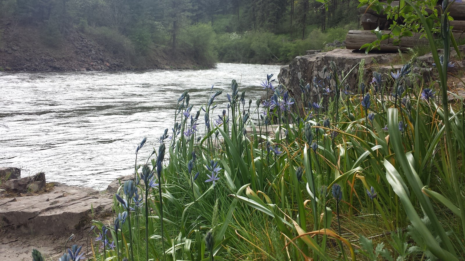
It was at this point that we realized that while we might have been too early for our tour, hiking up into the mountains, or camping in the National Forest, we had arrived at just the right time for the wildflower bloom in the valleys. Big, bright yellow daisy-like flowers covered every hillside. Next to our campsite, and scattered throughout the forest were white and pink blooming wild apple trees. We walked along the swiftly flowing Minam River and found wild apple trees, sunflowers and some other purple flower.

The next day we left the Creekside (our RV) parked under the apple tree and drove further up the Wallow Valley along side the eponymous river, through the neat and tidy towns of Lostine Enterprise and Joseph, under hills covered in yellow flowers, through hay and grain fields, past greening cow and sheep pastures. It was raining and with no chance of getting a good hike in we settled for the next best thing(s). A good burger and a fresh microbrew at Terminal Gravity Brew Pub. (Middle of nowhere, and the center of the universe). By the time we returned home, the RV was lightly frosted in white apple blossoms.

We woke to sunshine the next morning and really wanting to do some hiking, decided to try our luck at Catherine Creek State Park. According to the website, and the state brochure, it was not only open, it also had hiking trails. To get there we drove back to La Grande, then wound south, along Catherine Creek, for twelve miles before arriving at the campground. It too was open! We pulled into a lovely spot beside the wildly flowing creek, set up for the night, and set out to find those hiking trails!

The bad news was that there was only one trail it was only a mile and half. The good news was that the trail climbed through a beautiful forest and there were lots more wildflowers. We saw a ... blooming Oregon grapes, Calypso Orchids, lupines and more. Probably more wildflowers per foot hiked than anywhere else.

Trout lily
Following the night at Catherine Creek we headed a bit North, this time headed for Bird Tracks Spring Campground. Unimaginatively named for the fact that a bird walked in drying cement around a spring head...and left tracks. There was also a trail there that went along the Grande Ronde river and was a birding hot spot. We didn't see many birds and we did find the spring head with the tracks but more remarkable was our campsite. It was surrounded by yellow trout lilies! I don't think they bloom for very many days so it was all the more remarkably that we were there for their brief show.

Two days later we toured the RV plant. No wildflowers there but it was a very interesting, two hour tour. Learned that RV manufacturing and boat building aren't all that different. Admittedly an RV will not float but the design efficiency, and parts have a great deal in common...and they make it all possible for us to be on the road and see more wildflowers!

Friday, September 04, 2015

John Day, Dayville, John Day River, the John Day Wilderness, and the John Day Fossil Beds National Monument,

There are many ways to get a place named after you. In this country one of the most successful strategies seems to be having been the first president. There are Washington states, districts, counties, towns, roads etc, everywhere.  That option having already been taken the next best method seems to be 'finding' and naming it yourself.   Apparently however there is one other option that works particularly well in central Oregon.  Get yourself robbed and stripped naked by Indians. That's what Virginia trapper John Day did in 1812 and subsequently he now has a whole slew of towns, rivers (there are 4 forks of the John Day River), a National Monument and a Wilderness area named after him. We drove into John Day (town) early in the morning after a long night of discussing what exactly all this traveling was about.
John Day Fossil Beds - Outhouse

We didn't have any real expectations aside from maybe finding a grocery store and a shower. What we found was the John Day (river) running through the high desert, and a way of life and land that was totally new for an Easterner like myself. Here was a place where water, even more than high temperature and dry air, and millenniums old volcanoes, are the major players. Many thousands of years and hundreds of volcanoes (see the John Day Fossil Beds National Monument) ago the area around John Day (town, river, monument, wilderness) was a flat volcanic plain. Then the John Day Rivers started running, starting cutting down through the volcanic layers, creating deep river valleys and wide flood plains. Revealing the fossils of the National Monument and creating the rich flood plain soil of the valley. Today, even while the erosion continues, the river and the underlying watershed are tapped to irrigate the crops of area ranches and make human high desert life possible.

Slide Lake - source of the John Day River
After locating both the grocery store and the all important Shower at the Clyde Holiday State Park (no idea why Clyde was the namesake), we drove west through the valley and along the John Day river to the Fossil Beds. Hiking up green, blue and red canyons, and visiting the Canto Ranch in 90 degree heat. Sure the weather was hot, but this was all too amazing to miss. Beside, we stopped in Dayville (named after our favorite trapper and also containing the Murderers Creek State Wildlife Refuge) on the way back for a Huckleberry ice cream cone.

The next day we drove east through the valley and along the John Day River to the Strawberry Mountain Wilderness, the source for the John Day River and hiked up through huckleberry bushes (keeping an eye out for bears) to Strawberry Lake and then along a steep canyon wall to Slide Lake. Another great day of hiking, followed by happy hour brews at the 1188 Brewing Company in John Day (town)

On the third day we drove north and then east, checking out the areas around the North and South
Granite!! trail in the Elkhorn Range
Forks of the river and eventually setting up camp at Anthony Lake in the Elkhorn Mountains. The following day we hiked up into the North Fork John Day Wilderness. Walking up, into and around those rare western granite peaks was spectacular, and it felt a little like being home. Being granite, the plant life and trail resembled the White Mountains of New Hampshire. Unlike our hikes into volcanic based mountains, here we walked along rock solid outcroppings, and along numerous bogs. The plants too felt more like home, the trees a bit smaller and with a larger percent of rhododendrons and laurels in the understory. The views however, were still western. Large sweeping panoramas of valleys, volcanic mountain ranges, buttes and plains. The perfect capstone to a week with John Day.
A man, a really un-historic event, many amazing places and a legacy that only goes to show that sometimes really bad days can get you associated with some awesome places.

Wednesday, September 02, 2015

Three Month Anniversary!

Ozette, Northern Washington Beachfront
It was either the migrating geese or the "eeek" of the osprey that woke me. We're the only ones at Fish Lake, Oregon this first morning of September, it's 38 degrees and there's no doubt that it's fall.

It's been three months that we've been 'on the road'. Early summer, the first month, we drove from Boston to Ashland, Oregon, exploring Michigan, South Dakota, Wyoming, and Idaho along the way. The second month we explored Southern Oregon and Northern California while trying to get ourselves in shape for the PCT, only in the end to decide that was no longer something for us. The third month we left Ashland, looped up through central Oregon, southern Washington, up to the Olympic Peninsula and the south along the coast and back. We're still trying to figure out to best live this life on the Kelly and Dave Trail (KDT) but we're having some great adventures. There have been some amazing places and hikes along the way, many of which I have written about, many more still to tell. But along with all those great places and we've also met some amazing people.

Klamath Falls, the first major town east of Ashland, may be most well known for it's giant inland lake and as a major stop for migrating birds on the western flyway, but it also has an excellent coffee shop. Gathering Grounds Cafe has great coffee, great atmosphere, an a great proprietor. Yesterday when we stopped by he had an awesome Nicaraguan roast, and we got to talking about the shop, Klamath Falls, John Day (an central Oregon town I'll write about later), road bicycling vs backroad bicycling (the shop is a major promoter of all things bicycling), Burning Man (the shop is on route from Portland and Seattle), and life on the road and trail.

Last week, while hiking out to Cape Lookout on the Oregon Coast we hiked with an Oregonian from the Astoria area. Like many Oregonians she loves her state, especially the coast, spends a great deal of time camping and hiking around, and happily shared lots of stories about the area and life as we hiked out to the point and back.

The previous week, we'd run into a Washington couple while hiking the beach at Ozette, part of the Olympic National Park. We were each hiking the loop in opposite directions but we met back up at the campsite later that night. They were retirees from Port Townsend who regularly drove out to Ozette to spend the night and hike. We spent a good two hours swapping hiking stories, getting further recommendations from them, and talking about the logistics of living on the road, something they were interested in trying.

The week before that we'd spent four wonderful days in Port Angeles, houseguests of a family friend. A former mounted policeman for the National Park Service, Jim had some great stories to tell about working in San Francisco and DC along with local dinning and hiking recommendations.

While at the Dalles campground just outside Rainier National Park, way back in the second week of
Trail to Cape Lookout, OR
August, we meet Niles. Niles and his wife Jacqueline had rented an RV and were traveling much the same route as us, but in the opposite direction. Unlike us their main goal was to locate various geocaches, and also unlike us they were German. It's always interesting to get the European perspective on the United States. Trump was just starting to make his 'interesting' comments and was still considered more of a fringe curiosity so we didn't have to talk about that, but guns, politics and the wonders of the natural country all made for very interesting conversation.

Pretty soon we'll be heading (migrating?) south through California, Nevada and Utah. The vague plan is to make a loop through those states returning to Ashland in December for Christmas. Along the way there'll be more logistics to figure out, great places to hike, and hopefully more great people to meet.

Monday, August 17, 2015

Volunteer.gov and Malheur National Wildlife Refuge

Driving north from Steens Mountain along an endless flat plan, through an actual plague of locusts that left a hundred or so crisp bodies embedded in Bruce's radiator grill, we arrived at the desert oasis of Malheur National Wildlife Refuge.  Malheur is one of the most extensive freshwater ecosystems in the western United States, and home to hundreds of resident and migrating birds. It also offers some interesting volunteer options for migrating humans.


Retirement comes with lots of times and unlimited options of how to spend it. Some people travel (our current modus operendi), some watch TV (average U.S. retiree spends more than 60 hours/week watching TV), some work part-time, some make home improvements, and some volunteer. (U.S. News). We've been a little curious about volunteering at the National Parks and Forests so a fellow traveler and self entitled "Naturalist Nomad" told us about the volunteer.gov website.  In additional to the Park and Forest Services, Fish and Wildlife, the BLM and other Federal agencies all list their volunteer openings. A number of the posts are targeted to folks like us, traveling retirees. Many offer a free tent site, RV pad, or housing in exchange for 25-40 hours/week. Go ahead, take a look at volunteer.gov if you're interested.

Camp Host appears to be the most prominent job. While I think S.D. would make an excellent parking garage attendant when he's 85, right now I don't think hosting is our thing. However, search deeper into the site and there are some other, very interesting options, including some at the Malheur National Wildlife Refuge. We thought the idea of volunteering there for a few weeks, learning more about birds, and giving back a little sounded interesting, and so we were stopping by to see just exactly what the area looked like. And it was really pretty cool. Locust plague aside, it was obviously a very diverse landscape of marsh, lakes, deserts, mountains and plains all located on the Pacific flyway, there was lots of opportunity to learn, and these types of volunteer opportunities might make an interesting addition to our nomadic lives.

We submitted our applications yesterday and will keep everyone posted!!

Sunday, August 16, 2015

To the Steens!

Having decided what we weren't going to do (thru-hike the PCT), S.D. and I were a little fuzzy on what we were going to do. The long term solution would have to sort itself out over time, there were still lots of questions on how best to "live the dream". Short term we wanted to get back on the road.

Steens Mountain Geology
We knew we liked exploring new areas, camping out, and day hiking. It was now August and we needed to get somewhere cool. Temperatures inland and below 4000 ft were now in the 80's and 90's. The coast was getting crowded with summer beachgoers and we wanted somewhere quiet. Additionally we had to get upwind of smoke from the growing number of forest fires, and we wanted to be back in Ashland for Labor Day weekend.

River Valley on the West Flank
And so we went to the Steens! "Steens Mountain is a large fault block mountain in the southeast part of .... Oregon that stretches some 50 miles North South along the Alvord desert."  Daytime temperatures rise into the 70's and fall into the 40s and 50s at night. It's sunny, and being located miles from any major population center, or large water body, we were pretty sure it wasn't a family destination. And while we'd have to drive through the smoke from the 23000 acre fire in central Oregon, and others in Northern California, air around the Steens should be clear.

Perfect Glacial Valley on the East
As usual we left early in the morning driving through Southeastern Oregon and for about 35 miles in the  most desolate section of northern Nevada I could ever imagine. When the road turned back North, back into Oregon and up we arrived in the little town of Frenchglen at the base of the Steens. In Rick Bass's collection of essays "Why I Went West" he often muses on how certain places connect with certain people. His connection is to a corner of Montana. While my connection to the Steens is no where near as strong as his to Montana, and I only 'know' the Steens from our short visit, I do know that I love them!!!

We arrived mid-afternoon and drove east up and out of the town. After a few miles of sagebrush in the dryer, lower elevations, the landscape was replaced by junipers. Higher up it gave way to  aspen and mountain mahogany. Just after reaching timberline we took a right turn off the loop road, drove a short distance down into a small bowl-like area that was once again forested with Aspen and also contained a lake and the small Fish Lake campground, where we spent the night.

View Up Canyon Through Mountain Mahogany
Continuing on the loop road the next day we steadily climbed up through alpine wildflower meadows toward the summit. Being a fault block mountain the summit is more of a long ridge than the traditional pointy-top peak. Being a very old fault block mountain it has also been eroded over the 20 million or so years since it was pushed up. On the east, or steeper side, this erosion was caused most dramatically by glaciers, and the west by creeks, streams and rivers.


So to sum it up. Amazingly perfect U-shaped glacial valleys on the left, steeply-cut river canyons on the right, miles of alpine wildflower meadows, and fantastic 360 views. Oh, and my first mountain mahogany trees!

For some reason, we only spent a day in the Steens, but I promise, we'll be back.