 11:30 and here's Angela at the trailhead. Clarendon Gorge to the south, my first 4000fter to the the North. I feel great, really good. It's time to move on, to be continuing on the path I set out on many years ago. Guess, unconsciously that I've been avoiding this section because - well, its hard to backpack up a mountain.
The Trail immediately heads up. On the way are some of these trillums in seed. I walked the previous section in spring when they were blooming, and I'd never seen so many in one spot. Now its amazing to see their brilliant red seed pods.
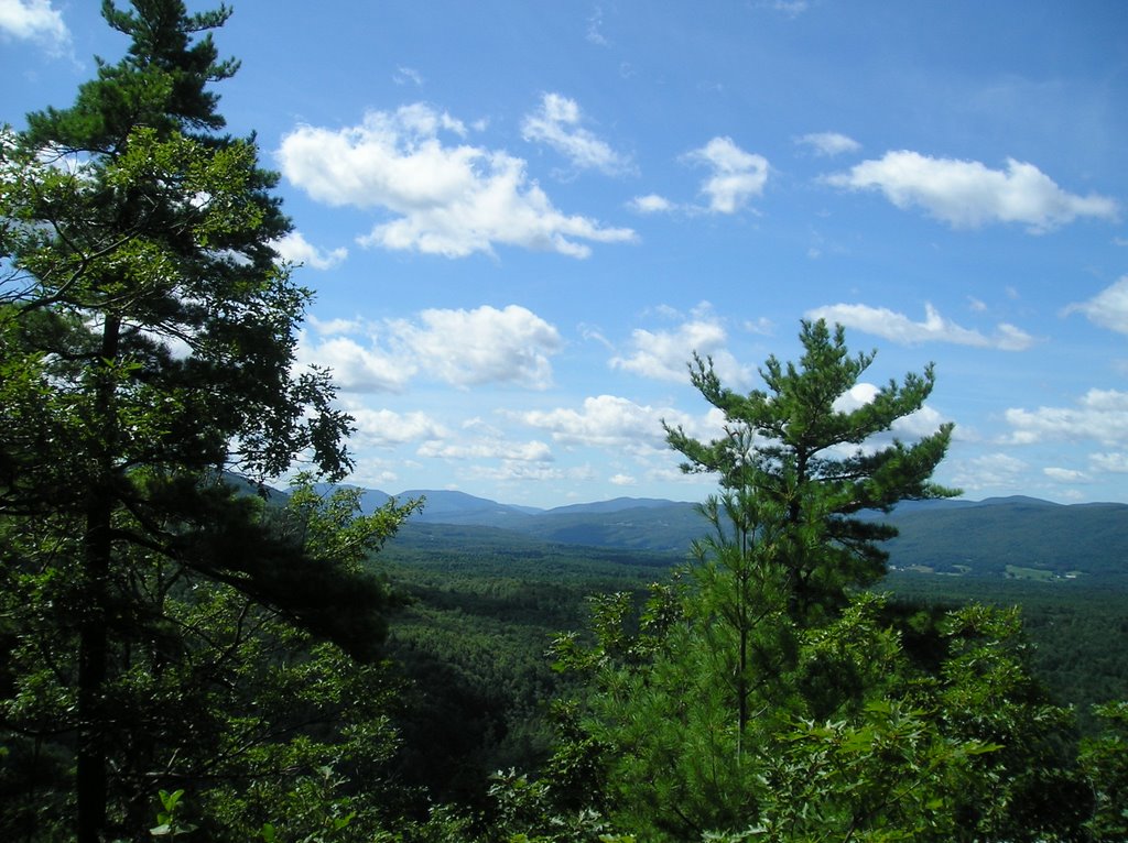 About 1000 ft up there is an overlook to the South. Cool to think I've hiked through those hills.
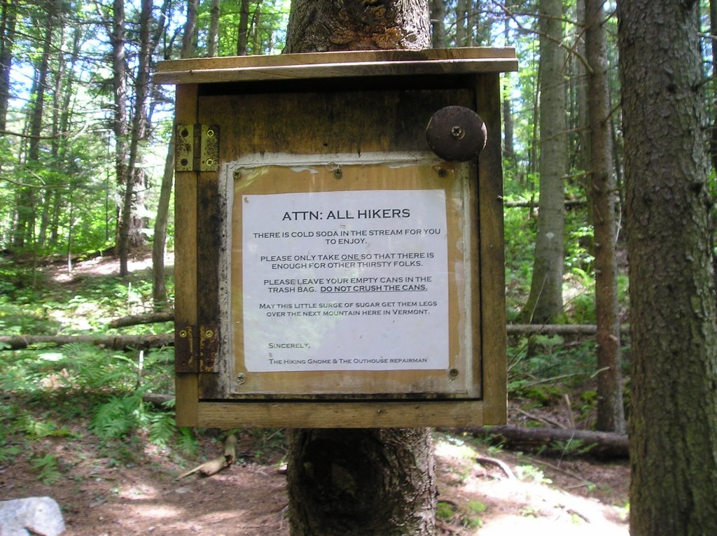
After a little drink and a snack, it's time to move on. While I'm happy my gut decided on this route, I'm a bit concerned about having to hike 12 miles, up a mountain, with a 26 lb pack - but gosh it is beautiful and there is always trail magic! I'd been hiking about 2 hours through amazing woods - huge pines trees and beeches, across little brooks and a few abandoned farm fields when I came upon an exceptionally nice stream - in which - very strangely - were 10 cans of soda. The sign on the other side of the stream however, explained it all.
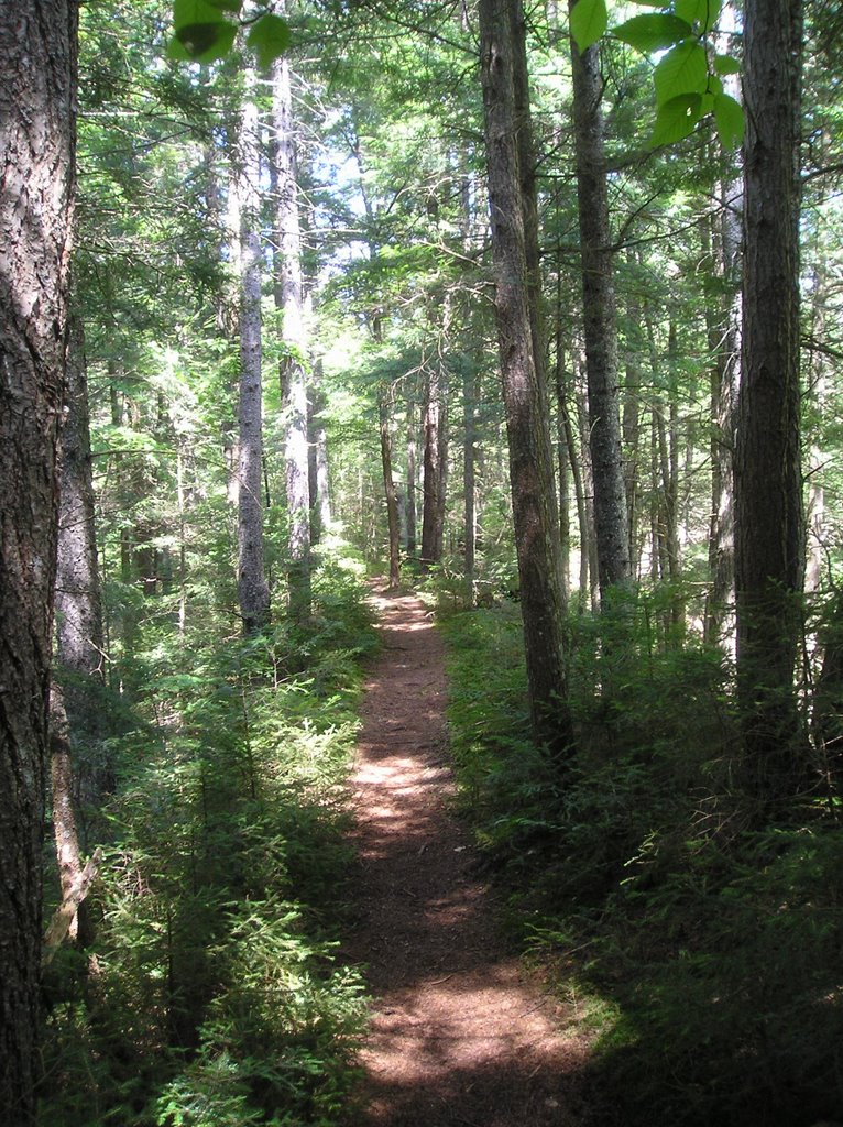
And of course aside from that there is just the miles of unending simple beauty...which my feet and hips are begining not to appreciate. Its 4:00 and I'm not even to the base of Killington. I'm starting to question my gut feeling to do this route. I'm wondering how I'm going to make it all the way back down, and I'm not even up, but right now I'm at a bridge crossing the Cold River and its time for a break. And then I remember - bus. Someone once mentioned that there are buses that run along rt 4, and according to my map, rt 4 is on the other side of Killington. The map also says its 7 miles from the rt4 trail head to Rutland, and 5 miles from Rutland to the rt 103 trailhead. So if my legs give out I don't have to go back over the mountain. Cool. This is, once again, doable. Sometime you have to go with your gut and trust that things will work out for the best.
At 6:30 I arrive at Cooper's Lodge. The days destination. Talking to a local there I confirm the bus option, stash my pack and head up the .2 mile scramble to the summit.
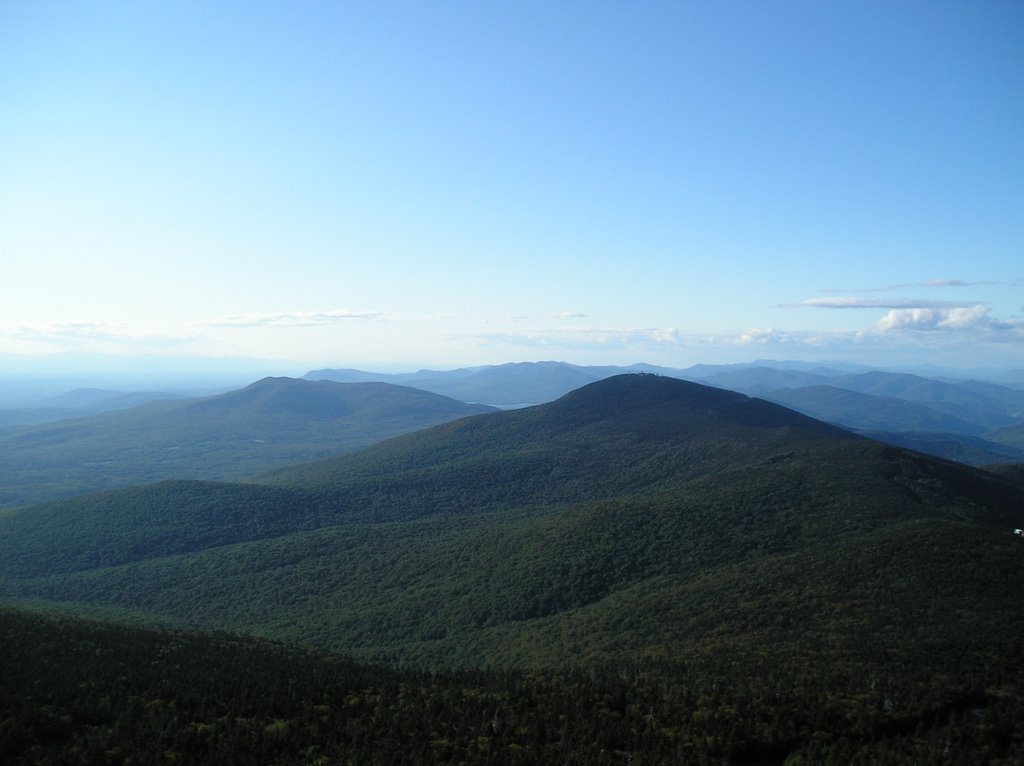
Need I say more?