Showing posts with label California. Show all posts

Sunday, October 18, 2015

KD and SD and the Three Campsites

(This post was written October  14th. One day before The Collision described in the upcoming post)

Once upon a time there were two nomads named KD and SD who lived and traveled in an R-POD. Camping and hiking their way around the county was fun but sometimes it was hard to find a good campsite. One that had great views, great hikes, a nearby town, quiet, and good weather.

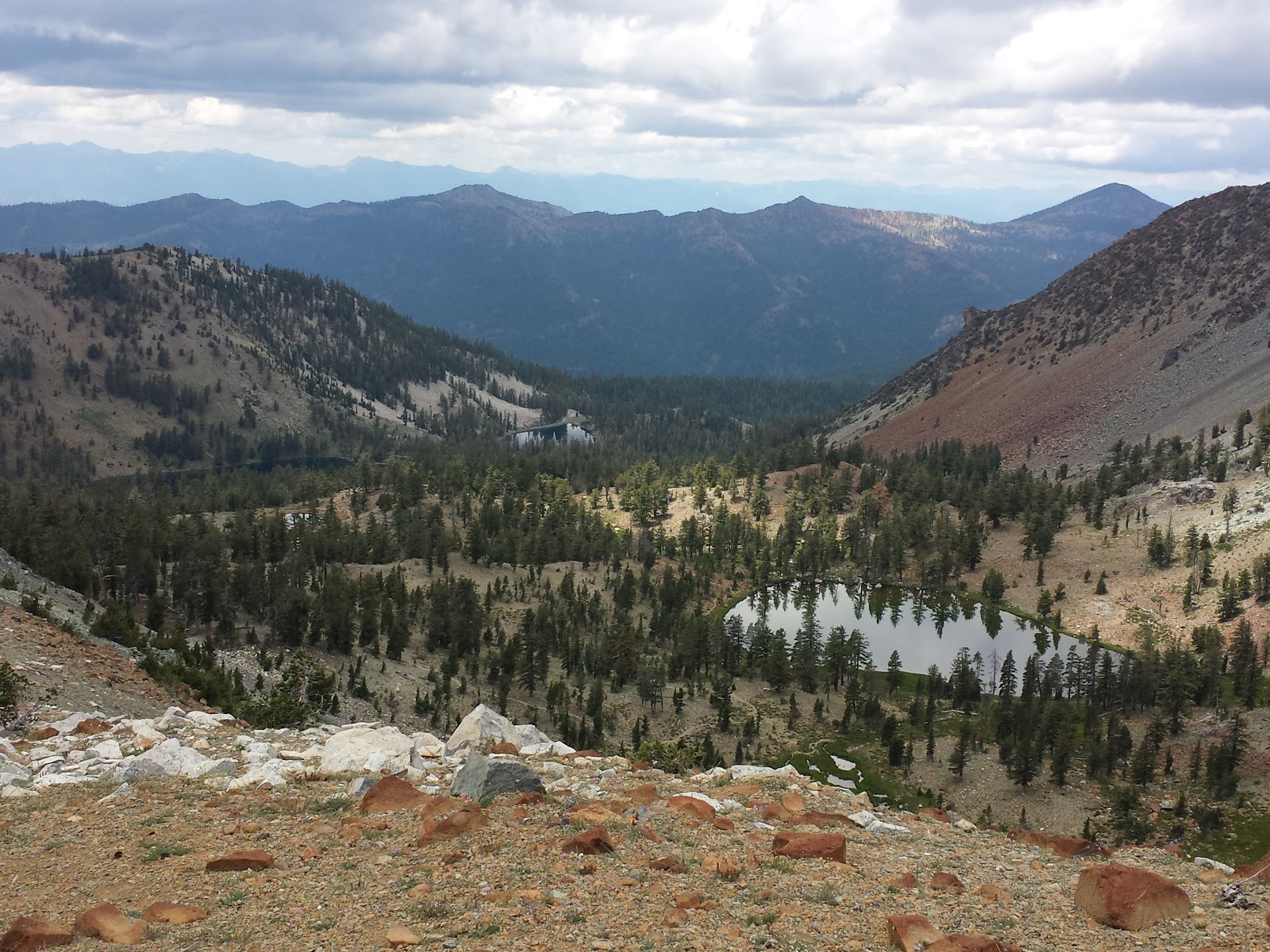
Above Yosemite Valley
 Sometimes they found a great campsite, like the Oh Ridge Campground on Lake June in the eastern Sierras. Nearby were two great towns, Lee Vining and Mammouth Lakes, Great coffee shops, bookstores, outdoor stores and a Vons (grocery store). The site was quiet and the views of the mountains and June Lake were stunning. The hikes into lake filled canyons were beautiful and they could and did make a day trip over to the West entrance of Yosemite.

But ... one night the weather changed. It got
Hiking up Bishop's Pass into the Sierras
colder and snowed. The pass to Yosemite was closed and the POD was cold! And so they moved South down 395 to the town of Bishop and then up to the Four Jefferies Campground (7000ft, Jefferies in this case refers to Jeffery Pines. Those awesome butterscotch smelling pine trees that you just want to bury your nose in and never leave.) And it was just right. The next day they hiked up to the Chocolate Lakes and had a great day. But...that night the weather changed. It got very cold. Snow started falling above them at 8000ft, . Even so, they wanted to stay but the battery in the POD was almost empty and solar showers just weren't going to be very practical at 40 degrees. Then it also started to snow at the campground and KD and SD reluctantly headed into town. (They spent a night in Bishop, CA at a RV park with full hookups where they charged the battery, ran the heat, took showers, did two loads of laundry and ate Texas BBQ for dinner and German pastries for breakfast.)


Wildrose Peak Looking Down at Badwater -
the lowest point in the US
Next they drove south and east 130 miles to Death Valley. And again they found the perfect camping spot at the Furnace Creek Campground (elevation -100 ft). That night they sat out in 70 degree weather and watched the stars and the Milky Way . The next day they hiked a perfect hike to Wildrose Peak. A hike they'd actually started 2.5 years ago but didn't have time to finish. This time they made the summit and enjoyed the views down and east to their current campground near the lowest point in the continental U.S. and west to the highest point in the continental U.S., Mt. Whitney, which was still covered in snow. Returning to their campsite they found the valley temperature soaring into the high 90's with an even higher forecast for the next day. It was too hot!

North Rim of the Grand Canyon!
They then headed east toward Zion. Traveling through Nevada and stopping one night at a RV park/Casino where they swam in an awesome pool but declined any gambling opportunities. Having ventured into Zion, they left after less than two minutes as there was a line to get in and all campgrounds were sold out. KD and SD apparently had forgotten it was Columbus Day, better know these days as Indigenous People's Day, weekend.

They then headed even further East to the North Rim of the Grand Canyon were they camped at the
Jacob's Lake Campground just 30 miles from the Park entrance. Camped among the quiet of a lodge pole pine forest at 6000ft, a small store/restaurant/inn across the street, only a few miles from many awesome trails in the Grand Canyon, and it was just perfect.

Monday, October 05, 2015

Oh To Live on Chocolate Mountain!

View from the trailhead
Image four millions of years ago an immense, mostly granite, mountain range lifting from North to South for 400 miles. Then imagine hundreds of glaciers carving out hundreds of those peaks into sharp summits and broad u-shaped valleys full of small clear lakes and fast running streams. Then imagine those fast running streams continuing this sculpting for another millennium. Then imagine that those peaks which rise from the desert in the east contain five different life zones, from the Upper Sonoran Zone to the the Arctic-Alpine zone above 10,500 ft. Then imagine hiking up through all those zones on a beautifully clear mid-fall day.

That's what S.D. and I did on Saturday. But not the imagining, the actually hiking. The 7.5 mile loop
First of the four lakes. Chocolate Peak
is to the right


up into the Chocolate Lakes begins at the 9000ft trailhead alongside South Lake. The aspen were just all yellows and reds, and South Lake a perfect blue. Following the Bishops Pass trail we climbed up through the Jeffrey's pines and into the White-bark pine forests. The Clark's Nutcrackers were busy, and unusually protective of their pine nuts. At 2.3 miles we turned left off the main trail and on to the Chocolate Lakes trail.

In the Arctic-Alpine zone. There are actual
glaciers over in those mountains!
The Chocolate Lakes are named for Chocolate Peak, a lovely 11,000ft brown mountain that does indeed look like chocolate (the chocolate topping is newer dark red volcanic rock that was deposited over an older white granite mountain), and rises over the four lakes. Hiking past them and scrambling up over the pass to Ruway Lake we entered the Arctic-Alpine zone. No trees, just small plants and even more stunning views. A little further on we connected up again with the Bishop's Pass Trail and hiked along Long Lake for more stunning views including a number of small glaciers that are still sculpting these mountains.
Looking West over Long Lake to Bishop Pass

The problem with the hike, the problem with all of the Sierras so far is that they are just too darn beautiful. It's incredibly hard to hike when every other minute you have to stop to take a photo. Even when you try and pace the photos, waiting until you are in the best possible location, you turn a corner in the trail and there is another absolutely fantastic view.

But we preserved. Finished the lovely hike and have more than 100 photos to prove it! (Those you see here are only a small, carefully selected few. )

Thursday, October 01, 2015

From the Sea to the Sierras


The new rig!

It's 6:30 am on Tuesday September 29th. The sun is rising lighting up the eastern slopes of the Sierras in the high mountain desert. Only eight miles south of Mono Lake, a 65 square mile shallow saline soda lake, and forty-five miles east of Yosemite Valley, the Pod and the new truck are nestled under the Ponderosa Pines overlooking June Lake. Only last Tuesday we were riding along the Pacific Ocean with the Pod and Bruce the van. It's been a week of changes.
Logistically the biggest change was swapping the van for a truck. Any misgivings we had on that score were quickly erased last Thursday when we packed up and drove east along steep, narrow, curving roads up 5000 ft into the Trinity Alps. Bruce just wouldn't have made the trip and survived. Hopefully Bruce will find a happy, less demanding home on the California coast. Long may you run!

The truck (and that is spoken in a very deep voice since it's a manly truck) is more than up to pulling the pod, is easy enough to drive and being diesel is getting great mileage.  An added advantage is in the west and mid west diesel is less expensive than gas.  The truck easily ascends the passes and the brakes don't smell on the descents. Only two and a half hours and 2000ft after leaving the coast we were in Redding, California, the high desert. We made a quick stop at the bank, post office, grocery store and in another hour, another foot of thousand feet in altitude (the park campground was at 6,000 feet), we were setting up camp, back in Lassen Volcanic National Park, back in the land of Ponderosa Pine forests and volcanoes.

Saturday we hiked up to Prospect Peak, the capstone hike of any visit to Lassen. From the summit at the North of the park, Mt. Lassen, Choas Craigs, the mud flow, Warner Valley, the Fantastic Lava Beds, the Painted Hills and the Cinder Cone are all visible...and amazing. The view of the Cinder Cone was especially so since Prospect Peak is right next door and looks down into the cone.

Sunday was moving day again. We drove East to Susanville, CA and then south on 395, skirting the Northern Sierras and driving through Reno and Carson City, NV. Back into eastern California and into a totally different world. Our current campsite's elevation of 7000ft, but that's low compared to the 11,000 plus peaks towering above it to the west. The air is dry, the climate technically desert. Where trees do grow, they're Ponderosa and Jeffrey's Pines and in the canyons, Aspen. Sand, sagebrush and rabbit brush cover the ground. The two most prominent features of the area are the Sierra Nevada range, which we'll be hiking and exploring soon, and Mono Lake which we explored yesterday.

Mono Lake is not your usual lake. First of all it's an inland lake. Water drains in, doesn't flow out. Secondly it's salty, and alkaline. Fish don't live here, only brine shrimp (remember sea monkey's - those are really brine shrimp) and a special kind of fly. Lots of them. To eat all the brine shrimp and flies, there are birds. Lots of those too. In addition to all that there are tufta's. Tall pillars of calcium carbonate that form where fresh water springs bubble up in the alkaline lake waters. Where the lake has receded, the tuftas rise out of the plain looking very other-wordly.

The sun is up now. The dry wind is howling through the campsite and up the canyon. Later today it'll reverse and start howling down until sunset. As the sky turns pink and red, the wind will cease, the pines will be quiet again. But for now the Stellar Jay is still scolding me for not feeding him, and there are canyons to hike!

Mono Lake


Tuesday, September 22, 2015

RVs, BATS, Trucks, and Travel Plans

It's a sunny day today in Arcata, California. In fact, most of our five days here in Arcata, on the California coast just North of Eurkea, have been sunny. We're staying at an RV Park just between the coastal plain and the mountains. In the mornings the fog sits on both the coast to the west and the mountains to the east, but usually we're in the sun. By mid-day the fog has blown or burned off either the mountains or the coast (usually not both) and we can go exploring.

The RV Park, Mad River Rapids RV, our first, has been a pleasant surprise. Everyone has been friendly, and very accommodating to our changing plans. We originally pulled in for just two nights while waiting for R-POD plates to arrive. The RV park is almost always sold out but worked with us to extend our stay when the plates were delayed and again when other changes (see below) meant an
BIG two man chainsaws!
even longer stay. The guys here have also been helpful with various RV tips and tricks that we need to set up the R-POD. They also had recommendations for places to check out.

Yesterday we  went out to the Somoa Cookhouse, had a lumberjack-style  lunch (family style) and visited their lumberjack museum. I haven't mentioned the logging out here much, but it is a significant part of the West's past and present. It's hard to ignore it's effect on the present (the clear cuts, the disappearing redwoods, overt references to snowy owls, lumbermills, mill towns current and dead, etc.). It was interesting to see the old photos, artifacts, and images from the past.

Rolling coastal farmland
Friday, the fog burned off the coast and we went for an excellent bike ride through seaside dairy and sheep farms, over converted railroad bridges (below which we saw a family of otters in the river), and along the Pacific coast.

Saturday, the clouds lifted off the mountains and we drove south through the Avenue of the Giants, a 26 mile road through what we've come to call BATS (Big Ass Trees). While we decided against paying the fee to drive Bruce through a privately owned BAT, we did stop at the excellent Humbolt Redwoods State Visitors Center and admired the Nash Quad Travel Log, a 1917 truck with a hollow redwood for its body. Built by Charles Kellog who imitated bird songs, and a campaigner for the protection of the redwood forests. (http://www.npr.org/templates/story/story.php?storyId=1521510) The truck layout is nice, maybe a little cozier than the R-Pod, but definitely cool. Also a bit heavier.
Travel Log (photo from mnn.com)

And speaking of the weight of the R-POD. We purchased the R-POD for a number of reasons, one of them being it suitability for towing by Bruce, the Dodge Caravan. After towing the R-POD from Coos Bay, Oregon to Jedidiah Smith, CA we had a nagging suspicion that Bruce might not be up for the job. Our next run, 60 miles from Jedidiah Smith to Arcata, CA confirmed that suspicion. It's not the Bruce couldn't do it, it just that he might well die trying. The hills weren't that big, and Bruce made it, but thinking ahead to the Sierra's...we just kept envisioning a groaning Bruce chugging up one side of the pass, and the smell of burning rubber as we smoldered down the other side. It is with great sadness, but total belief that it is the right thing to do, we used our time in Arcata to go truck shopping. The dealer was able to order the one we want and on Wednesday, September 23, we trade Bruce in on a 2015 Dodge Ram 1500 Eco-Diesel. (Please refer all follow-up questions on the truck to S.D. I know nothing other than it is silver, it has the 'tow package', will get significantly better fuel mileage, and according to the guys at the RV park, "We won't even know we're towing anything." ).

After that change, we hope once again to be on our way. Thursday we'll drive east and with a few stops along the way, with plans to be on the east side of Yosemite by Saturday. It's starting to get chilly there but we hope to have a week or however long we want to explore there before heading further south to Death Valley.

Tenative travel plans are as follows:
Yosemite
Death Valley
Zion
Staircase Escalante
Monument Valley
Moab
(with lots of stops in between!)

Thursday, September 17, 2015

Wrapping Up Our Pacific Coast Visit

Fern Canyon
It's been roughly a month that now that we've been traveling along the Washington, Oregon and Northern California coasts and rain forests. The coast is beautiful, the forests grand, the wildlife impressive. In all that time however, we've probably had three to four solid days of sun. The rest have been cloudy and or foggy, and with or without rain. And it's starting to wear a little on our attitudes. For instance today was supposed to be one of the sunny days. It's cloudy, and as I'm sitting out here typing, it's just started to rain. Not that it was 'dry' to start with so I guess actual rain doesn't really matter all that much...except that I feel grumpy either way. 

The book"Mountain Weather", which in addition to a discussion of mountain weather around the country, also details the four major North West Pacific Coast weather systems. Each one brings rain to the Pacific coast from Northern California, all the way to British Columbia. The only differences seem to be how much rain and wind will accompany the front, and if there will be a thin layer or a down comforter like blanket of fog accompanying it.

The people here like it that way. They love the rain, and are comforted by the fog. Yes they appreciate sunny days too, but only as a rare and sparkling phenomena. It's the rain that makes the Redwoods, the rain forest and the coastal dwellers happy, not so much the sun. Tuesday we hiked to Fern Canyon. Not because we have not seen plenty of the seven different kinds of ferns that grow on the famous fifty foot high "Fern Wall", but because we're afraid the information services person at Jedidiah Smith Redwoods Park will be extremely disappointed if we do not. We can "either hike the 12 mile canyon hike or drive down to the mouth of canyon but you can not leave without going!" she implored us. As promised, the canyon was pretty cool. Lots of ferns, moss, a stream, banana slugs, redwoods, and rain.

S.D. contemplates the Rain Forest
They also love their fog. Route 101 follows the coast, sometimes right above the ocean, and often in the fog. Last Thursday we had driven south along 101 from Coos Bay, OR to Crescent City, CA. Yesterday we drove continued South from Crescent City to the Prairie Creek Redwoods State Park near Orick, CA.  On both days the coast was blanketed in fog. But even though you can't see much there were always cars pulled off into the overlooks. Folks are out, peering off into the distance or hiking down the cliffs to the beach. (Atlantic Ocean folks please note - no one here swims at the beach. I've been told by more than a few locals that the idea swimming is "just silly". However, the water seems a little warmer than the Atlantic water off Maine.)

Personally I'm more interested in running into the rutting  Roosevelt Elk that are supposed to be everywhere in the Prairie Creek Redwoods State Park. Late August through early October is prime mating season and coastal locals (from Port Townsend to Crescent City) have insisted we have to hear the bull elk mating calls. We've seen the elks, but so far they've been silent and calm.

Currently we are hanging out in Arcata, CA for the next few days. Waiting for the R-Pod license plate and registration to arrive from South Dakota. Once we get that in our rain soaked, fog covered little hands we are turning due East and hopefully the sun.


Wednesday, September 16, 2015

Back on the Road...With an R-Pod 171

Written September Saturday, 12th

R-Pod In the Redwoods
After a brief hiatus visiting with family and shopping for the perfect RV we are back on the road. S.D., myself and our R-Pod 171. Tucked into a nice spot between the towering coastal redwoods of Jedidiah Smith State Park, CA, things are looking good.

It's the third full day in the 'Pod'. After picking it up in Coos Bay, Oregon and two nights in the fog at Sunset Beach State Park, we headed south. We're starting to feel like the 'pod' will do what we need. Provide a good home base for our adventures, eliminate the need for hotel days, allow us to stay 'out' longer, and let us get in some bicycling too! At the same time, unlike other RVs we looked at, it won't insulate us from the outdoors or enlarge our 'footprint', nor our opportunity for adventure too much.

S.D. in the Redwoods
If you've ever lived in a small boat, that's what living in the r-pod is like. It seems a good compromise between being outside, and still having some of the comforts of home.  Maybe it has more headroom than a boat and with a rectangular berth instead of a v-berth, but they're still very similar. There's just enough storage space for everything to have it's place, provided there isn't too much. One person can stand and cook in the two burner, one sink galley or get dressed, so long as the other is sitting down at the settee/table, or outside. There is a functional head (bathroom) but it's easier to use the shore facilities.

This morning after brewing coffee inside, and enjoying it outside, S.D. and I hiked through the redwoods, along the banks of the Smith River. The Redwoods are as amazing as ever, the Smith River clear and inviting. We returned home mid-afternoon. It's been three months any place felt like home but the r-pod is definitely in contention.

Sunday, July 26, 2015

Gear Updates from Real-Life PCTers

PCT Above Drakesbad
"The nalgene bottle is dead. At least to the thru-hikers." Such was the bold statement made by Pot, one of a group of 'grey-hair" PCT thru-hikers we meet up with at Drakesbad (see previous post). In addition to being a welcome haven for car-campers, Drakesbad is a welcome stop for thru-hikers. Not only do they making their showers, laundry and pool available, the ranch accepts and holds mail, provides free phone charging and serves their awesome meals at half price.

It was while waiting for our laundry to finish that we sat down with some of the thru-hikers. There were 5 of them and since they were the only non twenty-something thru-hikers we'd seen (and we've seen over 168 by now), we just had to buy them a glass of wine and ask them how it was going.

All in all they said it was going fine. They certainly weren't making the same time as 'the kids' but then again, they said, they were on the luxury tour, refusing to go without hot drinks, and warm meals. Apparently the twenty-somethings are mainly eating pop tarts, cold ramen noodles, cold instant potatoes, and trail mix. They don't have the time and spare weight for stoves, fuel, and pots.

But back to the death of the naglene bottle. S.D. and I had noted that almost all the thru-hikers were

In other trail-technology news hydration bladders have been relegated to backup reservoirs used only when hiking a particularly dry section, and the best tents are now being made out of high-tech sail cloth and use trekking poles for support. They're really light weight, practically indestructible, and being made to hold up in the wind, are also extremely water proof. They're also all being hand crafted at this point and are really expensive so we'll have to wait a while to get back into 'sailing' or...get one of our sailmaking friends interested in a new line of products?

We also learned that trail magic goes both ways. After sharing the wine and driving their packs from Drakesbad to the campsite, the thru-hikers were extremely happy. After listening to their stories and learning about life on the trail, both S.D. and I felt pretty great too!
View of Boiling Springs Lake from the PCT
Lassen in the distance
carrying their water in old soda and Gatorade bottles with a filter at the top. As Pot explained, nalgene bottles were too heavy, while disposable plastic bottles were much lighter and rather than having to try and clean them all they had to do was buy a new one every week or so and put the old one in the recycling bin. Additionally they didn't need to stop and filter water, just fill up the bottle attach the filtering straw/lid, and they were off. How cool is that!?

Saturday, July 25, 2015

Drakesbad & Lassen Volcanic National Park

A recent article in The New Yorker magazine has everyone suddenly alarmed about the seismic and volcanic potential of the Pacific Northwest. We haven't been in the area long but it's been long enough that our reaction to the article, like that of many locals, was "duh!"  For instance, this week we've been hiking in Lassen Volcanic National Park. The park surrounds the Lassen Volcano that last erupted in 1915. They've got the pictures, and devastated areas to prove it.

Bumpass Hell
In addition to a recently erupted volcano there is so much evidence out here of recent Ring of Fire activity that it seems hard not to know this place is on the move. There are lava beds, cinder cones, fumaroles, boiling hot springs, and mud pots everywhere.

A great hike in the Park to emphasize this point is the one we took to Bumpass Hell.  It's a three mile hike off the main park road that climbs a short ridge and then, after a sign warning you to stay on the boardwalk (the pioneer (Bumpass) who originally found the place burned his leg off by stepping in the wrong place) sends you off across a boardwalk over bubbling mud pots, stinky sulfur vents and boiling pools.

Another hot, but not as crowded geothermal hike is to the Devil's Kitchen.  The trail head for this hike is in the Warner Valley section of Lassen. And that's where we come to Drakesbad.

Warner Valley - Home of the Devil's Kitchen
and Drakesbad


In the late nineteenth century a professed relative of Sir Francis, Edward Drake, acquired "400 acres of land which he opened up to campers and weary travelers that came seeking his “hot waters”." " On June 20, 1900 the Siffords took possession of Drake’s Hot Spring Valley which was renamed Drakesbad (Drake’s baths) in 1908 by the Siffords in honor of Drake".


Soon after Lassen Volcanic National Park was established. Over time Drakesbad Guest Ranch was acquired by the Park Service, who runs it today. The Ranch, advertised as open to guests only, has cabins, a thermal heated pool, massage, archery, horseback ride and very nice meals. What initially attracted S.D. and I was that we heard it also had showers and a laundry! We were camped a half mile down the road from Drakesbad at the Warner Valley Campground. A small, nice campground that had water but no other facilities. It had been over week since we'd done laundry, and the drive to town was over 15 miles of rough gravel roads. Personal hygiene was also lacking as cleaning up in camp is a poor second to a hot shower.  The campground host told us about Drakesbad and said that if we were lucky enough to get reservations to eat we would also be able to take a shower, use the pool and the laundry.

A Drake, doing what we like to do best -
Hanging out in awesome places
And so it was that on our third morning at the Warner Valley Campground, the day after a particularly long, hot hike, we wandered up the road to Drakesbad to see if this oasis in the wilderness was really real. And it was! Not only was it real, with real showers and laundry facilities but they also had two available dinner seats!  With barely contained joy we made our reservations and then headed back off into the wilderness to the Devil's Kitchen with dreams of future showers, clean laundry and lamp chops to come. We might be in the middle of wilderness, it might even be a seismologically ticking time bomb of a wilderness, but we were there and we were going to have another great day of hiking followed by clean clothes, clean bodies and an awesome meal. It really doesn't get any better than that. 


Friday, July 24, 2015

What Makes a Hike Awesome: Deadfall Lakes and Mt. Eddy

Any day on the trail is a good day. Still some days, and some of the hikes do stand out as better than others, and it's made us wonder, what makes a hike awesome.

1. The trail has got to be long enough to really stretch the legs.
2. Wildflowers and big trees
3. Lakes and streams
4. Views
5. Micro-climates and ecosystem variations
6. Cool, considerate hikers
7. Moderate weather

All the trails we've hiked have had some combination of these elements but so far only one hike has had them all in spades: the hike to Mt. Eddy, past the Deadfall Lakes in the Shasta-Trinity Forest of Northern California.

Sure, there have been great wildflowers hikes like the Teton Canyon Trail in Idaho and the Manzanita Creek Trail in Lassen Volcanic National Park, hikes to awesome vistas, again in Lassen to Chaos Crags, as well as the Tetons and Elk Ridge in the Smith River Recreation Area. The cirque at Devil's Punchbowl can't be beat as an awesome mountain lake.

But the hike to Mt. Eddy? 10 miles and 3000 ft of elevation gain through multiple ecosystems, wildflower meadows, alpine meadows, mountain lakes, and awesome views in almost every direction. All our encounters with hikers, lots of thru-hikers on the PCT, other day hikers like ourselves, were fun and informative.  It is always nice to stop for a minute or two to chat about the trail, where they were going, etc.

The pictures will tell the rest of the story.


Discombobulation: Mt Shasta Region

Smokey the Bear says Sage Burning Can
Also Start Forest Fires
 July 13, 2015

We're starting to realize that the transition day between house living and car camping is a hard one. You wake up in the morning with information, food, hygiene, and housing all within easy reach. By nightfall you've had to pack up enough food (but not too much) to last a week or so, get water (potable), figure our where the good hiking trails are, find a place to set up a tent, carry stuff out of and back into the car a few times, and adjust to having no data connection of any kind.

Our first day out after a lovely weekend in Ashland, was no exception. Our goal had been to do some hiking and car camping in the Mt. Shasta area of Northern California. The Fifth Season was a great outdoor shop in Mt. Shasta City and the guy there made some excellent hike recommendations. For camping he thought any of the three sites on the mountain should work, or if not then we could try disbursed camping anywhere along the South Fork of the Sacramento River. The first campground we tried on Mt Shasta didn't have any water, so we drove back down to town, checked in with the Ranger station on where to get water. We were directed to the spring at the Mt. Shasta park where I was reprimanded for standing in the sacred headwaters of the Sacramento River, despite the fact that there were plenty of people doing the same thing, and honestly, standing under the spring and in the stream was the only way to get the water. (Did I mention that there was also a guy meditating, and burning sage in the spring?). Have I also mentioned that the first person who spoke to us in Mt. Shasta City informed us, without provocation, that "those are camera trails, not contrails"? 

Water obtained, the Sacramento profaned, interesting encounters had, we headed back up the mountain and passed the first water-less campground since it was not only dry, but also really dirty. I'll cut the rest of this short and just say that regarding the other campsites, nudity is prohibited, sage-burning, guitar-playing and drumming were very popular, hiking wasn't really an option and the sites were extremely close together. It just wasn't resonating with S.D. and I.

We felt pretty much the same disconnect with the folks camping along the suggested camping spots on the river. After a good two hours, and with evening approaching we settled on a site on a side road. After bagging up some garbage left by previous campers we set up the tent.This turned out to be a good site where we spent a restful night.  Hopefully the trail we'd hike the next day, to the Deadfall Lakes and Mt. Eddy would change the uneasy feelings we were having about the area and end that feeling of discombobulation.


Saturday, July 11, 2015

Serpentine Soils: Craig's Creek, Myrtle Creek and the Elk Ridge Trail


The Smith River
Micro-climates are fascinating. One minute you are hiking along in a open forest and 90 degree heat, then you turn a bend and into the shade of small hillside waterfall. The temperature drops 10 degrees, the plants change to ferns, sorrel and thick pines.

Hiking in Northern California and Southern Oregon, in our continuing effort to prepare for serious backpacking,  we've discovered a whole other kind of micro-climate. One minute you'll be hiking along in the open forest and, without turning any corners, the trees will become stunted, or change entirely, the ground cover will thin, unusual plants will appear and the soil will turn a dusty red and the rocks, of which there are suddenly many, will be greenish black and shiny. This we've learned is Serpentine soil and it supports entirely different vegetation from other soils and rock types, thereby creating it's own soil-climate.

We first noticed the serpentine 'soil-climate' on the hike after the Devil's Punchbowl. Wanting a hike
Serpentine Soil
that was a little less strenuous, and hopefully cooler we'd selected the Craig's Creek Trail, a 8 mile, mostly level walk along and above the South Fork of the Smith River. The trail wound into small waterfall valleys hosting coastal redwoods and then out to sunnier hillside of Lodgepole and Sugar Pine. At one point however the trail briefly turned red, the trees and plants all thinned out, some changing entirely and we were walking in almost full sun. A few more feet and we were back in the shade. "That was weird" I said to S.D., and we walked on. On the way back it was S.D. who commented, "Here's that place that was so different". Hmmm.

The mystery about that spot was solved that very afternoon. Since the Craig's Creek hike had turned out a little too easy for our Phase Two training program we elected to take another small hike. The Myrtle Creek trail was listed as a two mile interpretive trail explaining both the natural and mining history of the area in 15 interpretive stops. We couldn't resist!
The Ridge
It was at stop #6, in an area with red dirt, and unusual plants that we learned about serpentine soils. Ah! That explained the 'wierd' spot on the Craig's Creek Trail.

Apparently however, these two encounters did not fulfill our need for serpentine soil. The following day we decided to hike the Elk Ridge Trail. The description promised a moderately strenuous hike with over 2500 ft of elevation gain over 5 miles, along with fantastic views of the Pacific Ocean (20 miles to the west), and the Siskiyou Mountains (to the east). And the description was correct. What it failed to spell out was that the hike was almost entirely in serpentine soils, leaving the ridge exposed with little tree cover...and probably not the best hike for a cloudless, 90+ degree day.

But the views were certainly worth it. Standing on the ridge huddled under a stunted bristlecone pine,
red dust completely covering us from the waist down, blazing sun overhead, we gazed east toward massive mountain peaks. Looking west, our gaze more covetous than awed, we looked down over the canopy of the redwoods, imagining the cool shade below, and then further east to the massive fogbank that hung cooly over the coast. Not only did we learn about serpentine soils, we also now had a good idea of when they would, and would not make for the best hiking trips.

Devil's Punchbowl: A Phase Two Progress Report


I've got blisters. An inch-long blister on the right heel, and an inch high blister on my second toe. And a bit of heat exhaustion. S.D. is tired too, we just slept for a solid ten hours. I'm also a bit rattled after our first bear encounter. The good part, however is that, we're not too sore! Phase Two, the phase of our plan where we are getting in shape to go backpacking is a bit more difficult than expected. It's fun, and the scenery, bicycle riding, and hikes have been great but the bodies and minds are just taking a bit longer to get into the spirit of this phase.

Redwoods and the Smith River
Our current base camp is Panther Creek campground. It's in the Smith River Recreation Area, in far Northern California, just a few miles north and east of the Jedidiah Smith Redwood Park. The weather for late June / early July has been unexpected hot; 90's in the daytime, 60's at night. But "it's a dry heat" the locals tell us, so it's not bad.

Walking through the redwoods two days ago, it really wasn't. They grow about 10 miles from the

coast so the temperature was about 15 degrees cooler. Additionally they provide shade. We hiked along the Mill Creek for 8 miles, marveling at one awesome tree after another. Following that I went for a swim in the Smith River and that's when I noticed the toe blister. It was huge! That night I drained and bandaged it. We figured the shoes had been the main source of the problem and planned to switch them out with my old North Face 940s for the following day's hike to... the Devil's Punchbowl.

"Gentle" Switchbacks up to the Punchbowl
The Devil, or Satan, if you prefer, tends to be the namesake for nasty, inhospitable places. From the photo's we'd seen of the Punchbowl however, it looked like he'd finally gotten a good one. The Punchbowl is a glacial cirque lake high in the Siskiyou mountains. God's country. And we were really looking forward to the roughly 8-10 mile hike. With the 940s I wasn't worried about the blister, and we figured we were ready for a more difficult trail. 

I say, 8-10 miles when describing the hike because while the trail is the same no matter where you read about it, the mileage does vary. As does the difficulty rating concerning the last mile of switchbacks that climb 1000 feet. Our original trail description noted then as 'gently switch backs which made the trail possible for the average hiker'. The one I read today called them "serious and demanding." We took a photo, you make the call.

Anyway we set off early in the morning. Temperatures in the valley were again forecasted in the 90's. Up in the higher elevations we'd figure they'd be a good 10-15 degrees cooler. The forest service road that took us to the trail head, certainly took us up in elevation also - along a 15 mile, single lane road where one shoulder was a cliff and the other a rock face. Half way up that, we scared a mother bear and her cub, who then ran up the road ahead of us.

Bear spray double-checked and loaded into S.D.'s pack, we set off on the trail at about 9:00am. At about 10:00 we stopped for a snack and had our first out-of-car bear experience. We heard a branch snap up the mountain and to the right.  S.D. said it was a squirrel. Then another branch snap. Slightly closer. S.D. said it was a deer. I asked where? S.D. stood up and said, "it's a bear." Waved his arms and said  "Go away bear." It turned out to be a sow and cub foraging.  I informed the bears that 'we have bear spray'. And they did run away, sort of. They paralleled the trail about 300 yards away and then turned to go further up the mountain. S.D. asked if I really thought they understood "bear spray"? Hey, bears are smart.

After that little bit of fun we continued on, and soon up. The temperature was also going up. When we came out of the tree line, about 3/4 of a mile from the punchbowl it must have been 90 something degrees. Between the heat and the adrenaline from the bear encounter, I was beat. (or beat and bitchy if S.D. was telling the story). But we could see the outer rim of the punchbowl, across the dark, hot, exposed rock, from where I collapsed and slowly we made our way. First over a sweet little creek, then around the first pond, and then up the final climb to the punch bowl.

While I managed to take a photo, S.D. realized that I was not so much bitchie as dealing with heat
exhaustion. He soaked a rag in the water and used that to cool me off. Then I soaked some more in the lake and really began to appreciate the Devil's Punchbowl. Sure I was beat, and we still had a long way back to get to the car, but this place was amazing. Don't get me wrong all the exposed rock made it hotter than hell (reference intended) but it was beautiful. On the way back we talked with two backpackers who were planning to camp there. They'd heard it was even more amazing in a full moon. I can only imagine.

The hike back to the trail head was long and hot, and with me whacking bushes so the bears could hear us and S.D. getting tired, we were more than glad when we reached the van. It had been a hard hike, both physically and mentally. We'd had plenty of warning that there would be bears. Seeing them, and seeing how quietly they travel through the woods, it's just taking some getting used to. Hopefully the blisters will heal quickly, a lay day will help us recover from the heat, and I'll get used to the bears. Black bears, that is. Grizzlies, I'm still not sure of.