There are times when a slideshow is better than 1,000,000,000 words. This slideshow follows us up to Lonesome Lake, Kinsman Pond, North then South Kinsman. After that we camped at Kinsman Pond, leaving early in the morning to pop over the infamous Cannonballs, summit Cannon Mountain, and return via Lonesome Lake.
Thursday, October 14, 2010

Monday, October 04, 2010
Passaconaway, Carrigain and thoughts on Winter Hiking

 This weekend was the first time I've ever seen rime ice. It coated everything on the North side of Carrigain's summit and really made me think twice about winter summiting. We'd started our climb in shorts and long sleeve t-shirts but here at only 4700 ft it was cold enough to make ice. Imagine how cold it would be on top if is was snowing below. Image how cold it was at the top of Mt Washington only 50 miles North and 2000 feet higher. Image how much you'd have to carry in your pack to cover the possibilities! There are dead bodies all over Mt. Everest. I'd been reading about some of them in The Lost Explorer
 and other mountaineering books and the reason for it is often because they were not prepared for the mountain. While you probably won't stumble upon any dead bodies in the Whites, you will stumble across lots of unprepared hikers, and unless you carry a lot of extra gear – you could easily be one of those very hikers/bodies. Alarmist, but true – read Not Without Peril
 .
. But – its so good to be hiking, and now that the Whites are in my backyard, I can't imagine not going for an entire season. It's time to gear up for winter hiking!
Thursday, September 16, 2010
The Screen Room and Mosquito Batting


Wednesday, September 15, 2010
Lake Otsego and Ommegang Brewery
 Wednesday morning we headed south from the campground to Cooperstown and Stagecoach coffee. There wasn't a shoulder on Rt 31, but there weren't many cars so the ride was good. The coffee was excellent! After our little caffeine kick we cranked up the West shore enjoying the scenery and the addition of shoulders to the road. There was one giant hill at the end of the loop which I had to shift into granny gear to climb - but I did climb it! and flew down the other side into Glimmerglass State Park just as the rain started.
Tuesday, September 14, 2010
Cooperstown

 is a good book that goes into the details both about the father and the son's involvement with the town. Then along about the 1880s came the Clarks. Not content with running the Singer Sewing Machine Company, and the Dakota as well as founding the Met and a number of other significant museums the The Clarks of Cooperstown
 have run their little vacation town for four successive generations.
 It is a sweet little town, close to perfect, nestled on the South Shore of Otsego Lake. We set up camp at Glimmerglass State Park and made plans for a ride around the Lake on Wednesday. Our guide this time was Cranks from Cooperstown: 50 Bike Rides in Upstate New York
 , a very thorough guidebook to the area, and my daughter.
 We had dinner at a dockside restaurant, admiring the Lake and what Amy felt was truly unusual, a lovely, cloud free evening.
Monday, September 13, 2010
Bon Bon Alternative*

 We ended up riding a 36 mile circumnavigation of Grand Isle, VT, After braving the traffic of RT 2 we swung North on side roads stopping along the way to check out the volunteer-run bike-ferry between Grand Isle and Burlington, sampling homemade donuts, watching a para-sailer, touring the fish hatchery and enjoying the phenomenal scenery. From the west shore of Grand Isle you look into New York and Adirondack Mountains, on the east side, the ridge from Mt. Mansfield to Camel's Hump stretches North to South.
 It was a great ride for the end of this first half of the vacation. Tomorrow we head to Cooperstown for Part II. The Bon Bons will have to wait.
*Not to be confused with the Bon Ton Roulet.
Sunday, September 12, 2010
French Canadians and State Parks


Heading home, and pretty hungry by now, we stopped again at Hero's Welcome (they have great sandwiches!), and watched a whole peloton of French Canadian touring cyclists gather. A few Americans stopped by too, but the crowd was predominately French speaking.

Saturday, September 11, 2010
End of the Hiatus – Return to Grand Isle

But is was good to be back on the bike, and back in Grand Isle where we spent 3 days biking last year, and planned to spend another 4 this time. The main roads have nice shoulders and while the back roads don't, the drivers pull over, and there are honor system fruit stands with “Welcome Cyclists” signs.
As with last year we relied upon the Charles Hansen book - which is great at directions and also at pointing out the sights. According to him the ride around North Hero/Grand Isle is the best one in all the Lake Champlain region, and after our ride on Monday, I have to believe him.
Wednesday, August 18, 2010
Everest and K2 (books about)

During my own peak bagging lull, while we're bike riding on weekends in preparation for a week's cycling vacation in Vermont and Northern New York, I've been climbing The Big Ones (mountains over 8000 meters) vicariously. It all started innocently enough when a friend recommended Last of His Kind
 , the biography of Bradford Washburn, the past director of the Boston Museum of Science, and lifelong climber of Alaskan Mountains.
 Next someone lent me Edmund Hillary's account of his 1953 ascent of Mount Everett, View from the Summit: The Remarkable Memoir by the First Person to Conquer Everest
 . That then inspired me to reread Touching my fathers soul
 , a book by Tenzing's son who was part of the 1996 IMAX team. I'd read this book a few years ago as it talks a great deal about the Sherpa's, their climbing and culture. Then came Tom Hornbein's Everest: The West Ridge
 . Which tells not only how Tom Hornbein and Willi Unsoeld climbed Everest via the West Ridge route but also contains great quotes about mountaineering by the great mountaineers.
 Then somehow I start 'climbing' K2. The second highest, and some say deadliest mountain. First there was K2: the savage mountain
 which is about the 1953 expedition. While one of the team members did die, it really is, as all the other mountaineers in the other books say, a book about the 'brotherhood' of climbers. The culture that makes for a great climb, instead of just a summit. K2: Life and Death on the Worlds Most Dangerous Mountain
 , details all the climbing attempts on the mountain.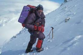
 is great! It is an honest look at an honest and really competent guy. Sometimes you wonder if he doesn't think a little too highly of himself, but then you realize, he's just relating the facts. It's the facts that speak highly of him. And he has a sense of humor. (Here's a clip of him on The Colbert Report)
And now, not only can I pretend to be in the Tour de France when I ride my bike, I can also pretend to be summitting K2, without oxygen, in 50 mph winds while hiking in the White Mountains.
Wednesday, July 28, 2010
Tecumseh: The Western Approach
Just because it's the shortest 4000fter doesn't mean you have to take the shortest path to the top. At 4003ft, the peak of Mt. Tecumseh is accessible via two routes. One up the ski slopes of Waterville Valley is the shortest but the Western Approach (which sounds much more impressively technical) is the nicer.
 Starting form Tripoli Road, a unique combination of fire road/campground, the trail crosses two brooks then begins a gentle ascent along an old road. One guide book called it a logging road, but another book, Logging railroads of the Saco River Valley
 , suggested it might have originally been a farm road. Now days, it is a nice wide path through a mature forest of maples, oaks, and gray and white birches. While the area was last farmed/logged in the 1910's it apparently never suffered through the devastating fires that set back forest reclamation in other areas of the White Mountains. Still the trees are so big, it's hard to believe that some of these large trees are only a hundred years old.
After about .5 miles the trail takes a right hand turn off the old road and begins ascending at a steeper pitch just as a few conifers begin to appear in the forest. Occasionally clearings offer views North to Mt. Osceola or turns in the trail bring you face to face with a fox. We saw this guy twice, once on the way up, and again on the way down. Tom, the only other person we met on the trail had seen the fox too, said it even walked in front of him for a little while. When we first 'met' Mr. Fox, he just sat in the middle of the trail and looked at us. Very calmly. The second time he had a chipmunk and only a few seconds for us. It was obvious from his demeanor and the many little paw prints in the muddy sections of the trail, that this was his hunting ground and that he was very comfortable with people. Not sure exactly, however, we fit into his plans.

The rest of the walk was very nice, the trail wide, and the view from the top was off to the North and the Tripyramids. On the way down we hiked through a great thunderstorm. They really are so much more enjoyable when you've got a warm car and a dry change of cloths at the end of the trail!
 Starting form Tripoli Road, a unique combination of fire road/campground, the trail crosses two brooks then begins a gentle ascent along an old road. One guide book called it a logging road, but another book, Logging railroads of the Saco River Valley, suggested it might have originally been a farm road. Now days, it is a nice wide path through a mature forest of maples, oaks, and gray and white birches. While the area was last farmed/logged in the 1910's it apparently never suffered through the devastating fires that set back forest reclamation in other areas of the White Mountains. Still the trees are so big, it's hard to believe that some of these large trees are only a hundred years old.
 After about .5 miles the trail takes a right hand turn off the old road and begins ascending at a steeper pitch just as a few conifers begin to appear in the forest. Occasionally clearings offer views North to Mt. Osceola or turns in the trail bring you face to face with a fox. We saw this guy twice, once on the way up, and again on the way down. Tom, the only other person we met on the trail had seen the fox too, said it even walked in front of him for a little while. When we first 'met' Mr. Fox, he just sat in the middle of the trail and looked at us. Very calmly. The second time he had a chipmunk and only a few seconds for us. It was obvious from his demeanor and the many little paw prints in the muddy sections of the trail, that this was his hunting ground and that he was very comfortable with people. Not sure exactly, however, we fit into his plans.

The rest of the walk was very nice, the trail wide, and the view from the top was off to the North and the Tripyramids. On the way down we hiked through a great thunderstorm. They really are so much more enjoyable when you've got a warm car and a dry change of cloths at the end of the trail!
Wednesday, July 14, 2010
Miles from Nowhere - Bicycle Touring
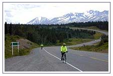 Miles From Nowhere
 is one of the best bicycling touring books ever! Joe Kurmaskie's Metal Cowboy: Tales from the Road Less Pedaled
 and Riding Outside The Lines: International Incidents and Other Misadventures with the Metal Cowboy
 are great fun, but they don't come close to describing the day – to – day hunting and gathering- all-the-while-dealing-with-new-cultures aspect that Barbara Savage manages to brings out during her and her husband Larry's two year ride around the world.
Today's world is remarkably different than the late 1970's when the Savages took their ride and you can't help wondering how it would play out today. Certainly they wouldn't need to go months without hearing from home, or pedal furiously over dirt roads to be in town for a wire-transfer, scheduled 6 months previous and we know that the wind still blows furiously in South Dakota and Austria, the Himilayans still have very high passes, India is hot and dry, and New Zealand is still populated predominantly by sheep but the bigger questions remain. Do drivers in the Florida Keys still run bicycles off the road? Can bicyclists still camp at Stonehedge? Do Egyptians continue to stare at foreigners, or just foreigners on bikes? Will New Zealanders loan you their car to tour the island? Can you still camp on the beaches in Tahti?
Hmmm, maybe I'll have to take a ride and find out.
Wednesday, July 07, 2010
Mt. Cabot

According to the AMC White Mountain Guide
 and the various forums on the internet, the property owner closed the trail sometime in the early 2000's. Although there was optimism that it would reopen (following negotiation with various clubs?/lawsuits?) it is still closed and that section has been removed from all official maps. Some hikers feel justified in trespassing, either through disregard, or as a political statement, maintaining that the trail is protected by a deeded, legal right of way. Others believe the owner closed the trail to avoid possible liability lawsuits.
Trails crossing private lands is not a new, or even unusual thing. Many times while hiking in the Whites, and other places, a sign on the trail will notify hikers that they are entering/leaving private land. The signs also usually ask that the hiker stay on the rail. Most hikers honor the request, most landowners allow the trails to continue. But as with all things, there are the exceptions.
I can understand some of the landowners concerns. Not all hikers adhere to Leave No Trace, not all assume personal responsibility for their well being on the trail. Some have even been known to sue the folks who rescue them. But there are laws to protect the homeowner and I do believe that if you purchased a piece of land with an existing trail, and in this case, an historic trail, you have an obligation to keep that trail open. If you can not fulfill that obligation then don't buy the property, or deed the land over to a land trust that can open the trail.
As it stands now there are three trails to the summit of Mt. Cabot. One that 'starts' in the middle of the woods on the border of the White Mountain National Forest land, one, the Kilkenney Ridge trail – which is an overnight backpacking trek a long a scenic ridge, and the Bunnell Notch Trail. I chose the path of least resistance, and am a bit disturbed by the situation.
Tuesday, July 06, 2010
Mt. Waumbek
 Saturday we walked up Mt. Waumbek taking the more popular route from the parking lot off RT 2 and crossing over the summit of Starr King Mountain. The honor of naming (and renaming) of the White Mountains seems to follow the rules of war – whoever possesses them gets to name them. For instance, the Presidentials were named by a bunch of hikers from nearby Lancaster, NH who happened to be the first group to climb Washington with necessary supplies for toasting the newly named peaks.*
Whoever (re)named Starr King Mountain must have done so sometime after 1850. Considering Starr King's cache at the time, I'm surprised at at the selection. Don't get me wrong, it is a nice mountain, with a good view South to the Presidentials but Waumbek, less than .5 miles to the East is higher, and has better views, and Starr King was, at the time, the guy who wrote the book on The White Hills: Their Legends, Landscape, and Poetry (Classic Reprint)
 as he titled it. Part guidebook, part romantic rhapsody the book combines a call for all to visit the Hills as well as preserve it and is credited with being a major cause for the White Mountain tourist pre-Civil War tourist boom.
  At one point Starr King Mountain had a summit cabin and a bridal path leading to it, as many of the White Mountains did at the time. The stone hearth now stands in a small meadow. Hikers gather there in the sun to enjoy the views and a snack, often before moving on to Mt. Waumbec. Most do not know about Starr King (full name Thomas Starr King, who was also a famous Unitarian Universalist Minister in Boston, and later San Fransisco where he has another mt named after him.) but everyone who makes the climb has a chance to enjoy what he most enjoyed.
 If hiking Mt. Waumbek from the West be sure and walk about 40 yards passed the3 summit. The peak is forested but there is a clearing to the East with views to the South of Adams, Monroe, and Jefferson.
*Forest and Crag, A History of Hiking, Trail Blazing, and

Saturday, June 26, 2010
Whiteface (I will not wear cotton while hiking)

Oh, and a shout out to the Wonalancet Hiking Club. They do an amazing job of signing and maintaining their trails, and their map is fantastic. Printed on tyvek (as all good trail maps should be) it covers the entire Sandwich range on a 1:40,000 scale. The reverse of the map side contains great trail descriptions too.
Monday, June 07, 2010
No Wildcats, but a Beaver, a Bear, and an Osprey
In Walking with Spring Earl Schaffer, the first person to continuously thru hike the AT, notes that the climb out of Pinkham Notch via the Wildcat Ridge Trail is one of the more challenging sections. So it was with some trepidation that we headed to that very trail on the most beautiful morning of the entire week. I wasn't all that confident that two middle-aged city workers could scale the rocky 3000 elevation, especially now that we had our packs loaded for a three day trip.

We left the Joe Dodge Center at Pinkham Notch following The Lost Pond Trail, a level .09 mile spur going to the Ridge Trail and bypassing, what was referred to as the 'dangerous Ellis River Crossing'. Have I mentioned that it was a beautiful morning? It was. So clear you could make out every detail of Mount Washington, and so still that you could see the ridges of Tuckerman's Ravine reflected in Lost Pond, broken only by the determined swimming of a Beaver. There are times, especially in the age of digital cameras, when you realize your photos probably look just like thousands of others, and then there are times, very unique occasions when you realize you are being presented with a rare photo opportunity – and you wish you had the skill to take that phenomenal photo. This morning was one of those moments. I'll let the pictures I did get do the 'talking' but just imagine...
It was while admiring the beaver dam that SD felt his pack give. The left stay ripped right out of its pocket and barring a sailors palm and needle (which we did not have) was irreparable. Duct tape might have done the trick temporarily but it was not responsible to head out into the wilderness for 4 days, up the roughest ridge in the Presidentials, with a broken pack. And so we headed back to the trailhead, back to the car, and back to North Conway.
 And that's when we first saw the bear. And I was just where I wanted to be when I say my first bear – in the car. He was cute, and he did look like Pookie, especially as he stood up and looked over at us. He also looked like he could swot your head of with flick of his adorable paw.
 We took a few (bad) photos and headed on our way to Eastern Mountain Sports where SD picked out an Osprey Atmos 65 Pack
 . By the time we repacked the bag and returned to Pinkham Notch it was noon. Too soon to call it a day, too late to reattempt the Ridge, we choose instead to take the 19 Mile Brook Trail with the idea that while we'd miss the Wildcats, we could stick with our original plan.
Earl Schaffer, the first person to continuously thru hike the AT, notes that the climb out of Pinkham Notch via the Wildcat Ridge Trail is one of the more challenging sections. So it was with some trepidation that we headed to that very trail on the most beautiful morning of the entire week. I wasn't all that confident that two middle-aged city workers could scale the rocky 3000 elevation, especially now that we had our packs loaded for a three day trip. 
We left the Joe Dodge Center at Pinkham Notch following The Lost Pond Trail, a level .09 mile spur going to the Ridge Trail and bypassing, what was referred to as the 'dangerous Ellis River Crossing'. Have I mentioned that it was a beautiful morning? It was. So clear you could make out every detail of Mount Washington, and so still that you could see the ridges of Tuckerman's Ravine reflected in Lost Pond, broken only by the determined swimming of a Beaver. There are times, especially in the age of digital cameras, when you realize your photos probably look just like thousands of others, and then there are times, very unique occasions when you realize you are being presented with a rare photo opportunity – and you wish you had the skill to take that phenomenal photo. This morning was one of those moments. I'll let the pictures I did get do the 'talking' but just imagine...
It was while admiring the beaver dam that SD felt his pack give. The left stay ripped right out of its pocket and barring a sailors palm and needle (which we did not have) was irreparable. Duct tape might have done the trick temporarily but it was not responsible to head out into the wilderness for 4 days, up the roughest ridge in the Presidentials, with a broken pack. And so we headed back to the trailhead, back to the car, and back to North Conway.
 We took a few (bad) photos and headed on our way to Eastern Mountain Sports where SD picked out an Osprey Atmos 65 Pack . By the time we repacked the bag and returned to Pinkham Notch it was noon. Too soon to call it a day, too late to reattempt the Ridge, we choose instead to take the 19 Mile Brook Trail with the idea that while we'd miss the Wildcats, we could stick with our original plan.
Sunday, June 06, 2010
Mount Hale and North Twin Mountain

We hiked Mount Hale first. Leaving from the trailhead on Zealand Road the Hale Brook Trail immediately begins its ascent,crossing a nice stream after roughly .5 miles the grade increases until the second stream crossing where a series of switchbacks begin as you enter the higher elevations of the conifer zone. Many of the firs here are dead or dying, probably as a result of ice storm damage a few years ago, but the good news is that this opens up occasional views North to Mount Washington. The firs on the summit, however are doing well and surround the clearing where the fire tower once stood, blocking all views except from the top of the man made cairn, and creating a nice wind-free haven for black flies. For those continuing on to Zealand hunt the Lend-a-Hand trail leaves the summit to the east but we headed back down the Hale Brook Trail. It was a nice hike, but probably the best part was checking Mt. Hale off the list once we returned to camp.

North Twin is another story. This was my third attempt although the first from this direction. Previously I'd planned to summit North Twin as a 'quick side trip' from South Twin. Not a great idea unless you're in good enough shape to make a quick 4 mile side trip after hiking at least 8 miles just to get to South Twin.
 Barring that, the North Twin trail is a great day hike that starts as a walk on an old railroad bed along a perfect NH stream and ends with an invigorating climb to two great outlooks. Along the way we did waded in the stream, passed through the zones, post-holed through snow, ran into a tree, and battled hungry black flies. The first, the false summit, offers views to the North from the Bonds to Mt. Washington. From the true summit, while bracing oneself against the 30 knot winds, the view looks out over the Southern Pemigawansett, particularly from Garfield to Flume. On the day we arrived the view was a bit hazy as a result of the Canadian forest fires, which cast a literal pall over the day. Enjoying one forest so thoroughly, its sad to know another is burning out of control. Still in all, it was a great day and another 4000fter was under our belts.
Subscribe to:
Posts (Atom)