Friday, May 27, 2016

Wildflower Tour of Northeastern Oregon

(This post applies to adventures during the last week of April, 2016)


One of the many hillsides of beautiful sun flowers
Back in March, S.D arranged a late April tour of the Outdoors RV factory in La Grande, (Northeastern) Oregon. That's where our little home was built and April seemed about the right time since we also wanted to be in Ashland, OR the second week of May. Having sprinted through Northern Utah, Northern Nevada and Southern Idaho we found ourselves at the factory, mid-April, a week ahead of schedule.

The La Grande valley itself is largely agricultural, with a lumber mill and two RV manufactures thrown in. There are several smallish rivers and lots of mountains surrounding the plain.  In mid-April the weather was sunny, and warm in the daytime. The valley was green with the new spring grass and budding trees. The mountains however, were covered with large amounts of snow. It was beautiful but also possible, we were a little early for camping in Northeastern Oregon.
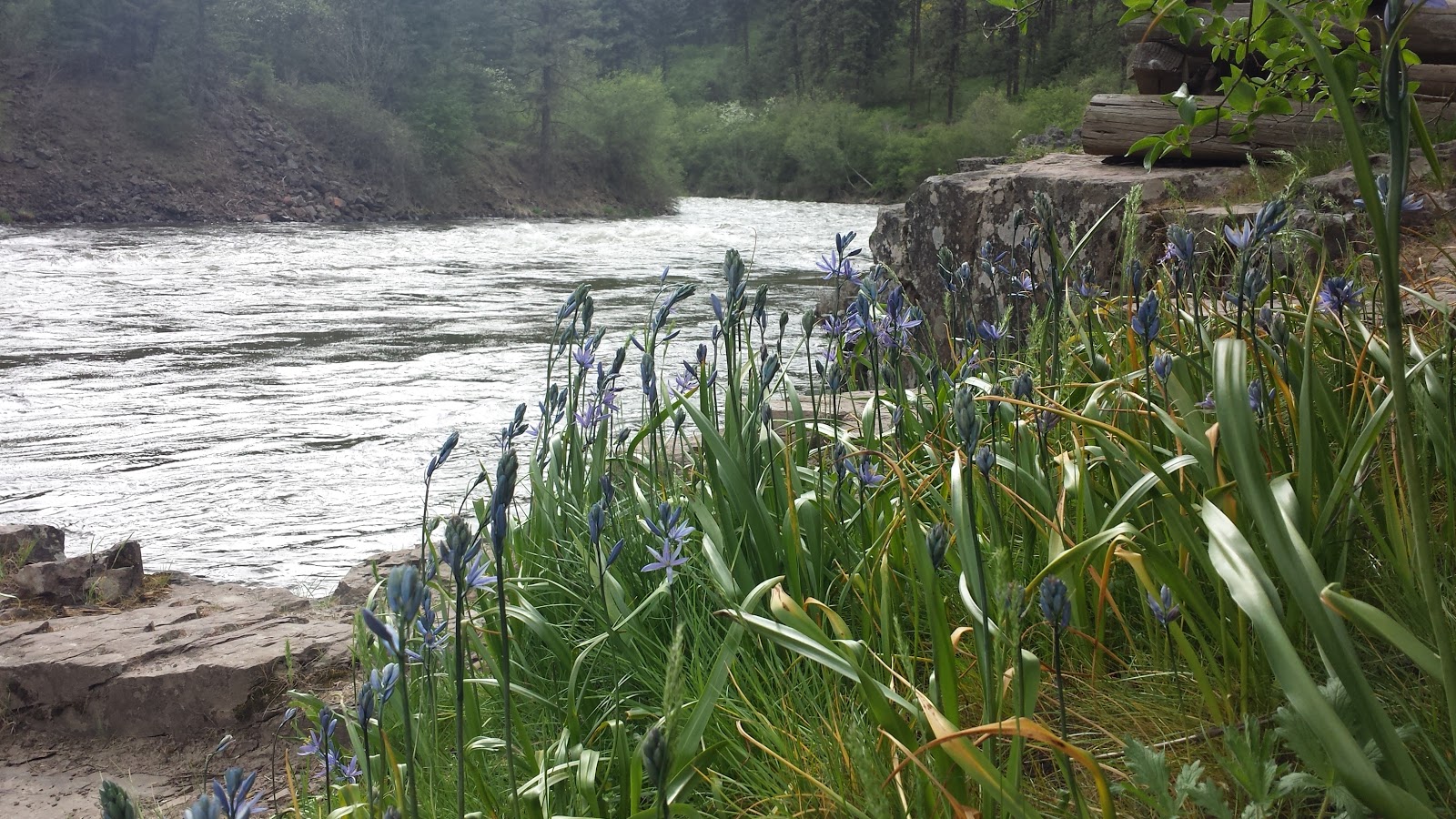
Unidentified purple flowers

We recalled from our previous time in Oregon that the natives seemed an adventurous bunch, undeterred by a rain or snow and walked into the Wallow-Whitman Forest Service Office to inquire about camping and hiking options. The Ranger inquired if we had noticed the snow? None of the Forest Service Campgrounds opened until at least May 1, and then only if the snow was gone. "You might" she ventured, "find that the state campgrounds are open."
Minam State Park - Camping under the flowers

We checked online, and it appeared that indeed they might...or they might not. It's amazing how unclear campground websites can be. But with hope in our hearts, and the promise from the Ranger that it was a beautiful spot we headed East up alongside the Minam River to the Minam State Campground. Thirty miles of winding paved and two miles of bumpy dirt road later, we arrived to find the campground. It was open, it was green and it was beautiful.

Calypso Orchid
It was at this point that we realized that while we might have been too early for our tour, hiking up into the mountains, or camping in the National Forest, we had arrived at just the right time for the wildflower bloom in the valleys. Big, bright yellow daisy-like flowers covered every hillside. Next to our campsite, and scattered throughout the forest were white and pink blooming wild apple trees. We walked along the swiftly flowing Minam River and found wild apple trees, sunflowers and some other purple flower.

The next day we left the Creekside (our RV) parked under the apple tree and drove further up the Wallow Valley along side the eponymous river, through the neat and tidy towns of Lostine Enterprise and Joseph, under hills covered in yellow flowers, through hay and grain fields, past greening cow and sheep pastures. It was raining and with no chance of getting a good hike in we settled for the next best thing(s). A good burger and a fresh microbrew at Terminal Gravity Brew Pub. (Middle of nowhere, and the center of the universe). By the time we returned home, the RV was lightly frosted in white apple blossoms.

We woke to sunshine the next morning and really wanting to do some hiking, decided to try our luck at Catherine Creek State Park. According to the website, and the state brochure, it was not only open, it also had hiking trails. To get there we drove back to La Grande, then wound south, along Catherine Creek, for twelve miles before arriving at the campground. It too was open! We pulled into a lovely spot beside the wildly flowing creek, set up for the night, and set out to find those hiking trails!

The bad news was that there was only one trail it was only a mile and half. The good news was that the trail climbed through a beautiful forest and there were lots more wildflowers. We saw a ... blooming Oregon grapes, Calypso Orchids, lupines and more. Probably more wildflowers per foot hiked than anywhere else.

Trout lily
Following the night at Catherine Creek we headed a bit North, this time headed for Bird Tracks Spring Campground. Unimaginatively named for the fact that a bird walked in drying cement around a spring head...and left tracks. There was also a trail there that went along the Grande Ronde river and was a birding hot spot. We didn't see many birds and we did find the spring head with the tracks but more remarkable was our campsite. It was surrounded by yellow trout lilies! I don't think they bloom for very many days so it was all the more remarkably that we were there for their brief show.

Two days later we toured the RV plant. No wildflowers there but it was a very interesting, two hour tour. Learned that RV manufacturing and boat building aren't all that different. Admittedly an RV will not float but the design efficiency, and parts have a great deal in common...and they make it all possible for us to be on the road and see more wildflowers!

Monday, April 18, 2016

Three Weeks in New Mexico

It's now mid-April and over a week since we left New Mexico.  I haven't posted much about those three wonderful weeks in the "Land of Enchantment" - maybe because it was just that - enchanting. Or maybe I was just lazy, or maybe there was just too much to write about. Considering that we're now heading North and West to new adventures there is little chance that I will ever get around to detailing our weeks in New Mexico but what I can do is summarize what we learned there.

So here they are, the top 10 things we learned about New Mexico (in no particular order)
Not included in the list but this is the
best commuter rail ever-
The Rail Runner

  1. New Mexico has a state decoration and it is the Chili Rasta. There are everywhere and they are big.  Santa Fe has the longest ones measuring in at 5 feet.  And just to be clear - these are hanging everywhere, all over the state.  And they are real. Hatch, New Mexico is the chili growing capital of the world. If you want to see lots and lots of chili's and thousands of chili rastas drive through Hatch. You don't even have to stop, just drive down the main street and  you will see more in those three minutes than in the rest of your entire life.
  2. The state parks are awesome. We stayed in five different ones. They were all different but all well run, with good trails, and outdoor stuff, as well as nice facilities. This is no secret. New Mexican's love their state parks...especially at Easter when they all descend for egg hunts.
    City of Rocks State Park.
    Lots and lots of rocks. Lots of Egg hiding spots
  3. New Mexican's are not fond of Texans.  It all stated in 1841 when the president of Texas invaded and laid claim to the state and continues to this day when Texans show up at the state parks in droves and mix their Easter eggs in amongst the local's. 
  4. Columbus, New Mexico (website features a chili rasta) is code for cheap, good Mexican optometry which can be obtained right across the border from Palomas, Mexico.
  5. Towns name and other words are often pronounced in un-expected ways. Everyone will tell  you that New Mexico is a blend of (at least) three major cultures, Spanish, Native American and Anglo. This makes for a culturally diverse and interesting state. It also so made it so that I stopped attempting to pronounce the names of most towns and geographic features until after a local had already done so. (and still managed to flub a few)
  6. According to the Forest Service Rangers, while there are black bears in the area one doesn't
    S.D. scoping out the Mountain Lions for me
    need to worry about them.  You should however carry the bear spray in case you meet up with a mountain lion. Oh, and stay together, they tend not to attack if there is more than one person. 
  7. When the weather forecast, or a local says that the wind is going to blow and it's springtime prepare for the wind to really blow. They're not talking a light spring breeze. They're talking about sustained winds of 40-50 knots with gusts in the 60s. Oh, and this being desert, there will be lots of dust in that wind so prepare to not be able to see more than five feet in front of you and to spend the following day(s) cleaning dirt out every remote corned of your car, truck or camper. If, on the other hand you have something in need of a good sandblasting - just bolt it down and your problems are solved!
  8. Flashlights are illegal in New Mexico. (Well not really, but they should be) The night sky, anywhere in the state is awesome!!!  We spent nights along the Rio Grande near Taos and a few more at Bandelier National Monument and every night just stood outside and looked and looked at the sky.
    Typical Descent! This one into the Rio Grande
  9. Any road may, at any time suddenly turn from a flat wide paved surface into a narrow, winding, dirt free fall into a river canyon.  There are three major wild and scenic rivers in New Mexico and several smaller streams, tributaries, washes, etc. Since the predominate land is sedimentary, anytime, and any place that water flows tens to form deep, steep valleys and canyons.  The roads follow the contours so it's important when plotting the day's drive, especially when towing an RV to careful note the terrain and any sudden, or even small switchbacks that may appear on a road. 
  10. Santa Fe is The Best Capital City ever.  Truly representative of the state, which as I point out in the next point, is awesome!
  11. And last but not  (and yes that's more than 10)--- it's just awesome!! I love New Mexico. The place and the people are unassumingly lovely. Diverse, interesting and open.

Sunday, April 17, 2016

Hee-la Not Gee-la

Looking up at the Gila Cliff Dwellings
(This post applies to the week of March 23-29. I'm way behind!)

In Tucson, we met up with an old friend from Maine.  We visited the Desert Museum together.  As we were looking at the reptiles, the guy standing next to us smiled benevolently as Dave, Linda and I discussed the Gila monster display at the Desert Museum.

"Where are you folks from?" He finally asked, plainly amused by something we said.

When we told him we were from the East Coast he responded, "It's Hee-la, not Gee-la."

Yes, it was the kindness of that stranger that saved me from mispronouncing not only the name of an


amazing reptile, but also the name of a national monument, a national forest and New Mexico's last wild and scenic river. And that was a very good thing as we spent an entire week exploring those very Gila (Hee-la) things.

CDT Sign!
We set up base camp on the Mesa Campground, in the Gila National Forest. For the first time in over five months we were in trees! Ponderosa pines, Mexican Blue Oaks and Juniper. It was open, high desert forest, but it was lovely. The Gila National Forest covers over 3.3 million acres, of mountains (over 6000 ft) in Southeastern New Mexico. The Gila Cliff Dwelling National Monument, Gila River and Gila Wilderness are all contained within the Forest.

The first day, in a new location is generally a scouting day. After setting up camp we drove North alongside the Gila River, to the Gila Cliff Dwellings. It's a long winding route but well worth the drive. The builders only lived in the cliffs for approximately 30 years but while there they took the time to make some really great little rooms and buildings. The Dwellings are located a little over half-way up the side of a narrow slot canyon off the Gila River. If location was as important then as it is today, I think a place on the River would have been preferable.

And in fact, that's probably where the cliff dwellers moved next. On the way home we stopped at some other roadside exhibits that explained riverside habitation.  

These days living along the Gila River is more difficult.  The Gila River is one of New Mexico's Wild and Scenic Rivers. New Mexico, in fact has five wild and scenic rivers. The fact that the state is also mostly desert and contains the lowest percentage of water held in lakes (all man-made) also means that all of those rivers are under constant pressure of being damned. Unbelievably the biggest motivation for damming seems to be recreation. The Gila is no exception. A number of folks and politicians seem to feel lakes are more fun that rivers. In my opinion they certainly are not fun, natural, wild or beautiful. There is a special beauty of extremes that comes from a river flowing through high canyon walls and desert.
Old Horse Corral

In the following days we took several hikes, not along the River, but into the Gila Wilderness.  The trails followed small streams into lovely, intimate canyons. One of those was on the CDT, or Continental Divide Trail.

Add caption
Starting out from the trailhead the path led North across the wide river valley before entering the narrow valley of the stream's outflow. After two miles of hiking along the meandering stream bed, checking out the many birds and exploring the the remains of a primitive horse corral, the canyon narrowed further. The stream now ran along the bottom of a narrow slot, the trail carved along the only dry(ish) land beside and above it. When the canyon narrowed so much that there wasn't room for the trail, the path turned north west and rose steeply out of the canyon. Within 400 yards we were up and climbing through high range again. Grasses, junipers, pinion pine and cactus doted the hillside.

At the peak, looking out over the Gila Forest, Wilderness and River I couldn't help but thank the stranger from the museum for helping me 'know' the area just a little bit better....and wonder if he ever went to Massachusetts if he'd be able to  correctly pronounce 'Gloucester', or 'Haverhill' for that matter.

Wednesday, March 30, 2016

1 Week, 3 States, 3 Deserts

Written March 21st

A desert, by definition, is an area of land that receives less than 10 inches of rain per year. With that limitation one might assume that all deserts are pretty much the same, especially ones that lie roughly on the same longitude. The last couple of weeks proved that assumption entirely wrong.

Since leaving Ash Meadows, we've driven east through Nevada, and Arizona to New Mexico and through the Mohave, Sonora, and Chihuahua Deserts. They may all receive less than 10 inches of rain per year, but due to differences in temperature range, and the timing of those 10 inches (or less) they are noticeably different deserts.

Mohave Desert (in bloom)
Driving through Nevada and then South-western Arizona we were in the Mohave Desert.  The landscape was a lot like what we'd been living in for the last three months. We were surrounded mostly by mesquite trees, occasional Joshua tree forests, creosote bushes and an occasional cholla or beavertail cactus. This being the year of the super bloom, ie the year after record fall rains, there were also lots of wildflowers. Acres of desert gold, desert ghost, phacilia, and other wildflowers.

The Mohave, the driest and most extreme desert, receives an average of 5 inches rain per year, generally in the spring and fall. Temperatures range from 20 degrees on January and February nights to as high as 130 in July and August. This creates a distinct landscape, a barrenness relieved by the occasional plant.

The cactus jungle that is the Sonoran Desert
Driving east through Arizona and into Tucson we were in the Sonoran Desert.  The Joshua tree groves were replaced by short then soon, towering Sonoran Cactus. Prickly bear, fishhook, barrel, organ pipe and lots of other cactus plants all crowded together. Succulents like agave, and yuccas also forced their way in to the wild plant jumble along with ocotillo, a tall, thin cactus-looking plant sporting red blossoms at the tip of their long spikes.  Hiking through this intimidating jumble looked impossible, if not painful. The Sonora desert is like the rainforest of deserts. It receives approximately e3 - 16 inches of rain, and temperatures are more moderate. Desert plants not fond of freezing temperatures thrive in the climate as do birds and animals. We spent a day at the Desert Museum just outside Sonora National Park in Tuscon. Five hours of walking through bird aviaries, cactus and agave gardens, desert reptile and mammal displays and we hadn't even begun to get a handle on the Sonora Desert's diversity. 

Chihuahua Desert
We hit the road, again heading east and into New Mexico. Plants began to thin out, the Sonora cactus disappeared and the remaining desert plants desert spread themselves out a bit thinner. Creosote bushes and mesquite once again appeared. And everywhere there were bright yellow desert popChihuahua's temperature range is closer to that of the Mohave, but days spent in the extremes are fewer. A more defining characteristic of this desert is that it has a monsoon season in July and August. What rain does fall, about 10 inches per year, the majority of it falls in those two months. Oh, and in the spring there is a lot of wind. Lots of wind. We stopped at the welcome center just over the line in New Mexico. The woman at the desk was less than welcoming but did manage to tell us that "The Wind" was coming. She couldn't tell us when, or from where, or what kind of wind it was going to be, just that "The Wind" was coming. Her ominous sounding prediction was made more so by frequent highway signs warning that "Dust May Blow" and instructing drivers to "Pull completely off the Highway during periods of Low Visibility". Well, the wind has arrived. It's blowing about 30 knots out there right now with gusts up to 45. Tonight they're predicting gusts as high as 60. There's something that happens with jet
Preview of hikes to come !
stream and land temperatures that really packs the isobars close together. If you're in a dusty area, and there are a lot of those in Southern New Mexico, then you could get a brown out. If there isn't any dust, you still have to keep an eye out for blowing debris and keep your own stuff tied down.
pies.  The

Tomorrow we're heading into the Gila Mountains. We'll be out of the desert and into the trees for the first time in over five months. It's going to be an adjustment.

Tuesday, March 15, 2016

Water - and the Radicalization of an Easterner

Kings Pool - Restored Spring at Ash Meadows
If I had a shot of whiskey for every time in the last few months, the months we've been traveling out west, when someone told me, "Whiskey is for drinking, and water is for fighting over" I'd have been drunk half the time.

And while it's a foreign concept back East, it does appear that water out west is for "fighting over." It's certainly something I've been thinking a lot about, pretty much ever since we crossed the Missouri River in South Dakota.  Not so much the fighting, or the whiskey, but the water.

From July through October it was all about the drought. And while folks seemed less than happy when rain was in the forecast, they mostly talked about snow pack. Water out west, generally doesn't
Irrigation Control Gate
come from the sky, it comes from the ground and from rivers. The rivers and aquafer get charged by the winter snows high in the mountains. Up and down the west coast, from the Cascades of Oregon through the Sierra's of California, there hadn't been much if any snow for the last two winters. Lakes were low, rivers only a trickle. People were arguing about where they should get more water. Could they dig deeper wells? What about cutting back on the dam releases? Sure the Salmon might die but the crops would be watered...and so on. 

Meanwhile the concept of water conservation seems total foreign. Farmers and ranchers are irrigating crops mid-day, spraying the precious water into the air, half of which evaporates in the dry air before reaching even plant leaves, let alone the roots. Where they don't spray they rely on the ancient and inefficient practice of flood irrigation. Cheap to install and maintain, but highly inefficient water use. The town aren't much better. Desert dwellers water suburban lawns, have no idea of what a low flush toilet even looks like, refill their pools daily and don't own covers that would cut down on evaporative loss.

On the Eastern side of the Sierras, in the Owens valley, 120 miles from Los Angeles we learned more and more about the ecological devastation caused by the Los Angeles water grab. It was a hard, sad read but "Cadillac Desert" lays out the story of how water from the Sierra's, the Colorado River, etc has all been diverted from their original courses and sent on to agriculture and far away cities like Los Angeles and Phoenix. From looking out the car window we could also see how so much of that
water was just wasted. It was a drought, but more than half of the water was still just wasted! Sometimes I needed that whiskey just to calm down.

The Endemic Ash Meadows Sunray
And then, in October, we came to Ash Meadows, walked into the bathroom and read an Edward Abbey quote on the wall:

"There is no shortage of water in the desert but exactly the right amount , a perfect ratio of water to rock, water to sand, insuring that wide free open, generous spacing among plants and animals, homes and towns and cities, which makes the arid West so different from any other part of the nation. There is no lack of water here unless you try to establish a city where no city should be."

Hayduke rides again! After living at Ash Meadows for two and a half months, western water issues are even more obvious - and even more worth fighting over. Ash Meadows is a wildlife refuge located along the Amargosa River watershed, and on top of miles-long faults.  It was created in the mid 1980's to save the very special ecosystem created by water in the desert. The result is 50 natural, mostly warm springs pumping out 11,000 gallons of water per minute. 50 little oasis-es and their resultant outflow streams. Along with the endemic and endangered pupfish there are 27 endemic species, plants and animals found nowhere else in the world.  All in the Mohave desert. Ash Meadows is really all about water.

What could have been - this alone makes
me want to drink
But not everyone is thrilled about the refuge or its "waste" of water. Locals resent the loss of 20 farm jobs, and/or the lost income from a potential housing development. There have been and continue to be campaigns against the refuge (and other wildlife refuges, national forests, national parks, etc). A "Kill the Pupfish" bumpersticker was produced - by the local town commissioner. Like the spotted owl for the lumber industry, the pupfish are the anti-symbol of agri-business. The feeling seems to be, if there's water here, people have the right to use/waste it. To hell with the species that have occupied the land for the past thousands of years, to hell with biological diversity.

Living at Ash Meadows, and being out West have changed all that for me. If some says that the need to pump all the water out of the springs for a few jobs, the ability to flood the desert or spray water into the air and grow some crop that would more economically be raised elsewhere is greater than the need to set aside precious acres in order to let special, endemic species live and to allow  people from all over to world to enjoy the beauty of the springs and appreciate the diversity of the unique environment, not to mention giving those rare and endemic species a safe place to thrive. Then I say - pass the whiskey, them's fighting words.


Monday, March 07, 2016

New Mexico - Here We Come

Ignorance may be bliss, but is it a good way to start a new adventure? Knowing next to nothing about 'the land of enchantment' we're heading to New Mexico next week to learn more, and maybe, just maybe be enchanted? (And find out what the flag is all about too)

Here's what I do know. I don't know enough Spanish. There are aliens in Roswell. Bats at Carlsbad Cavern.  The southern-most peaks of the Rockies are there, rising out of the desert. There are trees. After two months in the desert, S.D. is looking for trees. Big trees.  And chilies. Chilies seem to be ubiquitous in and with New Mexico.  After Nevada, I'm lusting for good food. Towns and cities include Albuquerque (which means an annoying Partridge Family song will be running through my head for most of the month), Taos and Santa Fe.  Willa Cather wrote a rambling, almost boring novel, "Death Become the Archbishop"
about it. And last but not least, Georgia O'Keefe painted awesome works there.

S.D. and my two and a half months at Ash Meadows have been awesome. We've both explored a lot, and relaxed. We've also installed a water pressure tank and solar panels with the idea of spending more time off the grid and out in the wild. So we are ready to go.

Suggestions and tips for what to see and do in New Mexico would be highly appreciated!

Monday, February 29, 2016

Wildflower Hunting, History Finding

Not as uninhabitable as it would appear
Our first weeks at Ash Meadows were spent exploring the dirt roads, seeps and springs of Ash Meadows looking for what we thought were elusive signs of past human history. Looking out over the landscape, this place, like most deserts seems desolate, uninhabited and uninhabitable. What we slowly realized however was that the real challenge was to find one spot that had not been altered by man. And that is proving elusive.

Man's hand is everywhere here. Prior to the white man, Western Shoshone and Southern Paiute cultivated and harvested willow, mesquite and other plants. Hundreds of years prior to them others lived here. No one is sure what changes they made to the land but pottery shards and chert blanket the bluffs and sand dunes.

One of those bluffs is also one few known locations of the rare, endemic, February-blooming Ash Meadows Milk Vetch. Early one morning we rode our bikes North on Longstreet Road, one of the five maintained Refuge roads towards the bluff. Aside from the chert remains we expected the area to be free of other signs of man. Ash Meadows Milk Vetch is delicate and does not like disturbed soil.

All along the five mile road we saw the imprints other 20, 30 and 100 years old roads. We also saw
the remains of one of the hundreds of irrigation ditches left over from the industrial agriculture era in the 1960s.  Three miles in we passed a huge flat turn off behind which rose the tailings from a clay mine. Ash Meadows has been mined for peat (yes peat), clay, borax and zeolite. While not evident to the casual observer, the hills still conceal three massive clay pits left over from the early to mid 1900s. The clay from these mines was used to filter oil. The only current mineral mined in Ash Meadows is zeolite. The small mine in-holding is located at the southern end of the refuge.

Turning West after the old clay mine road we rode by an improbably flat plain, glittering with glass shards. The bulldozed remains of the clay miners camp. This across the road from a deeply furrowed, barren field once used for flood irrigation.

Parking our bikes a little further down the road we walked south toward the probable location of the Vetch.
Middle of nowhere and yet

The soil under foot was really sandy, maybe some clay and alkaline, and it was uneven, even rolling, almost naturally so. Several hundred feet off we noticed a small mesquite grove and headed for that. Mesquite usually means water but this bluff was dry. Several hundred feet beyond that we say another mesquite grove. The trees were taller and strangely enough in the middle of that was a tall, wooden pole? A few more minutes of walking and we found that the pole was really the top  of some sort of water derrick? Beside the pole was a truck frame? and some piping. A little further on a big, now empty, hole that probably, once held water. A slow trickle of water seeped from beneath the derrick. Looking all around in all four directions we saw no other sign of man. No road leading to the derrick, no other structures, not even a probably irrigation field. But here, where we had hoped to find undisturbed land and endemic wildflowers was unmistakably yet another sign of man's activities, and impact at Ash Meadows.

Intrigued by the mysterious purpose of the derrick but disappointed not to find the wildflowers we turned around and started heading back to our bicycles. This time walking a little bit further to the west, more along the edge of the bluff, just in case. The area looked even sparser than that which we'd walked through on our way in but there was no sense in returning exactly the same way.

And that's when we found ourselves walking through chert. Obviously flaked pieces of hard rock. We'd heard that these types of place existed at Ash Meadows. Areas where the first Americans had worked stone into tools. We were amazed at the extent and the beauty of the flakes. However it was more sign of man's impact. Still no wildflowers.

A few hundred feet further, over a sandish bluff, and into some truly alkaline, dry soil and there we found the Ash Meadows Milk Vetch. Not only were they blooming, but they were surrounded by some of the other endemic plants of Ash Meadows, the Sunray, the Ivesia, and more. I don't know what it is about this place, but it touches me. There is a zen garden-like quality to it's sparseness. The area is amazing for its resilience. It's been farmed, mined, drained, stripped, totally re-arranged in some places, and still the springs flow, and the endemic plants grow and bloom in a seemingly inhospitable place, but a place that hides more life, and more diversity than any other place in the United States.
Other desert wildflowers

Wilderness may be the preservation of man, but diversity is the preservation of wilderness. 


Thursday, January 28, 2016

Nevada Crayfish Boil: Save the Pupfish

Both pricey delicacies and bug-like garbage eaters, crustaceans are weird creatures, but tasty. Lobster, the most well known of the family, crawl along the bottom of the Atlantic Ocean. Eating anything their big fat claws come upon, including garbage and other lobsters, they only come up in lobster traps and are thankfully, promptly boiled.

Crayfish, a smaller member of the crustacean family that originates in warm southern waters, are lobster's smaller cousins. The eponymous star of the Crayfish boil, Louisiana supplies 95% of the crayfish sold in the United States. In 2007, the Louisiana crayfish harvest was about 54,800 tons, almost all of it from aquaculture. Crayfish were introduced to the warm springs and outflows of Ash Meadows in the early twentieth century. Strangely enough they weren't introduced as a human food source but as food for the introduced bullfrogs. Bullfrog legs were popular in Las Vegas and since bullfrogs eat anything and eat a lot, the populations of endemic pupfish and speckled dace weren't enough to fatten then up. Enterprising farmers introduced the fast reproducing crayfish (which also eat pupfish and dace) to feed the introduced bullfrogs.

Restoration efforts have been very successful in bringing back the pupfish and speckled dace, and
relatively successful in eradicating the bullfrog. Crayfish, not so much. A few days ago I stood on the boardwalk alongside the Crystal Spring outflow and watched helplessly as a crayfish took down, and ate a beautiful blue pupfish. And that brings us to Cold Springs.

Located close to the center of the Ash Meadows National Wildlife refuge, between the eastern mountains and the western Carson Slough, Cold Spring is far from the fault line from which the warmer springs rise. Possibly that's why the water from this spring isn't warm. It's cold, and hence the name. Never-the-less the spring still pumps out huge amounts of water into the desert and as such was a prime candidate for human appropriation. Sometime in the mid 1960s the spring head was enclosed in concrete reservoir, pumps were installed and any native fish life was pumped out onto the alfalfa fields.

Today Cold Spring's water is no longer used for agriculture, but the spring has not yet been restored. The water flows up out of the earth and into that concrete box. The box is crumbling, full of wind blown dirt, lumber, algae and crayfish. Lots of ugly, fat pupfish-eating crayfish. Looking into that murky water, seeing those beady eyes, and spindly pincers wave menacingly back, I thought of the only appropriate response. Nevada Crayfish Boil!

Saturday, January 23, 2016

A Night at the Opera - Ash Meadows, a Cultural Meca

What do opera, Edward Abbey, robot girlfriends, and international travelers all have in common? If you guessed Ash Meadows, you're right!

Last Wednesday night we went to the opera. Yup there is an opera house here, a mere 15 minutes drive to Death Valley Junction, CA. The Amargosa Opera House was founded in 1967 in the former social hall of Pacific Coast Borax Company by a professional dancer from New York.

The performance we saw wasn't actually an opera however. It was a solo ballet pantomime and a very memorable experience. Also memorable was the inside of the Opera House itself. Painted by Marta, the dancer from New York, the walls are pictures of an 16th century audience. It's a surreal experience to be watching a ballerina perform with a renaissance audience, in the social hall, of a Borax Company, in the middle of no where, in the Mohave desert.

Marta's first performance at the Opera House was in 1968. During that year and the prior one, 
Edward Abbey was writing the final chapters of Desert Solitaire  "in a bar serving a legal house of prostitution at Ash Meadows, Nevada." Less than 10 miles from Marta. The bar was at Ash Meadows Sky Ranch. Consisting of a small motel, bar, brothel and as often accompanies Nevada brothels, an air strip, the Ranch was a popular desert oasis. The brothel and resort closed in the 70s and the land was eventually enveloped by the Refuge. There is no official access, but occasional refuge employees and volunteers do check up on it.

And then there is Cherry 2000. Soon after Sky Ranch closed a film crew showed up to make a movie. Cherry 2000 is a B-rated sci-fi movie, starring Melodie Griffin. The plot is pretty silly for an action movie: "In the year 2017, a rich man travels to the ends of the earth to find that the perfect woman is always under his nose." But hey, it was still filmed here. We haven't seen the movie yet, but the popcorn is ready.


And then there is today's international appeal of Ash Meadows. A little less than half of the visitors come from countries other than the United States. Last week alone we talked to travelers from Japan, Australia, Germany, Canada, and Brazil. It's great to hear about their enthusiasm for the Pupfish, the Meadows, and how much they appreciate the preserved and wide open spaces of the United States.

When you come right down to it, it is the wilderness, or at best the preserved and shared wide open spaces that are one of our greatest cultural treasures.

Sunday, January 17, 2016

Volunteer Life - In the Desert

Sunset Over Ash Meadows
This morning it occurred to me that the closest Starbucks, even the closest latte-serving coffee shop is more than 30-40 minutes away.  Less than a year ago, just to get to work, I passed 6 Dunkin Donuts, 4 Starbucks, 3 Au Bon Pains and countless local cafes.

Ash Meadows National Wildlife Refuge, where we're volunteering is located along the Nevada / California border, 30-40 minutes from the closest town, and 31 miles from Death Valley National Park. The refuge is home to, and famous for, being the home of several endemic species including the Devil's Hole and Ash Meadows Pupfish. The Refuge tag line reads "Where the desert springs to life."  I prefer - "Come for the Pupfish, Stay for the Springs".  Sure the pupfish are cute, but there are 50 crystal clear warm springs here putting out a total of 11,000 gallons a minute, and they all are amazing! Some are
Crystal Spring
accessible by boardwalks, some are hidden away in the folds of the rolling desert hills. But again, all-in-all an amazing oasis in the middle of the Mohave desert.

Volunteer life, even without lattes, is pretty sweet. This morning I woke up, took a walk alongside a desert stream, and strolled 3 minutes to 'work' at the Ash Meadows Interpretive Center.  Yesterday I helped collect pupfish DNA samples next to a crystal clear, hot spring. 

Inquiring minds have asked for more details on exactly what it is we are doing, so here it is.  For the months of January and February (and if I can convince SD) some of March we will be living and volunteering at the Ash Meadows Wildlife Refuge in Southern Nevada.  Volunteering requires that we work three, eight hour days (Thursday, Friday and Saturday). During that time we are responsible for staffing the visitor center as well as keeping it clean.  Once a week we also empty trash, recycling and clean pit toilets at the boardwalks.  On slow days we can also get out on the refuge and help with habitat rehabilitation projects, maintenance or just do roving interpretation.
Longstreet Cabin and our New Bikes!

The four other days of the week we get to explore. There is a lot to see and do on the Refuge, and our new mountain bikes were the perfect addition to help us do that. There are miles of dirt roads through the rolling hills. Even on our first day here we took a quick ride up to the Longstreet Cabin and Spring. Less than 4 miles to the north of the trailer pad the spring and cabin have both been restored. The cabin being built more than a hundred years ago is one of the oldest structures in the Amargosa Valley. The Spring, like many others here. had been destroyed by over pumping and aggressive irrigation in the 60's and 70's.  With the establishment of the refuge in the 80's and the subsequent projects to bring back the springs and provide living habitat for the endemic Amargosa pupfish, Longstreet spring was restored in the second round of projects, about 10 years ago. Today it, along with Kings Pool, and Crystal Spring and the three gems of the refuge. Riding to Longstreet the first day was the perfect introduction to the Refuge.

In addition to exploring Ash Meadows, there is also many places within a two to three drive that we
Dates - really for harvest
also want to check out including  Death Valley, Red Rocks Canyon, and Desert National Wildlife Refuge. For our first trip we drove about 50 miles south to the China Date Ranch. While the name conjures images of cowboys rounding up four legged fruits, the 'ranch' is really a date plantation. Everything around here is a ranch, even the brothels are called ranches. The Date Ranch is located in a hidden valley of the Amargosa River. The river creates a lush habitat for dates and for all desert plants and animals. We took a brief walk along the riverside trail. It's still winter here and most everything is dormant but it was wonderful. The dates are really cool too, and some were still being harvested. The ranch shop had about 8 different date varieties all available for sampling. They were all good. Some would be better for cooking, and some were sweeter, juicier and excellent just as they were. We had planned to get lunch a little cafe in Shoshone, CA but the day we went was the day of the 1.3 billion dollar powerball and the parking lot (and the entire town) was packed with cars of people buying tickets. The line must have been 1/3 of a mile long. With stomachs still full of dates we headed home for a late lunch.

It's coyote time!
And where is home you ask?  We are living in our trailer on a trailer pad at the refuge. There is another couple here and occasionally government folks stay in the bunkhouse next door. The bunkhouse has a washer and dryer which we can use. There is a TV but no cable. There is also wifi, both in the bunk house and in our trailer. At night, heck even during the day it's quiet. Sometimes the coyotes get a little loud but SD enjoys their company.  I enjoy the quiet. The sunsets, sunrises, surrounding mountains and desert continually surprise us with their beauty.

Friday, January 01, 2016

Last Month in Arizona

We're in Nevada now and for the next two months, but last month we toured the Western deserts of
Arizona. Arizona, the land where rocks float, giant trees sink and the winter desert blooms with RVs.

We started our tour way back at the end of November at Lee's Ferry, and I already blogged about
Colorado River @ Lee's Ferry
that. Not sure however that the post included the fact that there, as in many places in the southwest and especially Arizona, the ground is covered with pumice, porous volcanic rocks that weigh very little and actually float. Scattering a handful out onto the Colorado was like sending a hundred seeds downstream. These light weight rocks are everywhere and I still get a small thrill from easily picking up a big one.

From Lee's Ferry we headed south to Flagstaff. We spent a week or so exploring along RT 40, and where it still remained, RT 66. First we headed west to Williams, with a days detour to the South Rim of the Grand Canyon, and then east to Homolovi State Park, and the Petrified Forest National Forest.

Looks like a log, sinks like a stone

The Petrified Forest is one of those places like the Grand Canyon, that is more than photos or written description can do justice. I'm certainly not going to try but I will say that hiking the Blue Mesa trail through the 'forest' of log rock chips and finding giant petrified trees eroding out of bluish purple sand dunes was amazing. Also amazing was picking up a piece of one of those magnificently colored 'tree' pieces and feeling how really heavy it was. Really, really heavy. Certainly heavier than the floating pumice stone, maybe even heavier than granite. If that rock/piece of wood ever came close to water it wouldn't float for a second.
Blue Mesas

From there we headed further south and a bit west to Dead Horse State Park in Cottonwood, just west of Sedona. Sedona generally gets all the attention but the Verde Valley, in which Cottonwood sits, and through which the Verde River runs is stunning, in a the way only a river-running-through-the-desert can be.

One of the many magnificent
finds at the Quartzite swap meet
Heading further South, and almost to Mexico, we drove to Quartzite and spent a few days satisfying our curiosity about this legendary RV mecca. We wanted to know why every year, from January to March, millions of RVer's descended upon this barren desert outpost. Was it because of the thousand acres of free BLM camping? Was it just of the climate and companionship of other RVers? Was it the lure of the hundred acre swap meet, rock and RV show? Even though it wasn't peak RV season, still the desert sprouted RVs of every kind for miles along the road, and it was easy to imagine the place with wall to wall campers.

We were glad we had visited Quartzite off season. It was interesting, but just not our thing.  We then headed North, back to the Colorado River. Camping at Buckskin Mountain State Park along the shore of that awesome river. This time a ways downstream of the Grand Canyon and a few dams. From there we continued North, stopping at Lake Havasu to see the London Bridge, which we drove over while arguing about where it was. Then a night in Bullhead City visiting family. The next morning we drove on to Nevada and the Ash Meadows National Wildlife Refuge. We'll be in Nevada for a few months but are looking forward to going exploring more of Arizona this spring.

Wednesday, December 02, 2015

2016 : From Pupfish to Grizzly Bears

2016 is promising to be an extreme year, in an extremely good way!

In January and February S.D. and I will be volunteering at the Ash Meadows National Wildlife Refuge in Southern Nevada. July and August we'll be at the Tetlin National Wildlife Refuge in Tok, Alaska.

Ash Meadows is the home of the small, endangered and endemic pupfish, the cutest-named fish on the planet. Pupfish live in only a very specific environment and the crystal pools at the Refuge are one of them. When S.D. and I visited the Refuge back in September we took a walk down to the pools. We didn't catch a glimpse of the famous fish but we were amazed by the beauty, and diversity of the crystal clear water and shoreline. What's even more amazing is that the Meadow is less than an hour from Death Valley. That's only 60 miles from a barren salt flat to an oasis.

Tetlin has plants and fish too but it's more well known creatures are a bit furrier a bit larger, and cute only from a distance. We weren't able to stop by so all we know about the place is what we've read online and learned from talking with the supervisor, but we do know that there are bears, black, brown and grizzly. Our campsite will be at Deadman Lake, mile 1249.3 of the AlCan (Alaska Canada Highway), and it's remote. The nearest town/store is Tok, Alaska - 70 miles to the Northwest, and we won't have cell phone coverage or reliable internet. At the same time, there is plenty there to keep us busy.

All 560 National Wildlife Refuges throughout the United States are dedicated to... After traveling around for over half a year, S.D. and I are really looking forward to hanging out in two of these special places and getting to know these places, their animals,fish, fowl and plants in detail.

Except for the fact that we have to get from Nevada to Alaska, and then from Alaska back to the lower 48, all other stops and travel routes are still up in the air, that too promises to be a great adventure!

Thursday, November 26, 2015

Arizona - Above the Mogollon Rim

Our travel plans are often influenced by three factors, the calendar, meteorology, and geology. For the week and a half after our 'release' from St. George those three factors were the Thanksgiving holiday, the coming of winter with an exceptionally southern cold front, and the Mogollon Rim.

The Colorado River at Lee's Ferry, AZ.
Our campsite was just above this.
The Mogollon Rim is an escarpment approximately 3000 to 4000 ft high that runs east to west (approximately a few miles south of I-40) across the upper third of Arizona, about a three hours drive north of Phoenix. Generally speaking, the land to the south, and closer to Phoenix, is at around 3000 to 4000 ft above sea level. The land above the rim is significantly higher, and significantly colder. This works out well for the city folk in the summer as they can leave Phoenix on a 100 degree day, drive three hours north and up the rim, and enjoy some awesome 70 and 80 degree weather. In the winter, and say for Thanksgiving holiday, they stay below the rim.

Our truck was finally released, for the last time, from the auto-body shop on Thursday, November 19. The thought was to leave St. George the next day and head south into Arizona. Not wanting to run into all the holiday travelers, and actually not sure if we could find room to camp, we did not want to go below the Mogollon Rim until the Sunday after Thanksgiving.

That left 9 days for us to get from St. George to roughly, just south of Flagstaff AZ. 301 miles. Plenty of time to enjoy the high desert county in between. Except...there was this cold front coming, and the weather guesses were guessing snow around Thanksgiving.

The Paria river valley just north of the where it
empties into the Colorado River
The first leg turned out to be pretty easy and sweet. We left early Friday morning, headed east on 89, up to North Rim of the Grand Canyon, and then along the bottom of the Vermilion Cliffs. Within three and a half hours we were camped at Lee's Ferry Campground. Our site overlooked the Colorado River to the South. The Vermicelli Cliffs rose to the North and the Paria River ran to the east. It was one of the most spectacular camps. With the new RV, and it's full window dinette, we could even enjoy the scenery from inside. Which we did, when the temperatures dropped into the thirties.

To hike up the Paria River you have to
wade across the river a number of times.
I think we did it 5-6 times in two hours.

We also had some great hikes there up along the Colorado and Paria Rivers. It was such a great place that we even decided to stay longer. That was until the check engine light on the truck came on, and that only after we had to try about 12 times to get it to even turn over. With sadness in our hearts we packed up Sunday morning and headed South to Flagstaff, the nearest Dodge dealer.

To make that story short, the truck turned out fine. But now we were already on the Rim, with 7 days to spare and the cold front, now with below 30 degree temps and possible snow was still coming. The good news is that the new RV is insulated, and has thermal windows so we weren't worried about the system freezing. We were more concerned about how to have fun in the colder temps.

With all that in mind we drove west along I-40 to Williams, AZ. From there it was an easy day trip to the South Rim of the Grand Canyon, but it was a little warmer and we could stay in an RV park that had power (and use our electric heater).

Our route from Hurricane Utah to Flagstaff, AZ
The Grand Canyon was awesome. Cold and windy but just as awesome as ever. Williams, the town, is neat too. Billing itself as the last town to be by-passed by I-40, and hence the last town on RT 66, it has lots of great RT 66 stuff. The cold front came through yesterday with 40 knot gusts, a low of 27, but no snow.

Today, we're heading east, along I-40, back through Flagstaff and on to Homolovi State Park. It should be a little warmer, but it's still above the Rim, so shouldn't be crowded...and there are some great hikes there along the Little Colorado River.

Sunday, as all the city folk head back to work, we're driving down to the Verde Valley.